Sunday, July 20, 2014

Bombay Beach and the Salton Sea

Bombay Beach - it sounds so exotic. Is it a luxurious tropic resort? A coral island in the Andaman Sea? Well, not quite; it is a decaying, seedy resort on the shores of the Salton Sea in southern California.
Look at the aerial photograph of the eastern side of the Salton Sea. Bombay Beach is the rectangle in the center right. It is only about an hour drive from Palm Springs. This was a semi-trendy resort in the 1940s, but fish kills and environmental degradation of the Salton Sea largely killed the town. Once upon a time, Hollywood celebrities came to the Salton Sea to water ski and enjoy the winter sunshine. Not any more.

The mental_floss web page is less charitable
"It's a 10-by-10-block square of squat houses and mobile homes that was somebody's idea of paradise back when the town was incorporated in 1929. A beachy getaway 150 miles from the Pacific, it was supposed to be Palm Springs with water -- but decades of hyper-saline farm runoff and other problems turned the sea into a nightmare; plagued by fish and bird die-offs and outbreaks of botulism that leave its banks littered with corpses and its beaches smelling like hell, all but the hardiest tourists and investors had fled the scene by the late 60s. Even worse, the Salton began to overflow its banks, flooding the bottom part of town repeatedly. The remains of dozens of trailers and houses that couldn't be saved still sit rotting, half-buried in salty mud, along what used to be the town's most prized few blocks of real estate." 
Even the slate.com called it a "skeleton-filled wasteland." The setting attracts visitors interested in the post-apocalypse scenery. It would be a great setting for a zombie movie. There is a 2011 documentary named, "Bombay Beach," with music by Bob Dylan???
Drive on into town on Avenue A after turning off from California Hwy 111. Oh oh, it already looks like a place for urban decay photography.
The view north is a bit bleak.
But there is a shop and mailboxes, so there are some residents still here.
But continuing west on Avenue A, you do not see much evidence of active habitation. In this photograph, I think the box contains a swamp cooler. It is an old-fashioned air conditioner in which a fan blows air through a mist of water and cools via evaporation. In this climate, the humidity feels good.
The surrounding blocks are also a bit (just a bit) bleak.
 A road leads out past the levee to the lakefront. Was this a parking lot for beach-goers?
The lakefront is really rough, just scrap from former trailers and cottages.
Hmmm, someone was buried alive...
The beach is somewhat of a mess. The pilings are coated with salt, and the beach sediment consists of pulverized fish bones.
Back in town, Fifth Street is the waterfront esplanade (all right, the levee view esplanade). The graffiti is more interesting than the view.
On Avenue G, someone collected classic Volkswagen Beetles. At least they won't rust while awaiting concours restoration.
Finally, here is the official poster from the movie. It did well at independent movie festivals.
Not all is lost. Head east into the hills, and there are a number of modest resorts that attract Canadian visitors in the winter. This is Bashford's Hot Mineral Spa in Niland. The hot spring water flows into pools, where you can sit and absorb the mineral salts. If you are soaking at dusk, you see the swallows and bats swooping about and catching insects. It is very relaxing.

2014 Update

This is a late-1940s photograph from Desert Beach, from the Salton Sea Museum. The caption reads:

Skippers sail trim yachts, not subs, 40 fathoms below the Pacific on California's Salton Sea.

Desert Beach Yacht Club, 241 feet below sea level, welcomed the flyers with burning sands, 95 degree water and warm hospitality. A member of the American Power Squadron, the club holds speedboat races each fall. buoyancy of the salt-packed water makes for record-breaking runs.

Please click the link for a black and white version of Bombay Beach.

The aerial photograph was taken my my friend, Bill Birkemeier, from InTheLens.com. My daughter brought me to this great site (she knows my photographic interests). The ground-level photographs were taken with a Fuji X-E1 digital camera, with RAW files processed with Adobe Camera Raw and DxO Filmpack 3. The zombie-like atmosphere inspired me to experiment with color. The green-tone color frames were created by the cross-process emulation (i.e., E6 film processed in C41 chemicals). The red Volkswagen was faded blue, but with the Kodachrome intensity slider moved to 100%, the colors reversed. Rather cool.

Saturday, July 12, 2014

By the Sea, by the Sea, by the Salty Salton Sea

An air traveler flying east from Los Angeles International Airport flies over the smoggy urban sprawl and gradually ascends over the mountains and desert southeast of the Los Angeles Basin.  Continuing past the San Jacinto Mountains, our intrepid traveler sees to the south a broad basin with a shimmering blue lake, rimmed by mountains. This is the Salton Sea.
The basin where the Salton Sea now sits was once the northern extension of the Gulf of California. Over thousands of years, the Colorado River deposited so much sediment in its delta, it filled the basin and the Gulf retreated southwards. Native Americans occupied the basin 10,000 years ago and left archaeological remains. The Colorado River spilled over into the Salton Basin on numerous occasions over the millennia, creating intermittent lakes, one of which was Lake Cahuilla in 700 A.D.

The present lake was formed in 1901, when the California Development Company, intending to develop agricultural land, dug irrigation canals from the Colorado River. Because of heavy siltation in the canals, engineers created a cut in the western bank of the Colorado to allow more water to reach the valley. But heavy spring flood waters broke through the engineered canal and nearly all the river’s flow rushed into the valley. By the time the breach was closed, the present-day Salton Sea was formed. Historic photographs show a train being derailed by the flood, and H.B. Bell's 1911 novel, The Winning of Barbara Worth, covers this event.  The present lake is about 200 feet below sea level and covers about 380 square miles (from a May 2011 pamphlet by the US Fish & Wildlife Service).
The southern part of the sea is rimmed with dikes, most of which have a road along the top.  South of the dikes are irrigated farmlands.  In the first photograph, the factory in the distance is one of seven CalEnergy geothermal electricity plants. Water is heated by near-surface magma, and deep wells drilled in the geothermal field allow water to come to the surface and power electrical generators. CalSouthern sells the electricity to the grid. This is the same concept used by power plants in Iceland, a nation without oil or gas reserves, but with volcanism and near-surface magma.

The two photographs above were taken from Rock Hill, a volcanic plug that sticks up out of the soft sediments that make up most of the basin.  Rock Hill is in  the Sonny Bono Salton Sea National Wildlife Refuge:
"The Refuge is located within the Pacific Flyway, an important migration route for birds. The Refuge habitats and the Salton Sea are vital to these migrating birds as a resting place and wintering area. The Refuge was established as a sanctuary and breeding ground for birds and other wildlife when 32,766 acres were set aside in 1930."
The refuge was established in 1930 by a Proclamation from President Herbert Hoover. Originally, it consisted of 37,600 acres, but because of flooding by the Salton Sea, now only about 2,200 manageable acres remain (in other words, much of the refuge is under water).
This is an example of farm runoff. It is runoff from agriculture that maintains the Salton Sea, preventing it from evaporating in the hot arid climate. But, the irrigation water leaches salt out of the soil, and, over time, increases the salt content in the Salton Sea.  Currently, the salinity in the Salton Sea is about 44‰ (parts per thousand). To compare with other water bodies, the Pacific Ocean is 35‰, Utah's Great Salt Lake is 280 ‰, the Dead Sea about 210 ‰, and California's Mono Lake is 87 ‰ (from Saltonsea.ca.gov). The major ecological risk is if salinity increases too much, fish will not be able to survive, and the food source for countless migrating birds will disappear.
This is what happens to docks and concrete in contact with the water. Pilings get coated with a rind of salt, and steel is totally eaten away. These photographs were from Bombay Beach, subject of the next essay. You have never seen better urban decay until you have visited Bombay Beach.

Various web sites with scientific and ecological data:
  1. A general summary and overview of ecological problems is at this San Diego State University site.
  2. The State of California has a chronology of events at the Salton Sea
  3. The U.S. Geological Survey has a Salton Sea Science Office with publications and  LIDAR data.
  4. The US Fish & Wildlife Service has a site about the Sonny Bono Salton Sea National Wildlife Refuge.
References

Bell, H.B. 1911.  The Winning of Barbara Worth.  Kessinger Publishing LLC (2010 facsimile reprint, 518p.

The first photograph was taken by my friend, Bill Birkemeier, from InTheLens.com.  The others are with a Fuji X-E1 digital camera, with RAW files processed with PhotoNinja or DxO filmpack.

Saturday, June 28, 2014

Amazing Engineering Still in Use: Lock & Dam 15, Mississippi River

This post will be a bit different than previous ones in Urban Decay. Here we will highlight engineering and infrastructure that is still is regular use and has been maintained eight decades after construction. Lock & Dam 15 are on the Mississippi River at Rock Island, Illinois.

First, a short introduction. A river flows downhill towards the sea or a lake. In flat terrain, it flows slowly, and, provided water depth is adequate, vessels can traverse both upstream and downstream.  But, as the terrain becomes steeper, a vessel has more and more trouble moving upstream because of the increasing current. Therefore, to aide navigation, engineers build dams across the river to create a series of lakes or pools. The river ends up looking like a series of terraces with dams marking the lower (downstream) edge of each pool. To let ships pass, a lock or boat lift must be built at each dam. Locks are also used to bypass an area of dangerous water, such as cataracts or waterfalls.

Click the link for an excellent Corps of Engineers brochure on Upper Mississippi River locks and dams.  "The Upper Mississippi River – Illinois Waterway System includes 37 locks and 1,200 miles of navigable waterway in Illinois, Iowa, Minnesota, Missouri, and Wisconsin. The 9-foot Channel Navigation Project was largely constructed in the 1930s and extends down the Upper Mississippi River from Minneapolis-St. Paul to its confluence with the Ohio River and up the Illinois Waterway to the Thomas J. O’Brien Lock in Chicago. "The maintenance needs of the aging infrastructure are increasing at a rate much greater than the operations and maintenance funding provided for the system." This is a polite way of saying that Congress has been grossly underfunding maintenance for decades.  It is a symptom of our race to the bottom.

"9-foot Channel Navigation Project" means that barges with a draft of 9 feet can transit the system. In the south, the 9-ft channel begins at Baton Rouge. Ocean-going ships can travel up the Mississippi as far as Baton Rouge, but further north, cargo must be transferred to barges. I do not know haw a depth of 9 ft was selected in the 1920s, when the ambitious project was conceived.
Here is the Lock & Dam 15, with the dam, lock, and railroad bridge spanning the Mississippi River (undated photograph from U.S. Army Corps of Engineers). Across the Mississippi River is Davenport, Iowa.
This is the newly-built project in 1933.
Today, the scene looks almost the same, with the elegant Clock Tower building serving as the office for the U.S. Army Corps of Engineers on Arsenal Island (2009 photograph courtesy U.S. Army Corps of Engineers).
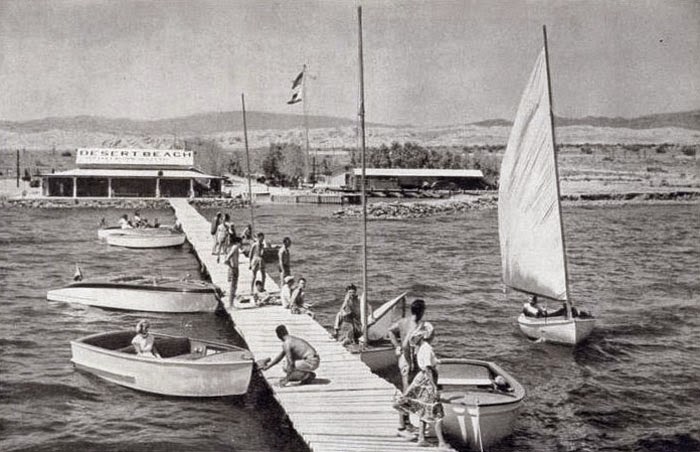
The main lock is 110 feet wide by 600 feet long. A lock is a basin of water that allows boats to change their elevation and pass from one water level to another. Gates open and the boat enters. The gates close and the water either drops if they are heading downstream or rises if they are moving upstream. Then the gates open and the boats proceed on their way. In this example, the barges contain coal and are moving upstream. The top photograph shows the gates opening on the downstream side. Coal is an example of bulk cargo that is most economically and safely carried by barge. Rock, gravel, petroleum, cement, wheat, soybeans, and extra-large machine parts or steel constructions are other examples of materials that can be carried by barge. As long as there is a nearby waterway, barges are much more efficient than trains or trucks.
This is a 1936 photograph of the dam at Rock Island. The water flow can be blocked by a series of roller gates that roll down a track to a specified elevation. "The 1,203-foot-long movable dam is the largest roller dam in the world consisting of 11 non-submersible 100-foot-long roller gates with 11 control houses. Nine gates are 19 feet 4 inches in diameter and two are 16 feet 2 inches."
These photographs show how the roller gates operate. They fit in an inclined slot and literally roll up or down the track to the specified elevation in the river. The advantage of this design is the cylinder is strong and can withstand impact from ice and logs. Also, a relatively low-power electric motor can roll the cylinder up or down. I do not know how they seal the ends, or what happens if debris lodges on the track.
These are photographs of hydraulic physical models at the famous Iowa Institute of Hydraulic Research at the University of Iowa in Iowa City (Mavis 1939). The Iowa River flows through campus, dividing it into east and west sections. In the 1930s, the river provided the water that was used for the models. My father noted in his diary that sometimes the river flooded the subbasement, and work was suspended until the water level dropped again. Also, sometimes the model froze in winter (he noted a period of almost two weeks in February of 1937 when morning temperature was -17˚ F.). In that era, many of the students showered in the laboratory - they must have rented rooms in rooming houses without bath facilities or without hot water. How times have changed; can you imagine contemporary students living with even minor inconvenience?

In the first photograph, the template for the bed is made of wood. Fifty years later, the construction process is almost identical, except that the templates are cut from aluminum.
This shows a model with three roller gates, of which the center unit is raised (Morang 1937).
This shows the flow pattern based on a time exposure photograph of confetti. This method of visualizing flowwas used at least through the 1990s.
This is a flume with a model of the Marmet Dam on the Ohio River. Notice the turbulence downstream of the gate. A flume is a long glass box which allows the technicians to see the flow from the side. Flumes are still in use in laboratories around the world.
Here are students and faculty of the Hydraulics Laboratory in 1936 or 1937. My father noted that in some classes, there were many Chinese students. Even back then, the government of Chiang Kai-shek was sending technical students to the United States to learn about engineering and science.

This was the era before electronic computing machines, and all observations were recorded manually on graph paper. We built much of the nation's infrastructure like this, based on sound engineering by hard-working engineers, scientists, and technicians. And we are letting it crumble away through neglect, political infighting, corrupt politicians, funds siphoned away to the military-industrial complex, idiotic concepts of how infrastructure projects are "socialism," and national stupidity. (And in the meantime, the Chinese have built magnificent highways and bridges, high-speed rail to Tibet, and initiated the China Railway Express, a new railway line from China to Europe. Guess who is on the ascendancy and who is sinking into third world decay.)

References

Mavis, F.T. (editor). 1939.  Two Decades of Hydraulics at the University of Iowa, Abstracts of Theses, Publications, and Research Reports. University of Iowa Studies in Engineering, Bulletin 19, Iowa City, IA.

Morang, C.N. 1937.  The Effect of Symmetrical and Unsymmetrical Roller Gate Operation on Discharge Coefficients. M. S. thesis, State University of Iowa, Iowa City, IA, 68 pp. 


Photograph No. 1 is from the Library of Congress:  

TITLE: Mississippi River dam #15, general view of completed dam, view from top of Clock Tower building
SUMMARY: Photograph shows dam across the Mississippi River and Davenport, Iowa. The Government bridge, which carries railroad, automotive, and pedestrian traffic, is in the foreground. The Davenport city skyline is in the background.
DATE: 20 March 1934
This image is available from the United States Library of Congress's Prints and Photographs division under the digital ID ppmsca.17351

Friday, June 20, 2014

South Nags Head - the Condemned Beach Houses that Never Collapse

Dear Readers, some of you may remember my previous articles about the elevated cottages at East Seagull Drive in South Nags Head, North Carolina. They were condemned when they were in danger of collapsing into the Atlantic Ocean. Well, to confound the skeptics, they are still standing as a testament to convoluted U.S. real estate laws and property rights, and are serving as a rather macabre tourist attraction.
An odd feature: one of the houses has been reinforced with secondary new pilings, and there is a real estate sign underneath. Have the houses been un-condemned?
The northernmost house in the group is leaning rather ominously. Is this one for sale, too?

Let's move to  a more cheerful topic: one of the largest sand dunes on the east coast. This is Jockey's Ridge State Park. The high, unvegetated area of Jockey's Ridge is known as a medano—a massive, asymmetrical, shifting hill of sand lacking vegetation. (El Médano, in Spanish, is "the sand dune," as well as the name of a town on Tenerife.) According to the state park web page, "Jockey's Ridge is the tallest active sand dune system in the Eastern United States, and the most striking of the remaining dunes on the Outer Banks. Shifting winds are constantly reshaping the dunes. Because the Ridge is always changing, it is often referred to as "The Living Dune.""
It is really interesting to walk to the top and see the Atlantic ocean to the east and Albemarle Sound to the west. You can pretend for a few minutes that you are doing the Lawrence of Arabia march through the desert, except there are no camels.
When it rains, a sizable pond forms in a hollow to the east of the main part of the dune, demonstrating that barrier islands can have a high ground-water table if there is sufficient regular rainfall.
A popular activity is to slide/jump down the steep east side, sort of like running down a snow field. Well worth a visit!

Click the links for the 2010 article on the condemned houses. The 2012 article described the houses and the beach nourishment project.

Photographs taken with Fujifilm X-E1 and Panasonic G3 digital cameras.