Sunday, January 10, 2016

Decay within sight of the State Capitol, Jackson, Mississippi

I have always been surprised how a run-down neighborhood can be only a few blocks away from a major commercial or government area. I first encountered this in Houston, where slum houses in the Fourth Ward had a view of the glamorous glass office buildings of downtown. I had not encountered this type of urban disparity in European or New England cities. Jackson fits the pattern: just west of the state capitol, slum neighborhoods are rough and being abandoned or torched.
George Street is (or was) a mess. I have not been back since I took these photographs in 2011, and many of these shotgun shacks have likely been demolished.
East Church Street, a block north of George street, was just as dilapidated. This is a photographer friend checking an abandoned house.
These were once nice residential neighborhoods. Unfortunately, I am not surprised they were allowed to decay. Jackson is in rough shape, and you readers know many of the reasons (I won't list them because this is not a political blog). When the houses are razed, the property no longer serves as a tax source. Less tax revenue means city services, infrastructure, and schools deteriorate, which leads to more people abandoning their properties and moving to more prosperous communities. The blight spirals - the race to the bottom that we see in so many American cities. It is absolutely disgusting.

Photographs taken on Kodak Panatomic-X film with a Fuji GW690II rangefinder camera (the "Texas Leica"). I developed the film in Agfa Rodinal developer at 1:50 dilution and scanned the negatives with a Minolta Dimage Scan Multi medium format scanner.

Friday, January 8, 2016

Lost flood zone houses: Marys Alley, Vicksburg, Misissippi

As of January 2016, another flood is surging down the Mississippi River. The high water, predicted to be about 52 ft above gauge zero on the Vicksburg gauge, will inundate low-lying areas west of North Washington Street. The 2011 flood reached 57.1 ft, a record, but even at only 44.6 ft, the Kings subdivision, located north of the Anderson-Tully Vicksburg sawmill, is subject to some degree of inundation. As a result, residents of homes built on ground level have often needed to evacuate, and the homes were repeatedly damaged. Finally, many of these low houses were purchased and removed via a FEMA program. As of 2012, all the houses along Marys Alley were gone. Click the link to see an aerial photograph from an older post.
These little houses were pretty rough by the time they had been condemned. I guess they were 1940s vintage, semi-shotgun style. They were elevated off the ground a few feet and probably had survived several high water events. But some other houses in this area were 1960s- or 1970s-vintage with slab foundation. A slab house in a flood-prone area?

These are scans of 120-size Kodak Panatomic-X film, exposed with a Fuji GW690II camera with 90mm EBC Fujinon lens. The camera was tripod-mounted. I scanned the negatives with a Minolta Dimage Scan Multi medium format film scanner.

The following list shows historic crest levels at the Vicksburg gauge, from the National Weather Service:

Historic Crests
(1) 57.10 ft on 05/19/2011
(2) 56.20 ft on 05/04/1927
(3) 53.20 ft on 02/21/1937
(4) 52.80 ft on 06/06/1929
(5) 52.50 ft on 04/28/1922
(6) 51.60 ft on 05/13/1973
(7) 51.50 ft on 02/15/1916
(8) 51.00 ft on 04/20/2008
(9) 50.20 ft on 04/16/1897
(10) 49.90 ft on 04/27/1913

And here are some low water records. You can see that the total water level range can be as much as 64 feet.

Low Water Records
(1) -7.00 ft on 02/03/1940
(2) -6.80 ft on 11/01/1939
(3) -5.80 ft on 01/06/1964

Wednesday, January 6, 2016

Lost Small-town Store: Main Street, Vicksburg, Mississippi

For much of the 20th century, many people did not have automobiles, and all towns had local stores to supply staples and groceries. Vicksburg had many of these small stores, but most have disappeared over the years. Williams Gro was at 1620 Main Street. I recall seeing the little shop, but it had been closed for years.
Finally in 2010, the city inspector condemned it along with the house next door. Oddly, both had the address 1620. The spray paint number is the indication that the building has been condemned and that the backhoe will soon crush the hulk.    
Note the Winston sign indicating opening hours and the Holsum bread sign. Holsum had a distributor in Vicksburg years ago.

Technical note: I recently bought an early-2000s Minolta Dimage Scan Multi medium-format scanner. With some manipulation, I got it to work on a Windows 7 computer. I have started testing it with my 6x9 cm 120-size Kodak Panatomic-X negatives, which I expose in a Fujifilm GW690II rangefinder camera (also sometimes known as the "Texas Leica"). This is a big beast of a camera with an astonishing lens. The scans at 2820 dots per inch yield a 100 mb TIFF file. But at that level of detail, I can see lint, flecks of dirt, and non-development spots (probably from bubbles), so it takes some time to retouch the flaws. Dear Readers, in the future, you will see more black and white files from the Texas Leica as I scan my archives.

Friday, January 1, 2016

Decay and loss, Port Gibson, Mississippi

Dear readers, happy and prosperous 2016 to you all!

EL Malvaney writes these great articles in Preservation in Mississippi about preservation efforts around the state as well as the all-too-common failures. The December 31, 2015 article was about Friends We Lost in 2015. The article mentioned a building in Port Gibson that burned in September. I was out of the country then and totally missed the news. But the article jogged my feeble memory and I found a 2012 photograph in my archives.
This was the former gasoline station at 200 Carroll Street, one of the buildings that burned. I took this photograph from a park across the street with a long lens. Some dudes drove up in a black SUV and waited for awhile. Then other dudes drove by, chatted for awhile, and exchanged packages. Sigh, another example of decay in America.
This is the old Trace Theatre on Main Street. I do not know if it is used.
This was a former grocery store on Carroll Street, also long deserted.
A short distance west of town is Vandeventer Street, with a number of houses that had seen better days a long time ago.
The reason I drove to Port Gibson that cold day in early 2012 was to see the remnants of the cotton seed oil mill on Anthony Street. The brick building in the center of the upper photograph dates to the 1800s.
A work crew was dismantling the machinery in this part of the mill. They said the machinery was being shipped to a factory in Nigeria.
East of Port Gibson on Hwy 18 is (or was) this pink club. The owner said she did not allow any trouble in her place. 

I need to return to Port Gibson before the rest of the town falls down or is dismantled. The 2012 photographs were taken with a Panasonic G1 camera with various lenses. The gas station and brick grocery were with a 50 mm Leica Summicron lens on the G1. Raw files processed in PhotoNinja software.

Wednesday, December 30, 2015

From the archives: Natural Swimming Pool, Colombo, Ceylon, 1959

Colombo, Ceylon (now Sri Lanka), 1959. Breaking swells from the Indian Ocean supply this cleverly-designed pool with clean sea water. In the 1950's, Ceylon's economy was thriving and Colombo's harbor facilities were inadequate for the amount of shipping trying to use the port. As a result, freighters often rode at anchor in the roadstead for days or weeks.

My dad took this photograph on Kodachrome film with a Leica IIIC camera and 5cm ƒ/2.0 Summitar lens (still in use). I do not know the exact date and am not sure where the Kodachrome was processed then. I doubt the family sent it back to USA, but possibly Kodak had laboratories in Bangkok or Tokyo.

Monday, December 28, 2015

On the Waterfront: Movie Stars of Kowloon (Hong Kong)

Victoria Harbour is one of the great natural anchorages of the world. It is sheltered from the worst of typhoons and, at least before super-sized vessels came into use in the mid-20th century, was a natural deep-water port. As stated in Wikipedia, "The harbour's deep, sheltered waters and strategic location on the South China Sea were instrumental in Hong Kong's establishment as a British colony and its subsequent development as a trading centre."
The original British settlement of 1841 was on Hong Kong Island, while the Kowloon Peninsula, on the mainland side of the waterway, became a colony in 1860, followed by the New Territories further inland. Great Britain gained a perpetual lease to Hong Kong island 1842 when the Treaty of Nanking ended the first Opium War with China. At that time, many in Britain felt the country had been duped by the Chinese because Hong Kong was sparsely populated and far from any of the centers of imperial Chinese trade. But after Britain proclaimed Hong Kong to be a free port in 1842, the colony grew and flourished, eventually becoming the great center of finance and commerce that it is today.
Hong Kong (Kodachrome, Leica IIIC, 5cm ƒ/2 Summitar lens)
The Kodachrome slide shows Victoria Harbour and Kowloon in 1950, before the waterways had been subject to extensive landfilling (often called "reclamation," as if something in nature needs to be reclaimed). The U.S. fleet is showing its presence. The Communists under Mao Tse-tung (or Zedong) had just completed their occupation of mainland China, and I am sure the United States was saber-rattling to warn Mao to not even dare think of invading the British Crown Colony of Hong Kong.
Today the Kowloon waterfront is a refined and popular tourist attraction, especially the Avenue of the Stars. 
Bruce Lee is here along with other Hong Kong movie stars. You can be a film director, too. (Trivia note: Bruce Lee, like yours truly, was a former University of Washington student.)
This is a popular destination for visitors from the mainland. I did not realize it before my 2014 trip, but residents of the mainland need a visa or permit to travel to Hong Kong - they can't just drive in or take a train on a whim. We noted that the ladies were typically immaculately and fashionably dressed, while the gents often looked like Bubba came off the farm and took the bus to Hong Kong.
This is the clock tower, near the ferry terminal. Take the ferry across the harbour and watch the scenery unfold as you cross to Hong Kong Island.
Sampans in Hong Kong Harbor, 1 Oct 1950. Only a year after the Communist conquest of the mainland, thousands of refugees had fled to Hong Kong, settling in Kowloon and on innumerable floating communities. These sampans were highly vulnerable to typhoons that periodically swept across the South China Sea. The small boats are now gone and the setting is much more industrial and sterile. 

1950 photographs taken on Kodachrome film with a Leica IIIC camera and 5cm ƒ/2.0 Summitar lens (still in use occasionally 65 years later). The 2014 frames are from a Nexus 4 phone (sorry). I made the map with ESRI ArcMap software.

Tuesday, December 22, 2015

On the loose in Arusha, Tanzania

So, you have arrived at Kilimanjaro International Airport before embarking on a climb of Kilimanjaro or a safari to one of the game parks. You are tired, jet-lagged, and grubby. Other than a sleep, what should you do? Explore Arusha, what else?
Arusha is a bustling commercial city in north central Tanzania. It is not a tourist destination in itself, but is certainly worth a day or two of exploring. The central market in any city is worth a visit. This one was a bit smaller then I expected, and seemed quiet, but possibly my friends and I arrived too late in the day for the main action. The produce looks good!

Some big beefy ladies haunt the market district.
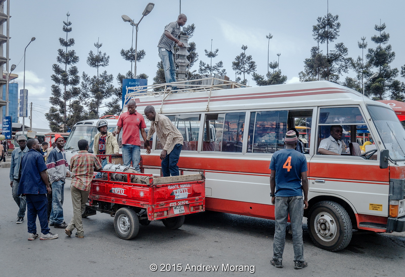
The market is next to the bus station, which is really active. There is no train service to Arusha now, but by bus you can go to Kenya or Uganda, and possibly further. That might be an interesting adventure.
Heading into town in the direction of the Clock Tower, the streets are commercial and lined with shops, small manufacturers, banks, mobile phone stores, and scooter/car repair shops. From what I can tell, everyone is busy, doing something, or plying some trade. Many of the stores run generators because while I was there, the mains electricity went off mid-morning and stayed off until early evening. Often the merchants sat on the sidewalk next to their generator. Yum, exhaust fumes.
A surprising number of merchants downtown were Indians (or Pakistanis?). We heard that many are descendants of Indian troops who were sent to Tanganyika in the early-20th century. When Britain gave up its colony, the former troopers stayed behind (or were left behind). Is this story true? In neighboring Uganda, the business class during the mid-20th century was dominated by Indians. Dictator Idi Amin (the "Butcher of Uganda") expelled the Indian traders, bankers, and merchants, and Uganda's economy virtually collapsed. (This sounds like the folly of Ferdinand and Isabella in expelling the Jews from Spain in the late-1400s - stupidity cloaked in religion.)
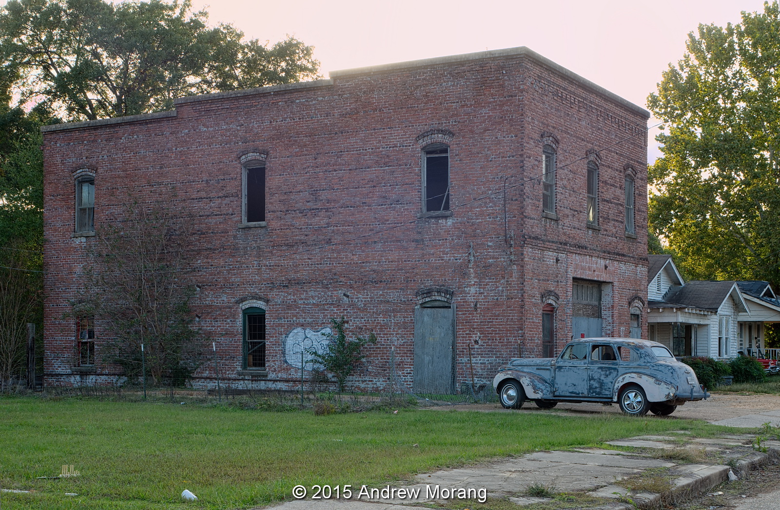
We came across a building with post office boxes, not a post office, just hundreds of boxes.
Near the bus station is a large and lonely cemetery. In the colonial era, it may have been the European cemetery. Sadly, it is neglected now.
On a clear day, Mount Meru looms over the city. Meru is a stratovolcano with peak elevation of 4,562.13 metres (14,968 ft). Our guide said there are climbing routes but it is not a common tourist destination.
We looked for English cultural remains, but I was surprised how few English buildings were left. This long colonnaded building was in the grounds of the Mount Meru Regional Hospital. Rangoon (see my Burma blog posts) has a much richer colonial architectural legacy.

This is the fourth of a series of Tanzania articles and has covered a short tour of Arusha. Should your travels take you there, do walk or take motorbikes round town.

Photographs taken with a Panasonic Lumix G3 digital camera with Panasonic 12-32mm lens. I  opened the raw files with Adobe Camera Raw 7.4 and processed most of the frames with DxO FilmPack 5 using the Kodachrome 25 emulation. I think it does not quite look like Kodachrome, but have no direct comparison available.

Thursday, December 17, 2015

More Urban Decay: West Porter Street, Jackson, Mississippi

Jackson west of the railroad tracks was once a prosperous, busy area of small shops, warehouses, and industrial concerns. Further west were tree-shaded neighborhoods, schools, and churches. Today, warehouses are boarded up, houses are abandoned or crumbling, and empty lots give little clue as to what was once there. A few weeks ago, I drove south on South Gallatin Street and saw a brick warehouse at the intersection with West Porter Street. It warranted a few photographs. I think the street address would be 2034.
This is the view west along West Porter at sunset in November.
The little cottage at 2032 West Porter was abandoned. The small fireplace was probably intended for a coal stove insert.
The resident at 2030 restores interesting old American cars, real Detroit iron.
On the north side of West Porter is another warehouse or shop. I could not tell if any part of the building is occupied.
This is the view north along Gallatin Street. It is somewhat desolate now.
These are the Kansas City Southern railroad tracks at the Gallatin Street underpass. These massive girders are early 20th century, the great era of railroad construction.

Photographs taken with a Fujifilm X-E1 digital camera, with some frames through a 35mm f/2.8 Olympus shift lens (to eliminate converging lines). I processed some of the RAW files with PhotoNinja software.