Sunday, July 3, 2022

When We Were Young: Beach Surveys in Rhode Island

Introduction


Once upon a time, during a previous life, I conducted beach profile surveys for the State of Rhode Island and Providence Plantations (the long official name, as printed on my pay checks). A technician or other graduate student and I would drive to the beaches every two weeks and survey the shape of the foreshore as far as the water line. We would survey from eight monuments (posts) that had been driven into the sand on the backshore in the dunes. In summer, we waded a distance offshore. It was a lot of fun. Summers were sunny and easy, and we mysteriously needed a full day to complete the surveys. We became dark bronze from the sun. In winter, we bundled up and sometimes slipped on the sand if it was frozen. 

Rhode Island's south shore is less developed than the coasts of many other states. This is an offshoot of the damage wrought by the Great New England Hurricane of 1938. Waves and surge from the hurricane destroyed entire communities on the south shore. Afterwards, the state wisely zoned large stretches of the barrier islands and salt ponds to be preserved as nature reserves or wildlife sanctuaries. As a result, Rhode Island's beaches today are surprisingly clean and traditional. Developers were not able to rape the environment by building multi-floor condominiums or vast McMansion tracts (in contrast, see the horrors of coastal Florida, New Jersey, Alabama, and other states). 


At the beach


Peat chunks on Charlestown Beach, August, 1976 (Kodachrome 25 slide)

After a storm, pieces of peat sometimes get washed onto the beach. The peat formed in the quiescent salt ponds, which were protected from ocean waves by barrier islands. As the barrier islands and spits retreat, the peat gets exposed on the open ocean side and is vulnerable to being broken up into chunks. This is proof of the barrier island rollover mechanism by which rising sea level causes the barriers to retreat landward. 

Yes, we had rising sea level back in 1976. We still have it, despite denials by scumbag politicians (you guess the party). We also were beginning to study the effects of greenhouse gasses on heat trapping in the atmosphere and reflectivity of solar radiation.


House remnants from before 1938 hurricane, Charlestown Beach, August 1976
Mr. Michael Schneck at old pilings, Charlestown Beach, August 1976 

When I was a student in Rhode Island in the late 1970s, I talked to people who lived through the 1938 hurricane. The memories seared them. They told me that old-timers always knew that any house at the coast should be little more than a vacation cottage with the cast-off furniture from the city house. If the storm knocked it off its posts, move it back on some new posts and re-furnish it with new castoff fittings. They scoffed at rich city slickers who built grand permanent houses next to the beach. That was the 1970s! Just visit the Outer Banks, coastal Florida, parts of Alabama, and numerous other beaches to see the monstrosities erected by developers since then.

Dr. Dan Urish enjoying the view and lunch, East Beach, August 1976

What wonderful summer days. At campus, I swam every day at lunch out to the buoys in Narragansett Bay. 

Barge formerly buried for 85 years, Charlestown Beach, December 1976
Oops. No sun bathing this day, Charlestown Beach, January 1977
Semi-exposed barge, Charlestown Breachway, Charlestown Beach, January 1977

Winter at the shore is usually quiet. Bathhouses are forlorn, as if they are waiting for their cheerful summer visitors. I wrote about Rhode Island bathhouses in 2010. 

Mr. Steve Yokubaitis, Weekapaug Beach, January 1977

On this fresh scarp, you can see roots and rhizomes throughout the sand. This shows that this dune had been mature and stable for many years before storm waves removed the seaward section. The shore face (to the very right) is covered with cobble, which is common on this formerly glaciated terrain.  

Charlestown Beach, January 30, 1977

Homeowners often hired contractors with bulldozers to push sand up to the houses. I think this was technically illegal, but do not recall if there was any legal action. 

Different states use different criteria to define private property versus public land. Public sand does not belong to private landowners, even if they think it is theirs to use. In effect, what is the definition of shoreline? Geographers and politicians have argued about this for over two centuries. If you are interested in the topic, NOAA has posted a list of shoreline references. Shalowitz' Shore and Sea Boundaries is a defining reference and summarizes technical and legal aspects of determining maritime boundaries in the United States. We will see more controversy related to shoreline definition as beaches retreat on most US coasts in the face of rising sea level (as a result of the climate change that millions of delusional Americans deny is underway).

In the next article, I will write about the Great New England Hurricane of 1938

Oops, sometimes we had to shovel the car out of the snow to get to the beach
Beginning of the great Northeastern Blizzard of '78 (flash photograph)

The Northeastern United States Blizzard of 1978 dropped record amounts of snow throughout New England. The Boston area was closed to outsiders for almost two weeks. We did not fare too badly in southern Rhode Island. We lost electricity, but we had down sleeping bags and did not have any issues. We cooked on a Bleuet GAZ camping stove. Those were the days.

The photographs above were all Kodachrome 25 or 64 slides, most from my Nikkormat FTn camera or my Leica IIIC, which I still use. I scanned them with a Plustek 7600i scanner operated with Silverfast Ai software.


Sunday, June 26, 2022

Rainy Days in Astoria (Oregon)

Columbia River from the Astoria Column (Gold 200 film, Kodak Retina IIa camera, 1/250 ƒ/8 - click to see more detail)

Astoria is a historic sea and trading port on the Oregon shore at the mouth of the Columbia River. It is a wet city because weather patterns from the North Pacific thunder in most of the winter (and often in the summer). 

The mighty Columbia is the largest volume river to enter the Pacific Ocean from the Americas. The average flow at the mouth (meaning near Astoria) is about 265,000 cubic feet/second. As an example of scale, the Mississippi River during the flood of 2011 had a flow in excess of 2 million cu ft/sec, while a large tidal inlet on the Gulf of Mexico coast (Destin, Florida) has a discharge of about 100,000 cu ft/sec. From Astoria, the estuary looks immense.

Dusk on the Columbia (Moto G5 phone file)
Freighters at anchor, Columbia River, Astoria (Gold 200 film)
Great blue heron, Columbia River (Gold 200 film, 1/50 ƒ/4)

Yes, the river dominates everything. 

Riverwalk, Astoria (1/50 ƒ/4)

The Riverwalk extends along the entire waterfront. It is a nice walk or bike ride, but a bit damp in the rain. Many of the tourist restaurants are situated on the wharf or in warehouses.

On the Riverwalk (the door is fake)
Chow time, fish and chips, Astoria Brewing Company (Moto G5 phone photo)

What do you do after a wet day walking the docks? Well, eat fish 'n chips and drink craft beer at the Astoria Brewing Company. These were some of the best fish 'n chips I have ever eaten. 

Room with a view, Astoria (Moto G5 phone file)
Road with a view (Moto G5 phone file)

Astoria has plenty of hotels and even some old-fashioned motor courts. We stayed in the heart of the city, within walking distance of coffee shops, a bakery, and restaurants.

West Marine Drive, Astoria
Kick Ass Koffee - what could be better than that?
Former cannery east of Astoria

Wouldn't you know it? The day we left, the weather cleared. So it goes. I would love to explore the old cannery, but the pier was tightly secured. At one time, thousands of workers packed fish at this and other canneries.

Most of these photographs are from Kodak Gold 200 film, taken with my Kodak Retina IIa camera with its Retina-Xenon 50mm ƒ/2 lens. This is a fully coated 6-element Gauss-type lens. I had just bought this little camera and was very pleased with its performance. 


Sunday, June 19, 2022

In the Olympic Peninsula (Washington)

Olympic Peninsula, Washington (courtesy ontheworldmap.com)

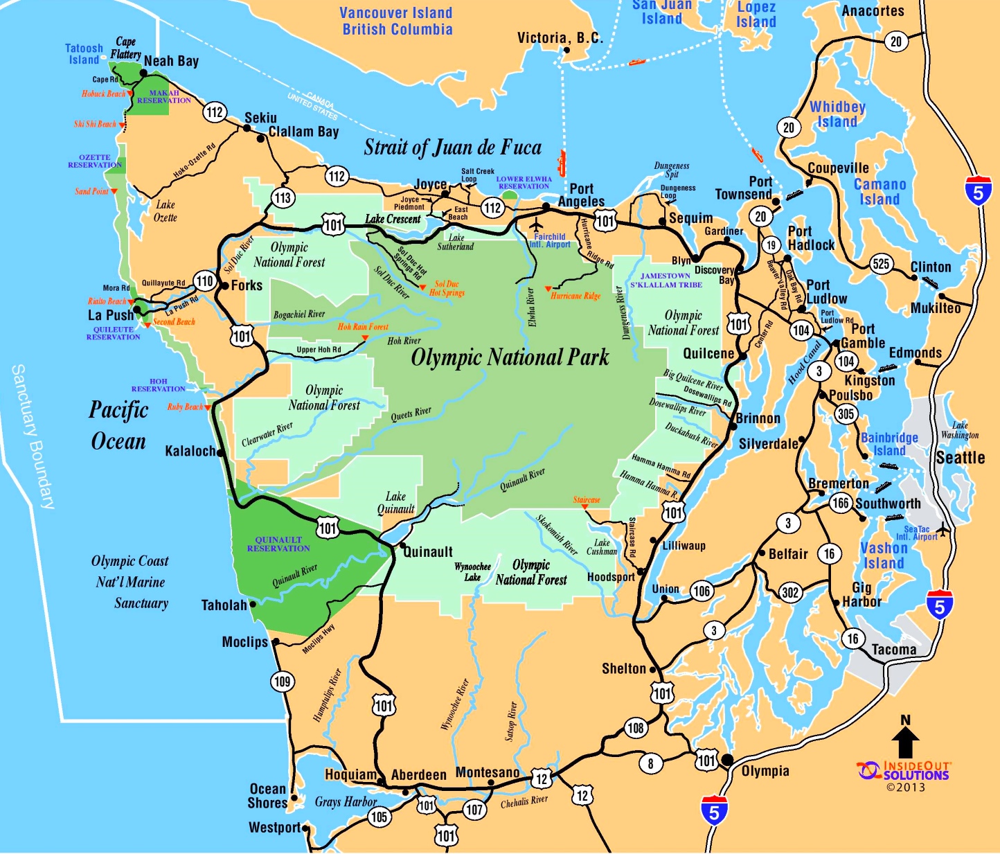
The Olympic Peninsula is a fabulous terrain of mountains, temperate rain forest, lakes, and lonely beaches. The Olympic Mountains dominate the core of the peninsula. In a previous life, I hiked in the Olympics, climbed Mount Olympus, and camped along the rugged Pacific shore. I revisited in early 2022 but only had time for casual day trips. 

Rain forest near Lake Quinault

First of all is the incredible rain forest. It overwhelms with giant trees, moss, ferns, and lushness. These lush forests are among the limited remaining primeval temperate rain forest in the lower 48 states. Rainfall ranges from 140 to 167 inches per year (in contrast, Vicksburg, Mississippi, receives around 57 inches and Athens, Greece, receives only 14.9 inches). We saw the unusual American dipper in one of these ponds. This little bird bobs up and down and walks along the bottom of ponds. 

Kestner-Higley Homestead, Lake Quinault, Olympic Peninsula (Gold 200 film, Kodak Retina IIa camera, 50mm ƒ/2 Xenon lens)
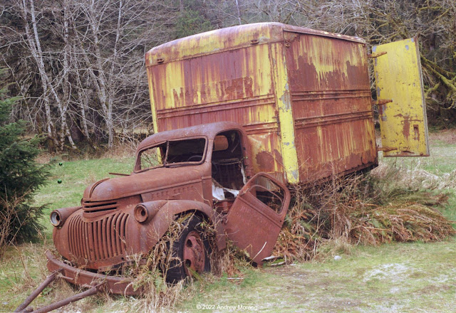
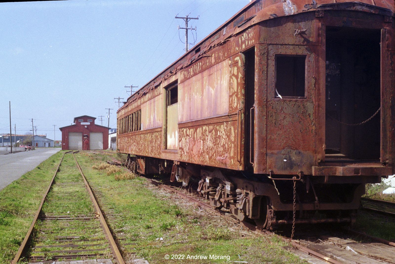
Chevrolet truck, Kestner-Higley Homestead
Chevrolet truck
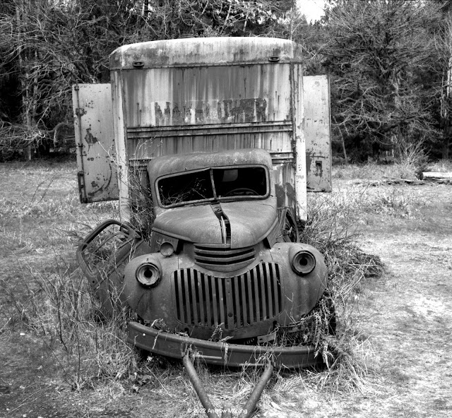
Chevrolet truck taken on Fuji Acros film, Leica M2, 35mm ƒ/2 Summicron lens 

The Kestner-Higley Homestead is at the northeast corner of Lake Quinault. The short circle trail is an easy and fun walk.

Pottery studio, Hoquiam (Gold 200 film, 1/100 ƒ/8)

This little 1930s grocery store is now a pottery studio. It is on East Hoquiam Road seemingly a long way from any towns.

Lincoln Street Grocery, Hoquiam (Gold 200 film, 1/100 ƒ/8)

Heading south on US 101, you reach Hoquiam. This former lumber town is on the north shore of Greys Harbor. The town is a bit rough and will offer some interesting photo subjects in the future.

Seat with a view, 121 Park Avenue, Aberdeen (Gold 200 film, 1/100 ƒ/5.6½)
Wishkah River at junction with Chehalis River, Aberdeen (1/100 ƒ/5.6)

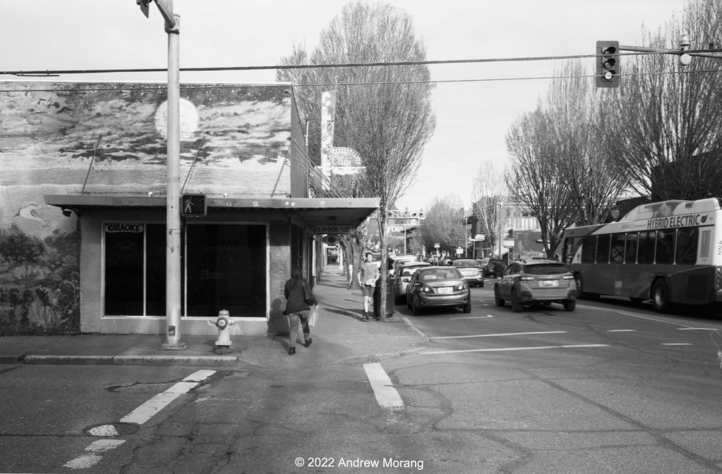
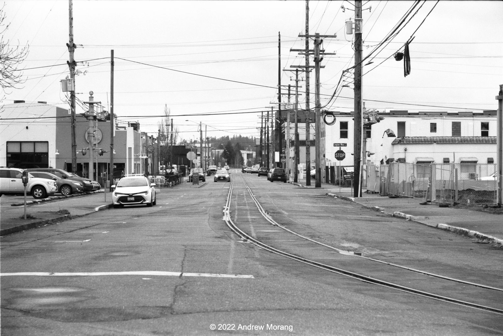
Aberdeen is more than a bit rough. I need to return and look around for more photo opportunities. The city is at the mouth of the Chehalis River where it debouches into Greys Harbor. The city thrived as a lumber port during the early 20th century because Greys Harbor was ice-free. The lumber could be shipped south along the Pacific coast to markets in California and Asia. But most of the mills closed in the 1970s and 1980s, and the town went through rough times. 

We ate at Duffy's Restaurant and had excellent smelts. Smelts are little salt water fish that are usually fried. In a previous life, the famous Durgin Park Restaurant in Boston served smelts. But once they dropped smelts (and mackerel!) from the menu, I knew the end was coming. 

This ends our all-to-short tour of the Olympics. Most of the photographs are from Kodak Gold 200 film that I exposed in my little Kodak Retina IIa camera. I scanned the film with a Plustek 7600i film scanner.

Sunday, June 12, 2022

Exploring the Capitol (Olympia, Washington) (Oly 02)

Washington State (from netstate)
Olympia and Capitol Lake (Hasselblad XPan camera, 45mm lens, Fuji Reala film)

Olympia is the capitol of Washington State. The city is nicely situated at the south end of Puget Sound about one hour southwest of Seattle (or 2 or more hours during rush hours - which last much of the day). Olympia is a nice little city with a population of about 55,000, but that increases to around 270,000 if you include nearby Lacy and Tumwater. Olympia was only incorporated as a town in 1859, making it a relatively new city compared to where I have lived in the past. 

4th Avenue, view east

The downtown is reasonably well-preserved and active. But it did not strike me as especially dynamic despite being the state capitol. It definitely has a less frenetic pace than Seattle or Tacoma. In the business district, most buildings appear to have tenants, and I saw bars, restaurants, banks, coffee shops, and theaters. Some of the downtown has the look of Old American City, a place that may have enjoyed a more golden era decades ago. 

Railroad bridge over Capitol Lake (35mm ƒ/2 Summicron lens) 

The rail network through the city is a bit complicated. This bridge crosses Capitol Lake (see the aerial panorama above).

7th Avenue Tunnel from Columbia St. SW (50mm Summicron, ƒ/4.0½)

After the rail line crosses Capitol Lake, it turns north and then turns east through the 7th Avenue Tunnel. I met a homeless man emerging from the dark and he said people regularly walk through it (hmmm, not me). A few years ago, a homeless fellow was struck by a train and lost an arm.

7th Avenue Tunnel from Jefferson Street (90mm ƒ/4 Elmar lens, 1/125 ƒ/4.0½)
7th Avenue (50mm Summicron lens)

 It took some looking around to find urban decay topics, but I found some.


When I asked the homeless fellow where the railroad tunnel emerged, he said near the black house. I did not know what he was talking about until I saw this old house coated with black paint. (Update: the house has burnt down.)

Jefferson Street view north (90mm ƒ/4 Elmar lens, 1/125 ƒ/5.6)

The tracks run down Jefferson Street to the Port of Olympia. I thought they were unused until one evening, I heard the familiar clanging and horn of a locomotive. 

Lumber pier, Woodard Bay Natural Resources Conservation Area (90mm Elmar, 1/250 ƒ/8.0)

The Woodard Bay Natural Resources Conservation Area is northeast of downtown. The pier once served Weyerhaeuser Timber Company's rail cars bringing lumber from the south. Formerly known as the South Bay Log Dump, cranes loaded timber onto barges, which then took the wood to mills in Everett. Today, the pier supports colonies of yuma myotis and little brown myotis bats. They forage as far as Capitol Lake and eat tons of insects every night. 

No coffee today, 3525 Shinckle Road

This ends our short tour of Olympia. Type "Olympia" in the search box to see older articles.

The black and white photographs are from Fuji Acros film exposed at EI=80 in my Leica M2 camera. Northeast Photographic in Bath, Maine developed the film, and I scanned it with a Plustek 7600i film scanner. The aerial panorama is from 2004, when I spent a few months in Seattle on a work project at Willapa Bay. A friend flew me over Olympia and to the coast.

Sunday, June 5, 2022

Jayden's German Store (Small Towns in Washington 02)

Pacific County and Willapa Bay. 

Driving west on Washington State Route 6, you eventually reach the environs of Willapa Bay. This is one of the largest estuaries on the North Pacific coast. For over a century, it was famed for its oyster harvest. The town of South Bend is on a bend of the Willapa River and serves as the county seat of Pacific County. During some business trips in the early 2000s, my coworkers and I passed through South Bend. It looked pretty rough back then.  


In March of 2022, South Bend looked much better. We wanted to lunch somewhere and were surprised to see signs for Jayden's German Store? What, a German deli in South Bend? We could hear the Brätwurst calling us ("Come eat me...").


Jaden's store is right on the main road. Find a place to park and shop for souvenirs, chocolate, mustard, and cookies. Pick up a few hot brats for lunch. We learned that the owner formerly cut hair and then decided to open the store and sell items from the old country.


Hand-made signs. Folk art at its best. I love places like this.


No more coastal coffee (Gold 200 film, Kodak Retina IIa camera, 50mm ƒ/2 Xenon lens)

Unfortunately, Coastal Coffee in its cheerful little blue house was no more.


The Pacific County Courthouse is an unusually ornate structure in immaculate condition. We met the city clerk, and she graciously opened the building and showed us around. 

Standby for more southwest Washington in the future.

Most of these photographs are from a Moto G5 mobile phone except for the frame of the cheerful little blue coffee shack.