(Guest post by morangm)
Most of Kodachromeguy's posts here feature abandoned and decaying rural towns in areas that are losing population and economic activity - places that are just no longer needed. In today's post, I'm going to talk about a different situation - decay caused not by decreasing population and economic declines, but rather decay in the midst of rapid growth, caused by self-defeating municipal ordinances.
Redlands, California, is a cute historic town about 60 miles east of downtown Los Angeles. Although it was originally an independent town settled by wealthy easterners seeking a pleasant climate for retirement and those seeking their fortunes in citrus cultivation, it has long since become attached to the ever-expanding Los Angeles metropolitan area. This area of California, the "Inland Empire", is one of the fastest-growing regions of the country. According to a recent demographic analysis by the City of Redlands, 80% of people who live in Redlands do not work in Redlands, and 80% of people who work in Redlands don't live in Redlands. So, while Redlands fiercely clings to its historical identity, it is no longer a self-contained entity. Like it or not, it is part of a broader metropolitan community.
In the 1970s, 1980s, and 1990s, Redlands voters, alarmed at the rapid growth of the region, adopted some slow growth municipal ballot measures and propositions. These measures, among other, more technical things, limit the number of new dwelling units that can be built within the city limits each year to 400 and cap the height of new buildings. Redlands is by no means the only municipality to adopt slow growth measures like this, and it is exactly these types of restrictions, adopted by many communities across metropolitan areas, that have contributed to urban sprawl and worsening traffic congestion. If you don't build up and in, you have to build out.
Redlands has a small but relatively lively and pedestrian-friendly downtown area which spans for about 4 blocks along State Street, with some activity in the surrounding blocks. Unfortunately, despite the region's overall economic growth, the area immediately west of downtown has declined in recent decades. The Redlands Mall, built in 1977, was placed squarely in the middle of what was once State St., bulldozing many historic buildings and effectively cutting off the main downtown corridor from the other end of State St. The I-10 freeway cut the city in half, blockading the northern residential areas from downtown. Additionally, the freight and passenger rail corridor ended service at some point, and various industrial and warehousing businesses closed up.
The slow growth restrictions in Redlands meant that redeveloping these central areas of town was not economically viable for developers. The Redlands Mall has sat abandoned for 10 years (which doesn't sound like much, but remember this is one of the fastest-growing regions of the country we're talking about!). There are many other vacant lots and abandoned buildings that no one is willing to invest in. Developers just can't turn a profit redeveloping a downtown area in California if they can't build upwards.
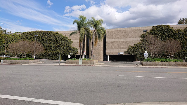 |
| The abandoned Redlands Mall |
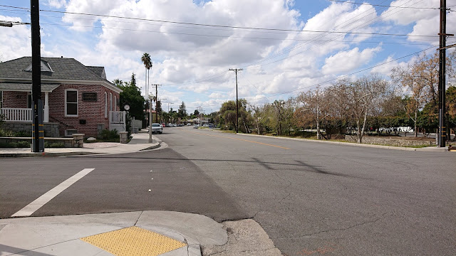 |
| West State St, the part cut off from downtown by the Redlands Mall, with the Chamber of Commerce on the left. |
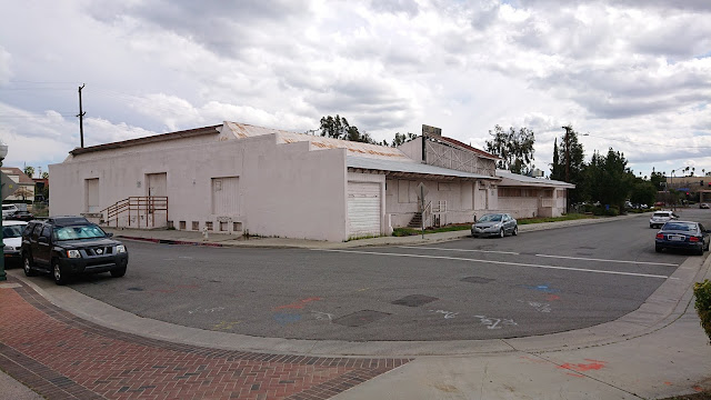 |
| Abandoned warehouse (possibly a citrus packinghouse?) right next to downtown |
 |
| Vacant lot and parking lot downtown. The backside of the abandoned warehouse is in the background. |
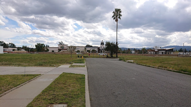 |
| Empty dead end downtown with Studio Movie Grill (formerly the Krikorian Cinema) in the background |
 |
| Abandoned house abutting the highway (in the background) |
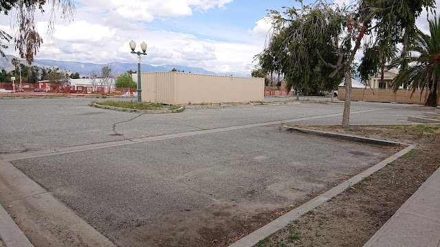 |
| Unused parking lot currently being utilized for construction storage. This will probably become parking for the adjacent rail station. I think this is the site for the newly-planned parking garage. |
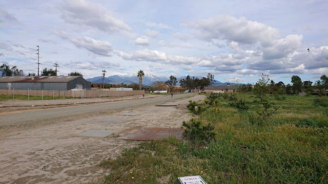 |
| Empty land and the newly-graded rail corridor |
 |
| Hey, I found a trolley! |
The Los Angeles commuter rail system, Metrolink, is currently expanding its service out to Redlands, revitalizing the old abandoned rail corridor and the
historic Santa Fe depot. As part of this effort, the City of Redlands got a grant to develop a really great transit-oriented development plan to guide redevelopment efforts for the area around the three new rail stops, which encompasses the Redlands Mall and other vacant and abandoned areas in the downtown core. City staff and hired consultants spent over a year developing this long-term plan for walkable, bike-friendly, mixed-use development. They held a series of public workshops to learn what the community wanted and to solicit feedback on the plans.
The plan, called the
Transit Villages Plan, lays out new zoning for the plan area, allowing buildings of 4 stories on average (with some sections of up to 5 stories allowed for architectural features) in the central part of downtown, with building heights tapering off as you get farther from downtown. The plan also specifies various architectural requirements to maintain the character of the town and prevent ugly big square boxes from being built, etc. It seemed like a good plan! It would help us to redevelop the decayed areas of downtown, encourage environmentally responsible and sustainable development patterns, accommodate necessary and desirable growth in a controlled manner, and ensure that we maintained the charm and character of the city.
However, the City's vision for this new denser, mixed-use development couldn't come to fruition with the existing voter-approved slow growth restrictions in place. So, the City put on the March 2020 ballot a new measure, Measure G, which would remove the old slow growth restrictions for the area within the Transit Villages Plan area (so, not the whole city, but just the downtown core).
Redlands went nuts! In the month or two preceding the Measure G vote, a vigorous public debate broke out in the local newspapers and social media. Although response to the Transit Villages Plan at the community workshops had seemed largely positive, there was immense pushback to Measure G. NIMBYism took hold. People didn't want to encourage more development in Redlands, didn't want to welcome new apartment-dwelling neighbors, and didn't want their views of the mountains obstructed by taller buildings downtown. But the debate was wild. Measure G's actual text was technical and confusing, and the City did a poor job of proactively explaining what it meant in lay terms and even explaining how the urban planning process works, what zoning is, what the existing measures were, etc. By the time the City finally released an FAQ that laid out clear information, the conspiracy theories had already made the rounds, people's emotions had already been roused, and the local Tea Party had organized in a serious way to oppose the measure.
Measure G failed miserably. About 65% of voters opposed it.
So what does this mean for the vacant lots and abandoned buildings of downtown Redlands? It remains to be seen. The City will have to redesign the Transit Villages Plan to conform to the old slow growth measures. Will developers be willing to invest in these properties given the limitations? We don't know.
Further confusing the problem is that the State of California has been aggressively pursuing legislation to increase the housing supply across the state, precisely because municipal slow growth measures like those in Redlands are driving up housing costs and encouraging sprawl. Some state legislation actually removes municipal new housing unit limits, so even without Measure G, parts of our slow growth limits are moot. The state is also requiring communities to provide large numbers of new housing units over the next several years. It's unclear to me exactly how this works, but my understanding is that if a City's zoning code does not conform with state requirements on housing provision, the City has no grounds to say no to a developer proposing housing units in whatever form. Thus, we may end up with denser high-rise development downtown anyway, but it won't be subject to the Transit Villages Plan's careful architectural guidelines. We may be stuck with whatever the developer wants to build with no local say in the matter. We might also end up bulldozing our few remaining orange groves on the outskirts of the town and turning them into housing developments, and people will build Granny flats in their garages or backyards. And if we don't conform to the State's requirements, we risk losing state funding for things like road construction.
So, the future of Redlands remains pretty uncertain for the moment. The way I see it, the failure of Measure G seems fairly self-defeating.
To be clear, there is some activity happening among all the vacant lots. The new Redlands Packing House District shopping center has been successful, Escape Brewery moved into the old Rondor building (a former trolley depot), and there's a new market-style eatery in the works in another old packinghouse. But none of this helps the housing situation, and it's not the walkable mixed-use development we envisioned in the Transit Villages Plan.
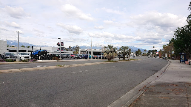 |
| Redlands Blvd just west of downtown. Perhaps the now-empty part of downtown will eventually look like this? |
Further reading:
Because Kodachromeguy always does this: All photos in this post were taking with a Sony Xperia XZ2 Compact smartphone. And for the record, Redlands almost never has this many clouds in the sky.


