Showing posts with label railroad. Show all posts

Saturday, August 2, 2025

The Leica IIIG in Oregon and Eastern Washington (May 2025) (Abandoned Films 13d).

We were restless after a very wet March in Olympia. It was time for a road trip. And I wanted to exercise my Leica IIIG camera and try Kodak T400CN film again. Some of these expired rolls have looked fine, but others have deteriorated. The rolls I used in Greece looked great. I should give up on this long-expired film forever, but thought I would try one last  roll. I loaded a roll in the IIIG for some of the great expanses of Washington state east of the Cascades (plus an overnight in The Dalles in Oregon). 


The Dalles, Oregon


The Dalles is a busy rail junction. But areas of this rail yard now have bare sections and unused tracks.  Still, an interesting place. The mill became a winery?


Waiting for a horse

Columbia Hills State Park


Cross the Columbia River, drive past Dallesport, and ascent a gravel road up into the Columbia Hills. In contrast to the forested mountains of the Columbia Gorge closer to Portland, these hills are in the rain shadow and are a dry terrain. The area is famous for wildflowers in early spring.


Dalles Mountain Ranch (50mm ƒ/1.8 Canon lens, yellow-green filter)


Farmland and the Palouse, Washington


Head east out of Richland, and you drive through miles and miles of beautiful rich farmland. As you continue east, you enter a land of hummocky low hills composed of loess (wind-blown silt). This is the Palouse. It encompasses parts of western Idaho and central east Washington. 


Rail junction, Roosevelt (Canon 50mm ƒ/1.8 thread-mount lens, orange filter)
Pasco-Kahlotus Road north of Pasco (50mm ƒ/2 Jupiter-8 lens)
Historic schoolhouse, Pasco-Kahlotus Road (Jupiter-8 lens)
Silo, Kahlotus (Jupiter-8 lens, yellow filter)
Grain terminal, Oaksdale (Jupiter-8 lens, yellow filter)

The Grain Train, Oaksdale

This roll of T400CN was thin, and once again, it may have been mis-development by Photoland at The Evergreen State College. I will not use their services ever again. This old T400CN is grainy, probably much more so than when it was fresh. But I still like the tonality, and the ICE scratch removal in my Nikon Coolscan 5000ED scanner is a great convenience. As a substitute, I can try Ilford XP2, which is the only C-41 black and white film still in production. 


Saturday, July 19, 2025

On the Waterfront: the Duwamish Waterway and Port of Seattle, Washington (Sea 07)

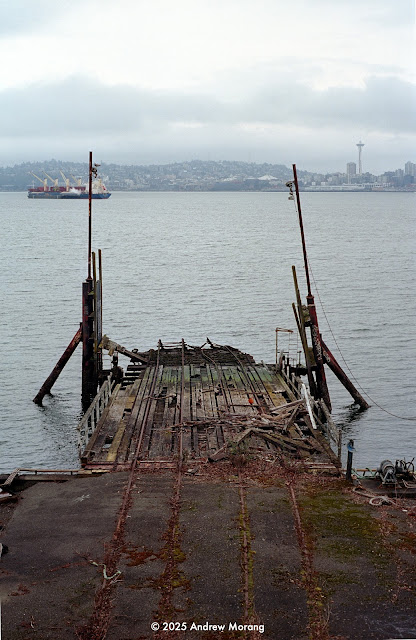
The Duwamish Waterway (river) flows into Elliot Bay along the base of the glacial drumlin that forms West Seattle. The mouth of the Waterway has been extensively modified to create the Port of Seattle. The city created Harbor Island and the other terminals by dredging and filling over the last century. This is a busy commercial harbor with container and bulk terminals. But I was surprised to find that the city has been preserving small parks and wetlands in the industrial zone. And bicycle paths let you bike along large sections of the shore, passing through or around the commercial terminals.  

March 2, 2025, was not raining, a good day to drive to the city and explore the waterfront. It was a cloudy Pacific Northwest winter day, the sky was overcast, and the light was blue.  Click any photograph to see it at 2400 pixels wide.


Port of Seattle and Harbor Island shore, view east
Seattle from Jack Block Park viewing tower
Port of Seattle view north (55mm ƒ/1.8 SMC Takumar lens)
Terminal 5 from Jack Block Park, view south (55mm ƒ/1.8 SMC Takumar lens)
Terminal 5, view south
Don't eat the oysters; Duwamish Waterway view northeast towards Seattle
Duwamish Waterway and Ash Grove Cement Seattle Plant (35mm ƒ/3.5 Super-Takumar lens)

Duwamish Waterway from Harbor Island Marina with West Seattle Bridge in distance
Rail car, West Marginal Way (35mm ƒ/3.5 Super-Takumar lens)
Work barges, Kellogg Island, from həʔapus Village Park & Shoreline Habitat (135mm ƒ/3.5 SMC Takumar lens) 
Bicycle club members

I met these gents in the viewing tower at Jack Block Park. They had biked all the way from Lake Union along the Seattle waterfront. They belonged to a club and were in their 70s and 80s. Two of them had ridden through the new Rte 99 tunnel (under the waterfront) on the official opening day when it was open for bicycles.

I took these pictures with my Pentax Spotmatic F camera on Kodak Ektar 100 film, exposed at EI=64. This is a high contrast color negative film, which I find it hard to use. The scans from my Nikon Coolscan 500 ED scanner had too much blue. I used skylight filters on the lenses, but an even warmer filter, like an 81B or 81C would have helped. I corrected the colors as well as I could with the neutral grey dropper tool in Photoshop 6. 

This is Seattle article no. 07.


Wednesday, December 4, 2024

Trains Through Chehalis, Washington

Chehalis is the County Seat of Lewis County, Washington. It is south of Centralia and is overshadowed economically by the larger city. But Chehalis has a well-preserved downtown with late 1800s and early 20th century buildings. It was primarily a logging and railroad town in the late 1800s.  It also hosts the BNSF rail line, which cuts right through the center of town. 


Thundering through, get out of the way! (West Main Street, March 23, 2024, Panatomic-X film, 50mm ƒ/4 Distagon lens, yellow filter)

These enormous freight trains come thundering through town. The lights flash at the West Main Street crossing, the barrier arms swing down, and you wait. The ground starts to vibrate, and these trains roar through at 40? 50? 60 miles per hour?


Track debris
Milky Way dairy transportation company

Milky Way is the largest milk hauling company in the Pacific Northwest. One of their terminals is right next to the rail line off West Main Street.


DrinkAMugAMilkAMeal (Samsung mobile phone photo converted to black and white)
Line off Prindle Street (250mm ƒ/5.6 Sonnar lens, dark yellow filter)

Chehalis is a nice little town. The Willapa Hills bicycle trail starts here and continues west to Pe Ell. Eventually, it will be graded and paved all the way to Raymond. I need to explore Chehalis in more detail.

I took most of the photographs with a Hasselblad 501CM camera using Kodak Panatomic-X film, all frames tripod-mounted. 

Sunday, May 12, 2024

Checking Out the Rails in Olympia (Oly 07)

Western Washington was once criss-crossed by hundreds of miles of rail lines. Many mountain valleys had regular or narrow gauge lines to serve the lumber industry. Many of them were abandoned in the 1970s as the lumber industry wound down, but some remnants remain. BNSF (Burlington Northern Santa Fe) operates its main line from Longview, on the Colombia River, north to Vader, Chehalis, Centralia, Tenino, East Olympia, and then on to Tacoma. This carries mostly cargo, but Amtrak uses the tracks for its passenger service. 


Olympia was once served by two railroads, the Northern Pacific and the Union Pacific. The tracks still exist, and Olympia & Belmore Railroad, Inc., operates the occasional freight cars. I sometimes hear a locomotive horn but have never see a train trundling down Jefferson Street. Amtrak's station is on the Yelm Highway in Lacey, the town southeast of Olympia. The Amtrak does not go into downtown Olympia.


7th Avenue Tunnel


The "Subway" (Fuji Acros film, Leica M2, 90mm ƒ/4 Elmar lens)

When the Northern Pacific first brought service into downtown Olympia in 1891, the tracks came down the Deschutes River valley, past the brewery complex, and along the tide flats. The track turned east and went through a tunnel to emerge near Jefferson Street. It is ugly and dirty now. A homeless man was badly injured in the tunnel years ago.


Jefferson Street


Jefferson Street view north. Where is the train? (Fuji Acros film, Pentax Spotmatic F camera, 55mm ƒ/1.8 SMC Takumar lens)
Jefferson Street view north
Steps on Jefferson Street (55mm ƒ/1.8 SMC Takumar lens)

The track in the foreground emerges from the subway (to the right out of the picture).


Jefferson Street view south
View north from Olympia Avenue NE (Kodak T400CN film, Leica IIIC camera, 5 cm ƒ/2 Summitar lens)


Rainbow Rails


Rainbow Rails view north (not very colorful any more; Kodak Tri-X, 100mm ƒ/3.5 lens)
Rainbow Rails with State Capitol in the distance and 4th Avenue bridge (Kodak Tri-X, Hasselblad, 100mm ƒ/3.5 lens)
Rainbow rails, view north, with West Bay to the right

The Rainbow Rails ran along West Bay to a wood processing facility a short distance south of Tugboat Annie's restaurant. The name came from the colorful paint that artists painted on the ties near the 4th Avenue bridge. Much of the paint has faded, so you do not see much rainbow any more. The track is a somewhat difficult walk, but you are next to West Bay and can sometimes see a freighter across the water at the Port of Olympia. Water birds occupy a pond just to the west. 


Port of Olympia


View south from Market Street NE (adjacent to the Olympia Farmers' Market)

This track comes in from the south along Jefferson Street (see above). It diverges, and two lines enter the port area (off-limits to visitors). Most of the timber now comes to the port by truck, but I hear an occasional train, usually at night. 

This ends our short railroad tour of Olympia. Later, I will post some pictures of the rail line near the unused Olympia Brewery complex in Tumwater. Thank you for riding along.

Saturday, March 11, 2023

Railroad Crossing at Tower 26, Houston, Texas (TX 02)

Houston from Tower 26,West Street, 5th ward (250mm ƒ/5.6 Hasselblad Sonnar lens, yellow-green filter)

Three railroad lines cross at a junction in northeast Houston called Tower 26. There is no tower there any more, but the name has lingered. It appears to be a popular spot for railroad photographers because it has public access via West Street. Serious freight trains thunder by on regular intervals. 

I had been looking for an interesting place to photograph railroads and drove to Tower 26 on December 17 of last year (2022). A fellow came up to me rather excited and asked if I was there to see the classic xxx rail cars. I was not quite sure what he was describing, but in a few minutes, the Polar Express trundled by, complete with restored passenger cars containing kids wearing their pajamas and at least one Santa Claus. OK, I had not expected that. What timing. 


Modified Polar Express rail car with picture window (80mm Planar-CB lens, no filter)
Polar Express en route back to Galveston
View east from Tower 26 junction (80mm Planar-CB lens)
Rail line junction, view east to downtown Houston (50mm ƒ/4 Distagon lens)

Tower 26 is northeast of the downtown in the district formerly known as the Fifth Ward. Some of it is pretty rough. I saw some abandoned cottages near the tracks of the type that remind me of west Jackson (Mississippi).

1510 West Street (med. yellow filter)
Facing the tracks, no address
Ready to move in, 2404 Brooks Street


Update March 26, 2023: These little cottages have recently been demolished. The land is bare and freshly scraped. Tractors and trucks were parked near the site. 

Standby for more photographs in the Fifth Ward. 

I took these photographs on Kodak Panatomic-X film with my Hasselblad 501CM medium format camera. Praus Productions in Rochester developed the film. I scanned it on a Minolta Scan Multi film scanner using the Tri-X 400 6×6 profile. The Silverfast software does not have a Panatomic-X profile, but the Tri-X showed the right tonality.


My Hasselblad 501CM with 80mm ƒ/2.8 Planar-CB lens and correct hood

Update April 15, 2023: I returned to Tower 26 on March 26. I met a gent (an MD from MD Anderson Hospital) taking photographs. When I told him I had taken some frames of the Polar Express, he said he was on that ride with his young son. He sent me a clip from the video he took during the ride. It can be a small world among photographers.


Dorky photographer with his Hasselblad at Tower 26


Saturday, December 4, 2021

Levee Street Railroad Yard, Vicksburg, Mississippi


The Kansas City Southern rail yard on Levee Street usually has interesting patterns, shapes, and textures to photograph. Long-term readers know that I have photographed here many times before, but I usually find new material when I explore. Nowadays, it is a rare treat to walk next to or within a rail yard that is not fenced off with security razor wire. The two big rail yards in Jackson are off-limits. 

Fairground Street Bridge, closed since the early 1990s

The rail yard is much quieter than it was before the 2011 Mississippi River flood. I do not know where all the rolling stock went. For older articles on Levee Street:

These photographs are from Kodak Ektar 100 film. I used a venerable Honeywell Pentax Spotmatic camera. Most of the rail yard photos are with my 135mm ƒ/3.5 lens, an inexpensive optic in its day but excellent mechanical and optical quality. Northeast Photographic in Maine developed the film and scanned the negatives with a Noritsu system. I reduced the saturation with Photoshop CS6 software.