Thursday, March 10, 2016

Time Warp: Hong Kong in 1950

Dear Readers, I recently scanned some of the family negatives and slides. To continue with the Hong Kong theme of the last two articles, here are some scenes from 1950.

A short history will help set the stage. During World War II, Japanese Imperial forces occupied Hong Kong. The occupation was brutal, and, due to starvation, emigration, and mass killings, the population dropped from 1.2 million pre-war to only 600,000 by 1945. Because of its strategic position in the South China Sea, Britain reoccupied Hong Kong after the war, even though most European powers were slowly divesting themselves of their colonial possessions. From 1945-1949, Hong Kong was a rather sleepy outpost of the Empire. But in 1949, Mao Zedong's communist forces occupied all of the mainland, forcing Chiang Kai-shek's Kuomintang government to flee to Formosa (now Taiwan). Soon, huge numbers of Chinese fled to Hong Kong. Stilwell and the American Experience in China, 1911-45 by Barbara W. Tuchman (1972) provides an excellent background to our difficult relations with China in the pre-war and WWII era.
The photograph above shows Victoria Harbour in 1950 with American aircraft carriers at anchor. Kowloon is across the water on the peninsula. The American fleet was likely intended to send a message to Mao to not dare mess with Hong Kong. This picture may have been taken from Peak Tower, which can be reached with a tram that ascends the mountain.
This is approximately the same scene in 2014. But Hong Kong is no longer a sleepy outpost!
Back to 1950, when the streets were relatively quiet and the buildings mostly less than 4 floors high. This may be the Tsim Sha Tsui residential area. Note the Art Deco design elements. My Hong Kong friend said it is interesting that the sign says "Cuba Dance School."
This may be Lai Chi Kok, at the terminus of bus line 6.
My friend noted the signs which say "Shanghai tailors," "Shanghai herbal doctors," etc. This might be North Point, where many Shanghinese gathered in the 1950's. Notice the cars drove on the left, a legacy of the British development of the road network. That is still true today, while on the mainland, cars drive on the right (as in USA and most of Europe).
This is the Tsim Sha Tsui sports field in Kowloon. The famous clock tower is in the distance on the right.
Repulse Bay is on the south side of Hong Kong Island.
This may be Po Chong Wan, a narrow waterway between Ap Lei Chou Island and the main Hong Kong Island. Today, there are yachts, pleasure craft, and shipyards here.
An early-style selfie. Note the necktie and the British-style knee socks, all very proper for a tropical climate. Recall, once upon a time, travelers dressed well for touring. Even I recall wearing a jacket and necktie in London, Vienna, Moscow, and other capitals.
Jump ahead 64 years, and selfies are still popular. She even has an appropriate tropical hat.

The 1950 colour photograph was taken on Kodachrome film with a Leica IIIC camera and 5cm ƒ/2.0 Summitar lens (still in use 65 years later). The black and white frames were taken on Kodak Panatomic-X film with a Canon IIB rangefinder camera and its 50mm ƒ/1.9 Serenar lens. The Canon was one of the early products of the Japanese industrial recovery after World War II. My dad took these photographs during a long trip from Guam to New York, via Hong Kong, India, Egypt, and Europe.

Thursday, March 3, 2016

Come to the Supermarket (in old Wan Chai)

Dear Readers, as you know, I love smells, sounds, colors, and activity of produce/meat markets. You may recall I wrote about the Asan Chowk in Kathmandu in 2011 and the amazing Thiri Mingler in Rangoon in 2014. The Wan Chai market (Chinese: 灣仔街市) in Wan Chai, Hong Kong Island, is a similar sensory overload. Hong Kong is a much more modern city, so the Wan Chai market is less earthy than the Chowk or the Thiri Mingler, but there is still plenty to see, smell, and sample.
The Wan Chai area is crowded, streets are narrow, and towering apartments and office buildings loom up over the streets. But this is where thousands of families come to shop for groceries. The Wan Chai wet market itself was built in 1937 and was in use for 6 decades. The market has been moved to a new building, while the 1937 building has been converted to a galleria with smart shops.
Wander about through the crowds, and enjoy the views. Find the fish mongers. I can't identify these morsels, but am sure I ate some of them already cooked. From Cole Porter's Aladdin:

They have: sunflow'r cakes, moonbeam cakes,
Gizzard cakes, lizard cakes,

Pickled eels, pickle snakes,

Fit for any king,

You don't want fish or eels? Well, how about a chicken? You can even meet her first, and make friends.
Ah ha, you are a carnivore. Plenty of vendors to supply your needs. I did not see a snake vendor, but I am sure they exist.
A well-lit ground floor area had numerous vegetable and fish vendors.
If you need more protein in your diet, here is a good source.
Dried herbs? Anything you want is available.
Incense is another popular product. People buy incense before they go to temples or cemeteries. The bundles in the lower photograph are used to ask for wealth blessings in temples. The Chinese characters on the packages, 旺財, mean prosperity.
This is a Chinese dried goods store. The bottles mostly contain dried sea food: abalone, scallop, fish stomach (fish maw), sea urchins, shrimp, cuttle fish, conch, kelp, and more. They are all delicious when cooked properly and are good for you (of course). The tan flat objects hanging from the ceilings are fish maw. My Hong Kong friend said the total value of the products in this photograph represents millions of HK$.
Finally, if you overindulged, a dispensary can probably sell you some bicarbonate.
When we were in town in October of 2014, street protests, known as the Umbrella Revolution, were still ongoing. This is in front of the Sogo Department Store on Hennessy Road, Causeway Bay. The bus and tram routes were disrupted for months, and local merchants lost business because their shops were blocked or their customers were frightened. Conditions were pretty calm when we were there, but there was significant violence later in the year.

Hong Kong is fun but maybe a bit overwhelming if you are not used to major urban areas. This was my first visit to HK since 1958 - yes, I'm that old. My friends Irene and Philip were gracious and generous hosts.

Photographs taken with a Fuji X-E1 digital camera or Nexus 4 phone.

Friday, February 26, 2016

Up the Down Escalator, Hong Kong

Hong Kong is a fascinating city with steep hills and challenging topography. Mid-Levels is a semi-plateau area on the west side of Hong Kong Island with a commanding view of Victoria Harbour and steep, windy streets. The photograph above is the view from my hotel window (A Room with a View - sorry, E.M. Forster). Midlevels has been settled for over a century, and some of the older British government buildings are up here.
Question: What is the most efficient way to reach the government centers, markets, and businesses at sea level? The traffic is so dense, a bus or taxi can take a long time. Ingenious solution: Take the escalator. This Central–Mid-Levels escalator and walkway system was a clever solution to move people up and down the mountainside and not increase traffic congestion. It was built in 1993 and runs 800 m, with elevation change of 135 m. In the morning, it runs downhill, and then reverses for the afternoon uphill commuter traffic. It is not one long unit but rather a set of 20 escalators and 3 inclined moving walkways, connected by footbridges.
There are some interesting sights along the escalator route. One of these is the historic Jamai Mosque, (Chinese: 些利街清真寺), at 30 Shelley Street, Mid-Levels. Just exit the escalator near the top of its run and enter a secluded courtyard, a pocket of vegetation and quiet surrounded by immense apartment buildings.
Return to the escalator and continue downhill. You get an interesting elevated view of the nearby streets and shops. The lower photograph shows the view down Shelley Street (named for the author?).
Down below, people are shopping and going about their daily chores.
You can see into some of the shops, such as this bespoke tailor. I remember how in the 1950s, gents would be fitted for suits, which would then be delivered to their hotels in only one or two days. My dad had a couple of silk suits from Hong Kong.
These ladies really really seem to be enjoying their pedicures. Hmmm... I wonder if they also have the little fish that eat dead foot skin?
After their toes are ready, I suppose they can visit this store and buy appropriate undergarments. You can buy anything in Hong Kong.

Photographs taken with Fuji X-E1 and Panasonic G3 cameras and a Nexus 4 telephone.

Monday, February 22, 2016

On Foot down the BrennerPass

The Brenner Pass or the Passo Del Brennero (1371 m) has been a major gateway between the central Alpine countries and the Italian Peninsula since ancient times. The Romans marched their legions across the Brenner and traders for thousands of years plied their goods across this route. Viewing the Brenner from the south, it does not look too impressive, but its relatively low altitude made it a critical passage point between south and north.
In 1867, this mountainous terrain was all part of Austria, but today, the Austrian/Italian border is right at the Brenner Pass. As a child, I remember driving over the Brenner with the family and having to stop at the customs booth for an inspection of passports and car contents. But now, both countries are part of the EU and the border stations are unmanned (although the migrant crisis may force Austria to re-institute border controls).
On a blisteringly hot day in August 2013, I walked (trudged) southwards across the border. I was tired and thirsty and a modest restaurant beckoned. A modest snack? It's so nice to be in Italy, they are so civilized, and they believe in good food! After this "small" lunch, chased down with several glasses of wine, I continued south down the Eisacktal.
The Brenner Railway (German: Brennerbahn; Italian: Ferrovia del Brennero) was one of the major railroad engineering feats of the Hapsburg Empire. The line climbs steadily southwards from Innsbruck up the Wipptal (Wipp Valley), traverses over the Brenner Pass, and descends down the Eisacktal to Bolzano/Bozen. As written in Wikipedia, "The railway line was designed under the Austro-Hungarian Empire in the mid-19th century to ensure rapid and safe transport between Tyrol and northern Italy, especially Lombardy–Venetia. It was thus strategically important not only for economic but also for military reasons, as Austria was strongly committed to maintaining its borders south of the Alps." The 127-km route took three years to build and opened on August 24, 1867. The railroad has recently been rerouted through new tunnels, and the old right-of-way is now a paved bicycle/rollerblade/walking trail. This is also part of the "Jakobsweg," the medieval Road to Santiago, which ends at Santiago de Compostela  in northwest Spain. I saw some pilgrims carrying crosses - were they intending to walk all the way to Spain?
Some of the old railroad work sheds and stations remain, now abandoned. This stone workers' hut was in Commune Brenner.
A little further south, I came across this old station at Moncucco Schelleberg or La stazione di Moncucco.  Note that the name was still shown in German, although this area had not been part of Austria for decades. But many traditional German names linger in the South Tirol. We forget how many borders shifted in the 20th century.
I finally reached the town of Gossensass, and I was beat. It was a charming town with old mansions dating to the Hapsburg era. The temperature was about 35°C, and I wanted an air-conditioned hotel and a beer.
Well, no air-conditioning, but I got a beer and a fish. I love Italy....

Photographs taken with a Nexus 4 phone (sorry, no real camera this time).

Monday, February 15, 2016

Gold in the Hills and the "Sprague"

Two weeks ago, I wrote about the rusting remains of boilers and parts of the great Mississippi River towboat Sprague. The Vicksburg Theatre Guild (VTG) staged its famous melodrama, "Gold in the Hills," on the Sprague for decades, until a catastrophic fire in 1974 that destroyed the vessel forced the VTG to move to shore. A good friend loaned me the Gold program booklets from 1959 and 1960, which contained some interesting photographs.
This is the Sprague at an unknown location underway with steam power. She was decommissioned as a towboat in 1948 partly because steam plant required heavy maintenance and large crews, while diesel power was much lower maintenance.
Sprague was built in Dubuque, Iowa, in 1901 for the Monongahela River Consolidated Coal and Coke Company. To celebrate Pittsburgh's bicentennial, Sprague was towed to the Monongahela River in 1958 and refurbished. The crew and cast performed Gold to sold-out audiences.
This is the Sprague moored on the Monongahela River in Pittsburgh. Our inland waterway system is one of the world's great transportation systems, but it is a resource that we have neglected and insufficiently maintained. Sound familiar?
"Gold in the Hills" was very popular with Pittsburgh audiences.
This is a note about some of the original cast of "Gold in the Hills." (Click the figure to enlarge it.)
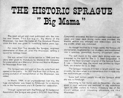
This describes some of the renovations done in Pittsburgh to the "Big Mama" (click the figure to enlarge it to see the text).
This is one of the actresses from "Gold on the Hills," standing somewhere on the Sprague, approx. 1956. This is my friend who loaned me the program booklets.
In 1960, planning was underway to dredge and build the Vicksburg Harbor Project. This artist's rendering was in the 1960 program booklet.

Thank you, Linda, for saving these articles all these decades.