Tuesday, May 1, 2018

The Country Fair - gambling, food, drinking, and fun (Nepal 2017-16)

During the first couple of days in Bhachchek, we kept hearing that schools would be closed on Wednesday. It was not a national holiday, so what was going on? Well, a country fair would be held at a bridge crossing over the Chepe Khola (river) at an elevation of about 900m. From Bhachchek, we had to descend about 900m to reach the crossing. (Note, click any picture to enlarge it.)
Rice fields below Bhachchek, approx. 1500m elevation. Exposed with a med. yellow filter to enhance contrast.
Vertical change in Nepal is especially interesting because you pass through different botanical zones. Near Bhachchek, the forest was thick with hardwoods and Rhododendron. Then about half way down into the valley, terraces with rice fields appeared. The villagers labor heroically on these terraced platforms carved out of the hillsides by generations of farmers.
Finally, we reached the Chepe Khola and crossed the suspension bridge. Nepal has many bridges like this. They are not suited for vehicles, but local folks often push motor scooters over them, along with the occasional goat and donkey. This bridge was packed with people from the surrounding towns coming to enjoy the fair.
The tents were set up on the right bank of the river below some rice fields. The boulders show that occasionally, an immense flood roars down this valley, carrying along bus-sized boulders. The river runs clear here, showing that it has descended from a rocky mountainous area.
The gents love to gamble at these gatherings. In the upper photograph, they throw rings and win prizes. In the lower picture, the fellow rolls cubes with the same symbols as are on the mat. I gave him a few rupees and lost (surprise!).
The food vendors do a roaring business. They use portable propane stoves. I am not sure how they get all the supplies to the site.
The young ladies show up in their city clothes, checking out the scene.
Finally, for our return to Bhachchek, we took a jeep uphill, loaded with not only with our group but also some village ladies. In rural Nepal, jeep rented by foreigners = free transportation. We lurched, banged, and sloshed our way uphill, getting out at the worst mud pits while the driver negotiated his way through the muck. These Mahindra Bolero jeeps are rugged. One of our soft, sissified, leather-seated play-SUVs would not last more than a couple of kilometers on a Nepali mountain road. Mahindra almost totally dominates the market for pickups and jeeps, along with an occasional Suzuki and Toyota.
On Friday, we loaded into the Boleros and ground downhill on the spine-jarring track. Oops, a siren. Some Nepali soldiers were heading downhill in a hurry in a rather nice pickup. In a couple of minutes, there they were, axle deep in mud, rear wheels spinning vigorously. The soldiers got out with their guns, looking on as the driver continued to spin rear wheels. We suggested he engage 4WD. He said it was. No, the front wheels were not pulling at all. Perhaps he didn't turn the locking hubs? While the soldiers watched, the American tourists carried gravel and rocks to the puddle. There was no effort among the seven idle soldiers to push in a coordinated manner, as a US team would. We asked our Nepali school construction coordinator what they would do if they had to go to war? "They don't have the capacity."

Eight hours later, we beat our way into Kathmandu through the dense traffic. The mud was easier.

I took the black and white photographs with Ilford Delta 100 film using a Leica IIIC rangefinder camera and a 5cm f/2.0 Summitar lens (in the family since 1949). This little Leica is a handy and reliable travel camera, and is inconspicuous and un-intimidating compared to a monstrous contemporary DSLR cameras.

Dear Readers, this  is the last of my 2017 Nepal entries. I hope they were of interest. On to other topics, other places, other adventures....

Thursday, April 26, 2018

Schools in rural Gorkha (Nepal 2017-15)

The Gorkha District of Nepal was the epicenter of the 2015 earthquake. The earthquake knocked down thousands of homes, shops, schools, and other structures. They were especially vulnerable because many were built of un-mortared brick or stone with no reinforcing. The walls simply crumbled in the shaking.

One of our projects in the area around the town of Bhachchek was to visit rebuilt schools. Some of the reconstruction was funded by the Gorkha Foundation, which developed innovative school buildings with translucent fiberglass walls. We also visited some schools to donate dental supplies to the children and teachers.
At the elementary school in Bhachchek, the children line up and do some exercises before class starts. The children we saw were well-behaved and cheerful.
We tried to instruct the children about dental hygiene. They were familiar with the concept of tooth brushing, but flossing was a bit too complicated for the little kids. But they were thrilled with their packets of tooth supplies.
While hiking uphill to the village of Siran Danda, we saw children in gray uniforms and neckties. These children go to a private school, not the elementary school in the previous pictures. These students were also fascinated by the odd lumpy Westerners.
The second day, we walked to a construction site in the town of Birauta, where the Gorkha Foundation had built one of their buildings. The village elders fed us a hearty mid-morning snack. Our host was a former UK army officer, Sub. Gobinda Gurung. He had been very organized and effective in 2015 when the earthquake struck, and lobbied the government effectively for relief supplies and other assistance for his townspeople. The children thought we were very odd (well, we are).
Courtesy of the Gorkha Foundation, April 2018
This is a construction photograph from Birauta. The bottom part of each wall is made of stone held together with concrete. A steel framework supports the fiberglas roof panels and translucent walls. In an earthquake, the upper portion of the building has some flex. One problem: we were told that at lower altitude, the buildings are hot in the midday sun.
Telling the students in Nepani about tooth hygiene. The guys responded to a hint that girls like fellows with good clean teeth. 
Talking to the teachers about kits that let young ladies continue to attend school when they have their periods. This is a Gorkha Foundation building with translucent sides.
From Birauta,we descended steeply through the forest/jungle to the Shree Nepane Secondary School in Siranchok.
I was impressed by the range of ages. It is a secondary school, but the teachers bring their little ones to work with them. The older students learn English and high school-level material. Mixing all ages reminds me of some Montessori schools, where older students help instruct the younger ones.

The last photograph, of the young laughing ladies, is my favorite frame from the 2017 Nepal trip. I took it with a Leica IIIC rangefinder camera and 5cm ƒ/2.0 Summitar lens on Ilford Delta 100 film, exposed at E.I of 80. The Leica is small and unobtrusive, and the shutter release makes a subtle "click." I think it is much less intimidating than a modern DSLR, which looks like the photographer is pointing a cannon at its victims.

Wednesday, April 18, 2018

Into the Hills, Bhachchek in Gorkha District (Nepal 2017-14)

We rode in a minivan west out of the Kathmandu valley on the winding, rutted, bumpy Kathmandu-Pokkhara highway. The road is choked with truck traffic because this is the major supply route for goods and petroleum products imported from India. All fuel used in Kathmandu is trucked in, which, as you can imagine, leads to miserable traffic jams on the twisty mountain roads and nasty diesel emissions along the way.
We lunched (dahl baht of course) in Anbu Khaireni, a bustling commercial town in Gorkha District. We had been following the Trisuli river downstream. We saw groups in kayaks and rafts, but the high levels of pollution and sewage dumping would make me dubious of the pleasures of rafting this waterway. In Anbu Khaireni, we switched from the comfortable minivan to hard-riding Mahindra Bolero jeeps.
After a few hours pounding uphill, it was time for tea break in Amppipal, a dusty little town in the foothills in the Gorkha District. There is a hospital in the town operated by a German NGO.
Finally, we reached our destination, the village of Bhachchek at 1790 m (5,900 ft) elevation. Tourists are uncommon here; the local folks were unfailingly friendly but thought we were a bit odd. Children especially found us fascinating. The streets are packed mud. I would hate to be here in the wet season.
A surprising number of small shops line the streets. They sell beer and goods from India, such as plastic ware, tools, biscuits, clothing, cooking oil, and simple cosmetics.
From what we could tell, many of the goods come up the mountain in wagons pulled by these sturdy Mahindra tractors. The wagons do not have suspension (just rubber tires), and as a result, they clang and bang noisily.
Dusk usually meant darkness and extra chickens taking their evening constitutional before heading for the roost. Some days featured a few hours of mains electricity, some days none. One night I woke up with a light shining in my face because the power had started up.
We stayed in these little cabins. The lady who ran the place cooked heroically for us, but we could tell she was unfamiliar with tourists. For example, if we wanted extra tea or eggs, she often had to send a boy to a nearby shop to fetch a package. The shower water was cold, but a large wood-fired boiling pot was set up near the huts. The toilets were rough (surprise...). My hut was the one on the very left, behind a white shirt on the line. Just beyond the corrugated metal barrier was a chicken coop. The rooster made his 04:00 noises, followed by clucking and scratching. The country life....

The black and white photographs are from Ilford Delta 100 film exposed in a Leica IIIC camera with 5cm f/2.0 Summitar lens (both from 1949). The last picture is from a Nexus 4 mobile.

Saturday, April 14, 2018

A River Flows through Kathmandu: the Bishnumati (Nepal 2017-13)


Two rivers flow through the Kathmandu Valley of Nepal. The main one is the Bagmati, which separates Kathmandu from Patan. It is considered holy by both Hindus and Buddhists. It rises in the Himalaya north of the Kathmandu valley and, after a major right and left turn in the city, flows generally south towards India through the Lesser Himalaya. The Bishnumati River also originates north of Kathmandu and flows through the western part of old Kathmandu. It joins the Bagmati in the southern part of the city about 3/4 mile south of Kathmandu Durbar Square. Both rivers are a mess. They have received  untreated sewage for decades, trash, old car bodies, and general detritus of a city without pollution controls.

Bishnumati River, view N from Swayambhu Marg Bridge

The view north from the Swayanbhu Marg bridge is rather discouraging. The river smells (OK, stinks), and there is trash and sludge in the water. The gravel berm or levee on the right in the water is perplexing. Is it to prevent flooding of some feature on the banks? A stream comes in from the left near the bridge in the distance. Possibly the berm is designed to prevent the flow from striking the bank on the right and causing erosion. Also note the broad gravel/sand bank on the left. The city maintenance workers should remove this gravel to allow the river greater flow capacity during flood.

Bishnumati River, view S from Swayambhu Marg Bridge

The view to the south is also discouraging. But there was a tractor digging in the gravel bank. I hope they intended to truck the material away. There are major brick works south of Kathmandu, and almost surely there are clay pits and excavations that could accept this excess riverine sediment.


About 1 mile west of the Bishnumati River is the Swoyambhunath Stupa. From the east, you ascend several thousand steps to the temple complex on a hilltop. It is a crowded scene with vendors, tourists, and Buddhists from many countries. The woods and general grounds are pretty trashy. Monkeys live in the woods and thrive picking food scraps.


I will only show two pictures from the main temple grounds of the Swoyambhunath Stupa. The site has shoulder-to-shoulder people. Many of the old buildings were terribly damaged by the 2015 earthquake. Most were made of unreinforced bricks, and the walls tumbled down in the earthquake. We saw construction crews laboriously rebuilding structures by hand.


I took the first three photographs on Kodak Tmax 100 film with my Leica IIIC rangefinder camera with 5cm ƒ/2.0 Summitar lens and a medium yellow filter. The scenes at the Swoyambhunath Stupa were from a Nexus 4 phone.

Tuesday, April 10, 2018

The Mississippi Delta 26: New Hope MB Church, Estill

In October of 2017, the Mississippi Heritage trust announced its 2017 list of 10 Most Endangered Properties. On the list was a handsome wood church in the hamlet of Estill, north of Hollandale. I had never heard of the site before, so my wife and I checked it on our early April Delta trip. The church is on Walcott Road just north of the intersection with Avon-Darlove Road.

From the Heritage Trust:
New Hope Missionary Baptist Church-Estill
Nominated by Kendall Aldridge

New Hope Missionary Baptist Church is a rare example of an early twentieth century rural African American Delta church. Constructed in 1918, the building survived the great flood of 1927 because of its close proximity to Deer Creek, which is higher than the surrounding land.  A wood-framed building with hints of Gothic Revival style in the infilled pointed arches, the abandoned church has several large holes in the roof, allowing rain to poor in.  In addition to the leaking roof, there are cracks between much of the clapboard siding, allowing water to blow in during a storm.
 You can see the pride that the original founders took in their church from the engraved corner stones.
The church was closed, but I could take one interior picture by holding my phone against a glass pane. While walking around, a gent in a truck and a lady in a car stopped and asked if I was going to restore the church. I assume they were aware of the listing on the most endangered list, but I had to disappoint them that I had no connection with any restoration efforts. The lady said she lived on the adjoining farm. She said there were many pictures of river immersion baptisms from decades ago. I checked on the Library of Congress holdings but did not find any such pictures.

These snapshots are from a Motorola Moto G5 mobile phone. I also took some real photographs on Kodak TMax 100 film with a Spotmatic, but these need to be developed and scanned. Please wait for an update.

Update: July 2018. Preservation Mississippi announced that the The Delta National Heritage Area announced its 2018 grant awards. One of these was to support stabilization of the church in Estill:

• Mississippi Heritage TrustJackson, MS – $24,500 to support preservation of the New Hope Missionary Baptist Church building in Estill, Washington County, MS, by installing a metal roof, securely storing church pews and furnishings, and engaging the congregation and other residents in developing a long-term plan for use of the building

Thursday, April 5, 2018

Perched on the Heights: Chiwong Monastery, Solu Khumbu, Nepal (Nepal 2017-12)

Chiwong Monastery with Phaplu airstrip in the distance

Dear Readers, this is the last monastery that my friends and I visited during our circle trek in the Solu Khumbu. The Chiwong Monastery is perched on the edge of a steep mountain - almost a cliff - with a stunning view to the south. The town of Phaplu is in the distance, and the residents of the monastery can monitor the aircraft flying up the valley, making an abrupt turn, and dropping down onto the airstrip.

Chiwong Monastery has a web page:
The Chiwong Monastery was founded by the late Sangey Lama, in 1923. Sangey Lama’s ancestors, and all Sherpa people, have their origins in Kham, in northeastern Tibet. They migrated to the Everest region of the Solu Khumbu and made their home there, some 500 years ago.

At one time, the Chiwong Monastery echoed with the prayers and scholastic activities of the many monks and nuns that resided there. The monastery has a proud history, having been home to several spiritual leaders and learned monks. Chiwong Monastery had the privilege of hosting Dza-Rong-Phuk Sangey Ngawang Tenzing Jangpo, from 1955-1958. And, His Holiness Trulshig Rinpoche lived at the monastery from 1960-1967.
The monastery has a modern guest house built only a few years ago by an Italian organization. From the guest rooms, it was a steep walk uphill to the main buildings. I do not have any pictures of the older buildings. They were hard to capture because of the steep topography, but in the first photograph, you can see the complex from the ridge top.
This monastery also serves as a school for boys of various ages. Most eat in a group, but at every meal, 3 or 4 of the younger boys eat with the older monks to socialize them to the upper echelons of the establishment.
We has some of the best food on our trek here. We were invited to eat with the senior monks.

The Lepon (aka Abbot) of Chiwong Gompa was a humble man who rose to that position from a village background. As a boy, he had trained at the Buddhist Academy in Serlo (described in an earlier post). His personality and personal philosophy led to his rise to the top and his approach to running a monastery full of young students. My friend, Don Messerschmidt could converse with the Lipon because both spoke village-level Nepali. The Lipon told us he had been to New York. That must have been quite a cultural and noise shock.
As usual, the kitchen offered some interesting scenes with hard side-lighting. The middle frame of the young man washing his hands had a light leak or some bad flare.
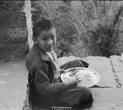
Some of the younger students had their dahl baht outside on the porch. I noticed they were using spoons rather than their fingers.
The monastery also fed our porters. The kitchens in these monasteries are big operations, as you have seen in my various pictures from this and other Nepali monasteries.

The black and white photographs were from Tmax 400 film exposed in my 1949 Leica IIIC camera with a 5cm ƒ/2.0 Summitar lens. I used a Gossen Luna Pro Digital light meter to measure the light.