Tuesday, October 1, 2013

Cisterns of Venice, Italy

Long-time readers may remember that when I explored historical Patan in Kathmandu, Nepal, I noted how old apartment buildings were clustered around a central square or patio, in which there was a well.  In the era before municipal water supply, not only was the well essential to provide water for the residents, but it was probably the center of social life, a place for gossip, and a way to keep check on who was coming and going. Venice had a similar culture.

In Venice, the paved area in the middle of a cluster of houses was known as a campo. Venice has only one square, and that is the Piazzo San Marco, the monumental gathering place before the St. Mark's Basilica, the Clock Tower (Torre dell'Orologio), and the Procuratie Vecchie. So a piazzo was a major decorative and political feature, while more modest campos were found throughout the islands and neighborhoods. And most campos were equipped with a cistern to trap and save rainwater. The cistern consisted of a brick-lined chamber filled with sand.  Rain water filtered down through the sand to maintain purity.
Campo Realto Novo, Venice
Here is the top or head of the cistern in the Campo Realto Novo, near the Realto bridge. Look at the magnificent pink marble - one huge carved piece topped with old wrought iron grillwork. At one time, some of the paving tiles on the ground would have been perforated to allow rainwater to enter the sand pit below. Years ago, the residents of the surrounding houses elected a well marshal to keep the paving blocks and the general area clean. While washing, the perforations were sealed to prevent dirty water from entering the cistern. Fouling the water was punishable with death. (Hmmm, why isn't fouling our waterways today punishable in a similar manner?)  In this campo, a tap with running municipal water was added much later (see the foreground).
Calle del Teatro, Venice.
Here is the cistern in the Calle del Teatro, near the site of Marco Polo's house. The house is gone, but tour guides take you there to show you where it was supposed to be. This cistern has has a decorated iron spigot. The paving blocks are newer and the perforated ones are gone or covered up.
Here are two more cistern heads, again carved from single pieces of marble. Imagine the skill hundreds of years ago to quarry this stone, drag it out of the mountains, carve it, and bring it to Venice by wagon and barge. It is similar to the enterprise displayed by the ancient Egyptians, who quarried rock and brought it down the Nile by barge.
Campo-Sant'Angelo, Venice.
This cistern is in the Campo-Sant'Angelo. This example was made from several marble pieces.
Palazzo Cavalli-Franchetti, Venice.
This unit with spectacular carving and ironwork is in front of Palazzo Cavalli-Franchetti, whose other side fronts the Grand Canal. I suppose if you were wealthy and owned a palazzo, you also could afford an elegant cistern.
Let's cross the Grand Canal on the Ponte de l'Academia, which is next to the Palazzo Cavalli-Franchetti.  This is the view to the east, with the dome of Santa Maria della Salute at the skyline. Truly, there is no other place else on earth with such an astonishing architectural heritage in such a small area (well, possibly one exception: the temples at Angor in Cambodia). Also, consider the skill of the medieval architects, who knew how to build a foundation in soft, muddy deltaic sediment that could support a monumental stone church weighing thousands of tonnes.
Campo S.Vio, Venice.
The neighborhoods south of the Grand Canal also needed cisterns. This example is at Campo S.Vio, by the Palazzo Barbarigo. I could not tell if this was a single piece of marble or multi-piece.
Calle del'Abazia, Venice.
As our final example, here is a monumental single carved piece at Calle del'Abazia, by the church of San Gregorio. Again, you can see that the paving stones are new, and the old perforated ones are covered.
Giudecca canal, Venice.
Finally, from the ancient to the ultra-modern: this is the Giudecca canal, the main deep-draft navigation channel for ferry boats and cruise ships transiting from the Port of Venice through the Laguna Veneta, past the Lido, and on to destinations throughout the Adriatic and Mediterranean. This is a serious passenger port, and some weekends see up to 40,000 tourists invading the fragile city. They overwhelm the local stores, restaurants, and toilets. The smell of money, but possibly the seeds of destruction?
This is a 1958 post card from the Giudecca Canal in front of San Marco square. The label on the card states, "Paquebot SAN MARCO, Societe de Navigation, Venise." My parents sent this card to a relative.

For more information on Venetian cisterns, see these volumes on architecture:

McGregor, J. H. S. 2006. Venice from the Ground Up.  Belknap Press of Harvard University Press, Cambridge, MA, 384 p.

Howard, D., and Moretti, L.  2002.  The Architectural History of Venice.  Yale University Press, New Haven, CT, 384 p.

Venipedia has a description of the cisterns:  http://www.venipedia.org/wiki/index.php?title=Wellhead , accessed September 20, 2013.

Photographs taken with a Nexus 4 phone (sorry, no real camera this trip).

Tuesday, September 10, 2013

Feltre, a gem of Venetian / Italian Architecture

Feltre (Venetian: Fèltre) is a quiet town in the province of Belluno in Veneto, in northern Italy. The Dolomites loom to the north.  Feltre is the southern end of the Alta Via 2 hiking trail, which snakes through the Dolomites starting in Brixen, and a few nights here are a grand way to end an exhausting trek, sleep in, eat, and let your blisters drain.
Within the Dolomites, much of the architecture and tradition is Tyrolean because the mountains were part of the Hapsburg Empire until the end of the first World War, after which they were ceded to Italy. Feltre was largely destroyed in 1509 and rebuilt in classical Renaissance style, so it is decidedly Italian rather than Austrian. Your view from the hotel window tells the story: clay tile roofs, narrow lanes, and the Dolomites just to the north.
Feltre draws you in many ways.  First, it is a city of narrow stone-paved roads.
The town is full of shaded walking lanes.  Just walk randomly and something nice will be just around a corner.
Then there are the arches.  Ancient Italian towns are full of arches.
Then the plazas with neat architectural features and art.
Maybe best of all, like most Italian cities, Feltre is a food town.  These people have used fresh local ingredients for centuries, long before trendy American urbanites "discovered" the local food movement.
Want a light snack?  How about a sandwich in crusty bread and a glass (or two or three) of local wine?  It doesn't get much better than this. I found prices to be really reasonable and people incredibly hospitable.

An editorial note:  Small towns in Italy, Austria, Germany, France and Spain are clean, neat, and, for the most part, architecturally preserved  Their residents live harmoniously with their past and recycle their buildings.  Why do so many small U.S. towns look shabby, have dirty, pot-holed streets, have ghastly strips consisting of vile, fast-food restaurants and quickly-built steel commercial buildings, and why have they let their architectural heritage decay?  It baffles me.

Photographs taken with a Nexus 4 phone, reprocessed with ACDSee Pro software.  The automatic white balance of the Nexus is often off and needs manual correction.  Also, a fundamental flaw: it does not save a RAW file.

Saturday, September 7, 2013

Revisit to the Pláka of Athens, Greece

When visiting Athens, one of your first destinations should be the Acropolis and the Pláka District. Compared to the noisy and congested modern city, in the Pláka, you have a sense of village life before the cars and mobile phones and pollution.  To refresh your geography, the Acropolis is the limestone hill on which temples and sacred precincts have existed for 3000 years.  Classical Athens was situated around the Acropolis, and the Pláka is the last remnant of the 1800s village that clung to the slopes before 20th century urban sprawl.
First, here is a 1951 photograph of the Acropolis taken on Kodak Plus-X black and white film. The big temple is the Parthenon.
View from the University of Athens History Museum (site of the original 1800s university).
Walk in the Pláka, look up, and the Acropolis looms above you.  History is everywhere. The two photographs above were taken from The University of Athens History Museum. The building is one of the few remaining from before the King Otto era. From 1837 to 1841, it served as the first university of the independent Greek State.  The museum is free, and the building is air conditioned if you need a cool break.
The narrow lanes wind up and down, and are really pleasant.
View north with Mount Lycabettus in the distance
Sadly, look in the distance, and the frenetic, uncontrolled post-World War II urban construction is all too evident.  Thousands of elegant homes, mansions and early 20th century Art Nouveau buildings were demolished and replaced with rapidly-constructed concrete boxes.
Still, take your time, look around, and stop for a relaxing drink or meal under an umbrella.
Temple of the Winds, 1951
Here is the Temple of the Winds, another 1951 scene.  This view does not look very different today.
I have written about the flea market in the Monastiraki District before.It is a bit dull compared to the 1950s (see the link) but still worth a visit.
It is definitely worth a visit to see lovelies like these two.
Emerge from the flea market, and you are in Monasteraki Square, now a popular meeting spot with easy access to the Metro. Beware of pick-pockets.
Turn around and look south, and there is the Acropolis dominating the skyline.  The building in the foreground is a former mosque, one of the few remaining from the Ottoman era.

Editorial note:  The US media is full of ominous stories about the terrible state of the Greek economy, strikes, civil disobedience, and general gloom and decay.  The stories may be true to some extent, but as a tourist, you are mostly sheltered. The Greek people are as friendly as ever, the restaurants a bit less expensive than five years ago, the food as good as ever, the wine better, the scenery as magical as ever, and the ladies weigh less than 300 lb. Moral: don't believe the scare stories in the media.

Update, October 2016:  Conditions have deteriorated badly in Athens. In 2015, it looked almost "normal." One year later, the city looks distinctly grungy, as if buildings have not been pressure-washed or painted in years. In rural Greece, trash is everywhere. Street repair is of a much lower standard than before. Graffiti has been sprayed on almost all flat surfaces as well as on busses and trams. The area between Omonia and Monasteraki has a distinctly Middle-East flavor and crime there has increased. I am changing my previous opinion and now recommend tourists not travel to Greece until it can sort out its financial and security issues. It's really sad.

2013 digital images were from July 2013 with a Nexus 4 phone, reprocessed with ACDsee Pro software. The 1951 photographs were from a Canon rangefinder camera (possibly a model IIB) with 50mm ƒ/1.9 Serenar lens.

Wednesday, August 28, 2013

Former mining town: Lavrio, Greece

Lavrio (Modern Greek: Λαύριο, classical Greek: Λαύριον) is a seaport on the southeast corner of the Attica peninsula, about two hours drive from Athens. This is the warmest part of mainland Greece, and the palms and tropical plants almost make you think you are in the tropics. In antiquity, Lavrio was famous for its silver mines. The mines, worked by slave labor, provided much of the revenue for the Athenian state. Around 483 BC, the mines provided funds to expand the Athenian fleet to 200 triremes, thus laying the foundation of Athenian naval power. According to the Blue Guide, Greece, some mining was already in progress here in paleolithic times. The mines were eventually exhausted but were reopened in the late 1800s by French and Greek companies to extract manganese, lead, and cadmium.

I think all mining has now ended.  But hills around town still have dilapidated factories, industrial buildings,  and pieces of machinery.
On the shore road is this half bridge, once probably holding a conveyor system or an ore railroad.
This iron pier extended out into the bay from the half bridge.  I noticed the cobble on the beach had a dark red, chunky appearance.  It was probably some sort of slag.
Today the modern town is cheerful, and locals and tourists sit in the plazas and enjoy coffees and meals.  A ferry goes to Kea (Tzia) island,with connections further to the Cyclades, and there are plenty of yachts in the harbor, so the town has a healthy tourist influx.
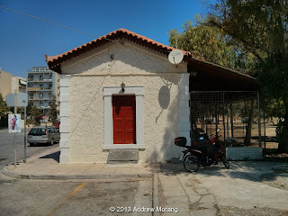
Lavrion was the terminal of the Athens-Lavrion Railroad, last used in 1957 (see the 2012 post on the rail station in Markoupolou).  The old depot is now a restaurant. Putting restaurants in old depots is a popular use, but many of these eateries in the USA fail rather quickly.
Here is another railroad building also reused as a restaurant and another one being used for storage.

Photographs taken with a Nexus 4 smart phone (operated by dumb user...).