Showing posts with label Waterways Experiment Station. Show all posts

Friday, July 29, 2011

Pumps from the Waterways Experiment Station, Vicksburg, Mississippi

Pumping water has always been a big activity at the Waterways Experiment Station, the Corps of Engineers research center south of Vicksburg, Mississippi. In the past, most hydraulic models were physical models, meaning they were three-dimensional reproductions of the earth, rivers, and channels through which water was run to test how different engineering works performed.

Over the last decade, the amount of physical modeling done at the station has dropped off greatly because of the high cost of the technicians and equipment. Also, numerical (computer) models can now do many of the simulations more quickly and can test a wide range of options. Therefore, much of the old pump equipment has been surplussed, and some of the hangers have been removed. The scene above shows Pump House 3063 being demolished.

The pump house formerly housed six or seven 200 horsepower pumps that distributed water to the surrounding shelters and to an open-air model of Old River Control. Pipes ran underground to the various shelters, and the return water flowed back to the lake.


This was massive, heavy-duty equipment. The pump house appears in a 1949 aerial photograph of the station, so we can assume the pumps are older. The body of water that served as the reservoir was known as the Supplemental Lake (with Brown's Lake being the "main" lake). Over the years, the lab switched to using city water to reduce fouling from silt and organic debris. The lake now is a healthy habitat for fish, turtles, snakes, and fish. I occasionally see a Belted Kingfisher perched on a pole looking for lunch.


All the pumps were taken away by a metal recycler on May 11, 2006. I heard that he found a buyer for the equipment, so maybe these historic pumps are still at work somewhere.

Digital images taken with a Sony DSC-W7 digital camera.

Wednesday, July 13, 2011

Follow-up: Demolition of WWII-era building at the Waterways Experiment Station, Vicksburg, Mississippi

In the last essay, I showed some photographs of Building 2025, one of the "temporary" structures erected in World War II at the Waterways Experiment Station. I am glad I stopped to record what was left because on July 8, 2011, the backhoe started tearing it down.

It does not take long for a machine to tear down wood walls. But the floor was well made; the tractors drove on it without it collapsing.

This very interesting manifold was part of the water sprinkler system. Plumbing was well made in those days, made to last.

Finally, I found a room with thousands of 35 mm slides strewn about on the floor. They had once been labeled and neatly stored in sleeves or Kodak Carousel trays. Is this the fate of most old photographs? We cherish 100-year-old photographs of people and cities, but age and rarity have enhanced their value. Once photography became a common hobby in the post-war era, people took millions or billions of snapshots and dumped the negatives and prints in boxes. Possibly only the original photographer considered the work valuable. I often read on photography forums how a digital photographer backs up all his files on a RAID machine and sends a spare backup to safe storage somewhere. And if those machines fail, will it really matter? He takes 10,000 photographs a year and all of them are works of art? It is a guy thing. Will his family ever really look through his tens of thousands of files? The same with this old building. Does it really matter that it was torn down?)

(Photographs taken with a Panasonic G1 camera. The scene with the slides was an 8-second exposure.)

Update, July 13, 2011. The demolition continues.

During the 1980s and 1990s, this part of Building 2025 was the supply depot, where you could pick up stationery supplies, field books, some tools, work gloves, and similar small items. Back then, pens and pencils had "U.S. Government" or "Federal" written on them. They even stocked fountain pens and ink (was it red ink?). At the end of the summer, students would raid the supplies and take off to college crates of diskettes and notebooks. Then they closed the depot, with the idea that it was cheaper to send a government employee to Office Max to buy supplies. So much for convenience or saving money.

Monday, July 4, 2011

Historic Buildings at the Waterways Experiment Station, Vicksburg

The Waterways Experiment Station (now known as the Engineer Research and Development Center or ERDC) is a 550+ acre army base in Vicksburg, Mississippi, located south of I-20 off Halls Ferry Road. The station was created by Congress in 1929 as a response to the great 1927 Mississippi River flood as a testing laboratory for the Corps of Engineers to build hydraulic models and study riverine processes.

During World War II, the laboratory's mission expanded greatly in response to the war effort, and many temporary wood building were built for offices and workshops. One of these is Building 2025, used until recently as the Shipping and Receiving office. Sadly, it's time has come and it is being dismantled.

I am not sure why it will be demolished other than the typical problems associated with 60-year-old buildings, such as difficulty in maintaining climate control and possibly vermin.

I recall visiting Washington, DC, in the 1960s and at that time, there were still many clusters of these one-floor wooden "temporary" buildings still being used as government offices. Most have disappeared, so now you have to find them on remote bases off in the hinterlands.

The work crew removed asbestos shingles that covered the original pine siding. A couple of the gents told me that overall the building was in excellent condition. The asbestos panels had preserved the pine siding and there was no rot or decay.

After 60 years, the ceilings and floors had not sagged at all. I am sure the joists were heart pine or cypress. I asked about recycling the wood, but the workmen said it would be too expensive to dismantle piece by piece.


There is still a lot of furniture and detritus inside, but little is worth recycling.

The walls were painted with industrial pink, possibly a bit more cheerful than the gross green you see in most institutional buildings. The blue box contained some sort of router for the computer network.

A final farewell.

(All frames except for no. 1 taken with a Panasonic G1 digital camera with 14-45 mm lens, tripod-mounted.)

Saturday, December 25, 2010

Update: Mississippi Basin Model - Further Decline

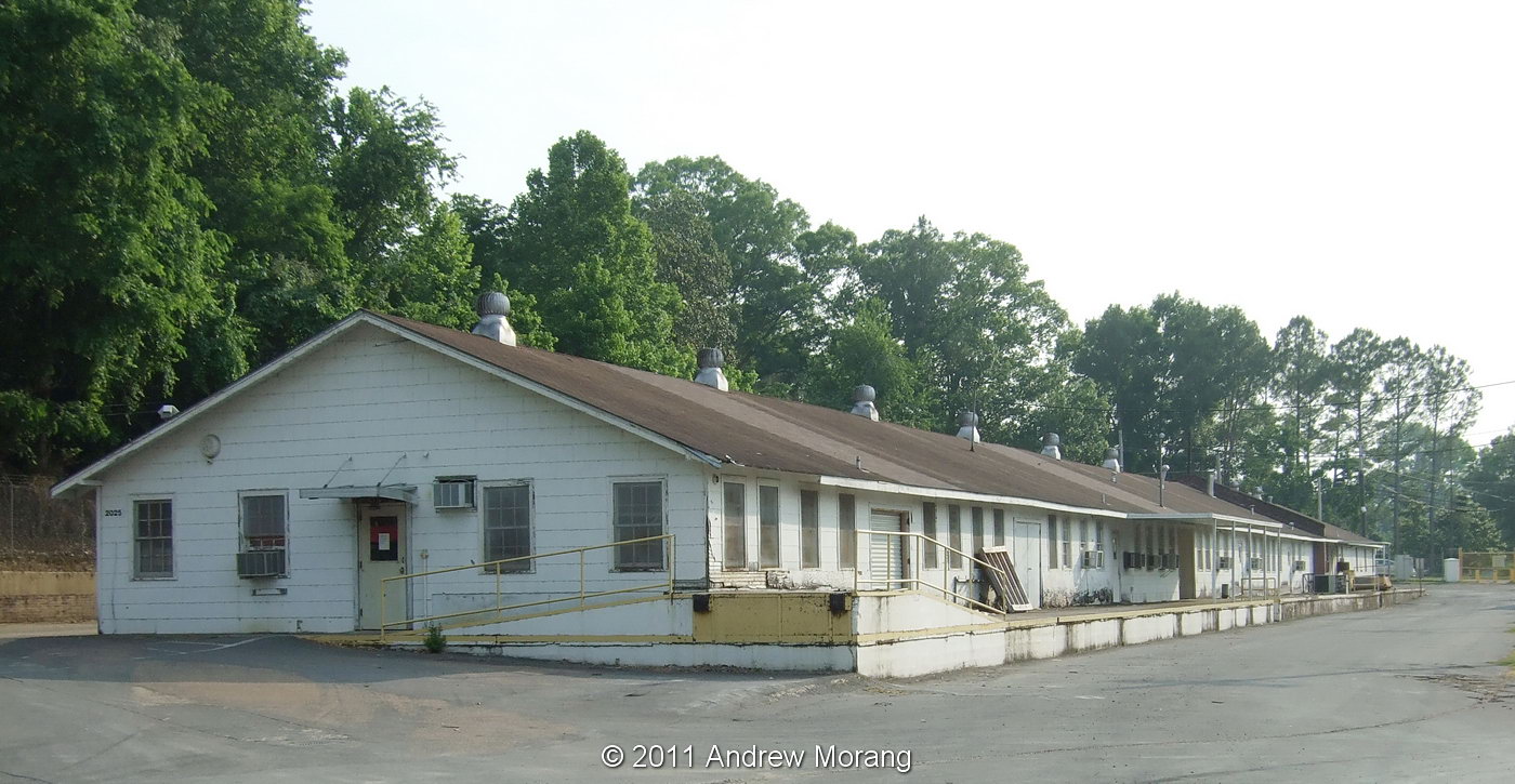
Dear Readers, bad news: what is left of the famous Mississippi Basin hydraulic model in Jackson (in Butts Park off McRaven Street) has deteriorated noticeably in the last year.

This was the largest hydraulic model in the world, meaning it covered the largest continental land area ever to be assembled into one comprehensive tool to test water flows. It was last used during the 1973 Mississippi River flood when the Old River Control Structure was almost undermined. The structure's failure would have led to a large proportion of the river's flow going down the Atchafalaya River waterway rather then along the present path past Baton Rouge and New Orleans and on to the Balize Delta. The model was maintained through the 1970s but finally discontinued because of the expensive manpower requirements. The land was deeded to the Department of the Interior and subsequently to the City of Jackson in the early 1990s. Since then, trees and brush have covered much of the site, buildings have fallen down, and vandals have damaged equipment and stolen property.
You can get an idea of the vast size of this operation from the photograph above. This is part of the lower Mississippi below Vicksburg. The accordion-folded mesh serves as friction to simulate trees (hardwood bottom land) in the delta plain. This area is not as overgrown as other areas because of the broad expanse of concrete.
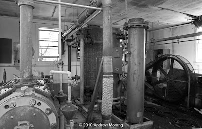
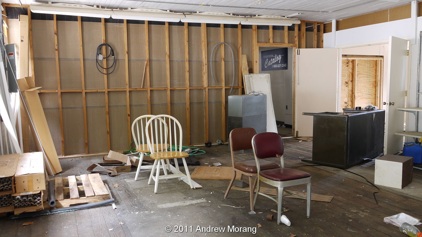
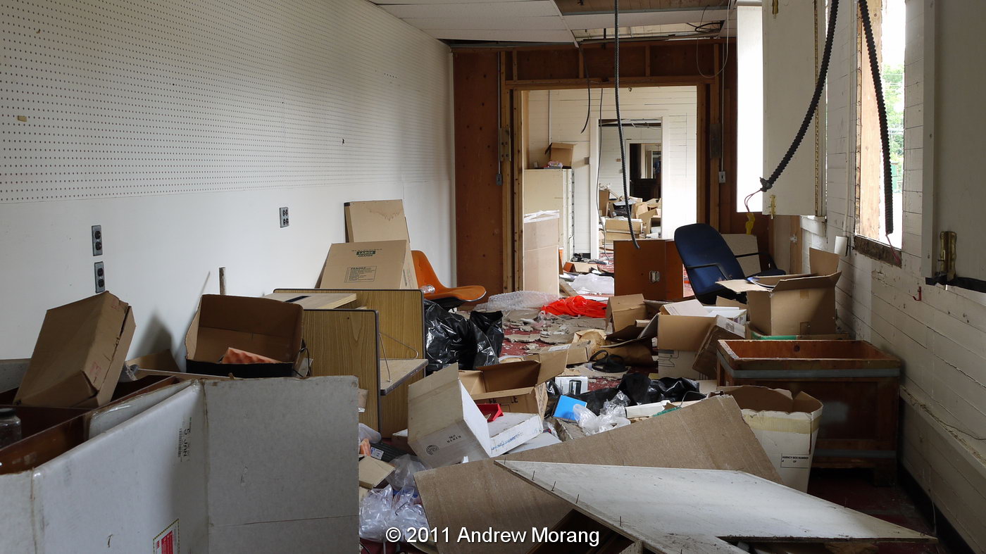
One of the compressor houses still has its roof, and the equipment inside is still present. Another one-story building on the site has completely collapsed. Another one suffered a fire so intense that the steel roof joists warped.
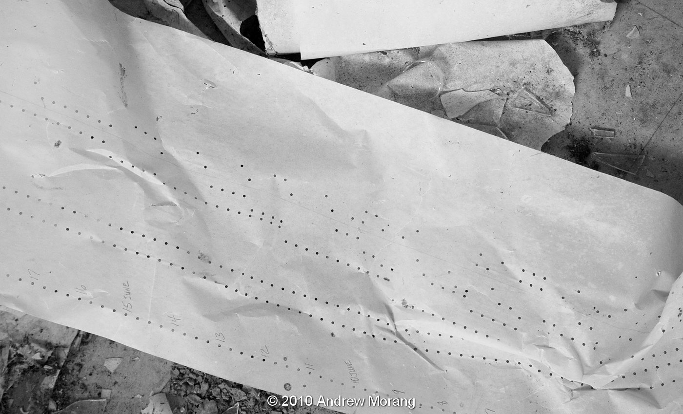
In the lower-river control house, a number of the Stevens chart recorders have been stolen since last January. These machines provided a permanent record of a flood in the form of stage hydrographs. They recorded on chart paper with pens, similar to tide recorders and just about every other type of technical data recorder in the mid-20th century.
The punched paper you see above was for the flow controller system. This controlled a variety of orifices in the flow controller tank, which in turn released precisely measured amounts of water to the model. The charts could be played back many times to rerun particular flow events or storms. A coworker told me that at one time, many bookcases were filled with these paper rolls. Fascinating technology, but I can imagine the manpower required.

You can see more photographs of the site in this January 2010 blog entry: Basin Model. If you want to see what is left, visit soon. The deterioration appears to be accelerating. It's really sad to let this historic civil engineering wonder go.

UPDATE JULY 2017:  A volunteer organization has been formed to clean and clear the site and develop it as an education/interpretive center. They have already done amazing work at clearing trees and cleaning off some of the concrete walkways. Readers interested in participating in the cleanup work, please contact: 

Sarah McEwen
President, Friends of the Mississippi River Basin Model
601-376-9131
Twitter: @MSRiverBasinMod
Facebook: @FriendsofMississippiRiverBasin Model