|
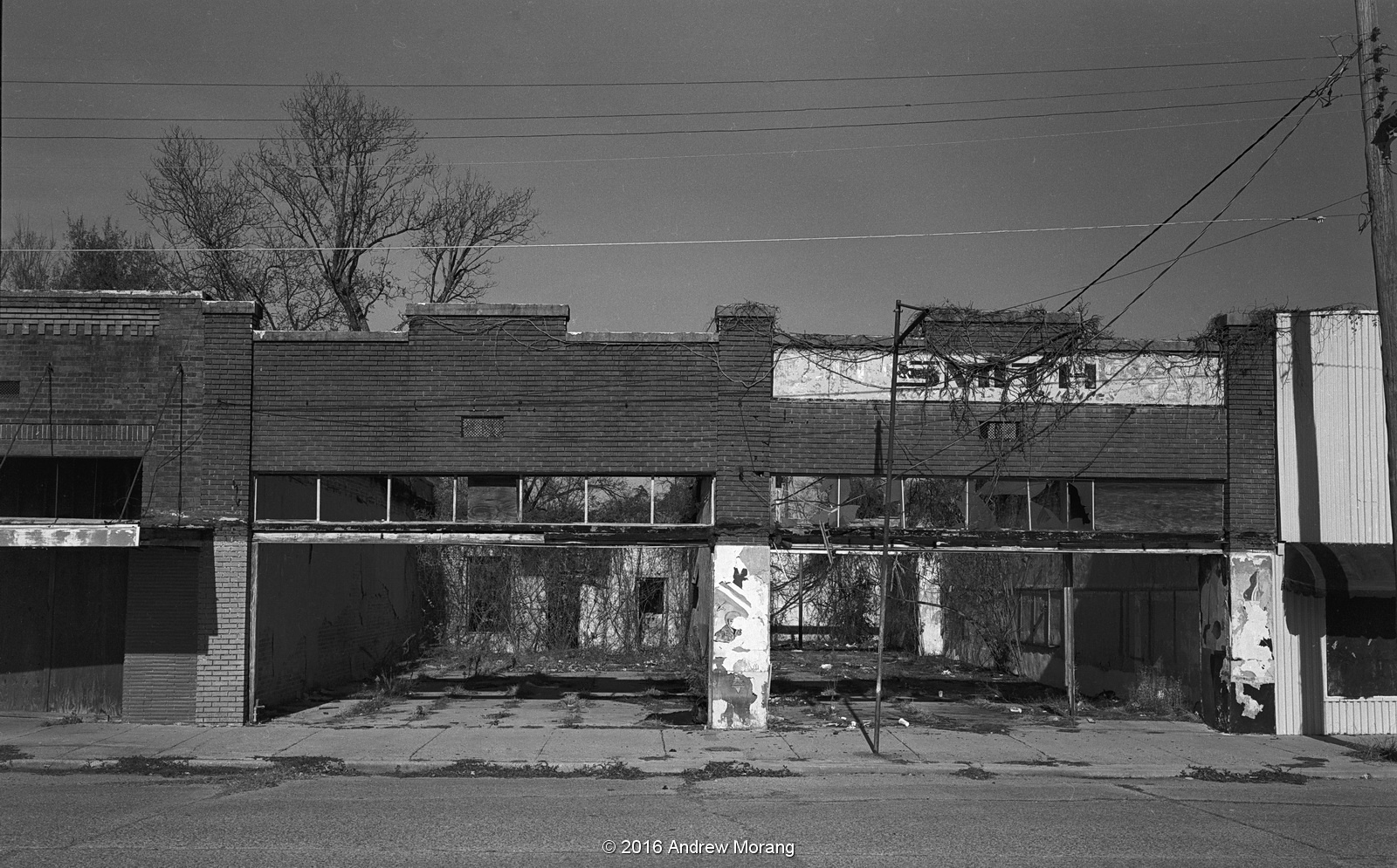
| Snyder Street, Tallulah, Louisiana |
 |
| Snyder Street, Tallulah, Louisiana |
Tallulah, the parish seat of Madison Parish, Louisiana, is a small town in northeast Louisiana just off Interstate 20. I remember going there about 25 years ago with some other photographers to take pictures. It was rather forlorn then, and is even rougher today. The main businesses are the parish government and the large state prison on Green Street, with agriculture in the surrounding farm fields.
 |
| 220 Snyder Street, Tallulah, LA, Dec., 2016. |
 |
| Depot Street, Tallulah (digital file from 2013) |
Snyder Street, facing the railroad tracks, was once the thriving commercial strip. Today, most of the store fronts are empty, and a couple of roofs have collapsed. Several times a day, a Kansas City Southern freight rumbles by, often with four locomotives pulling container carriers. This is the new global commerce that has left towns like Tallulah behind.
East Green Street is also U.S. Highway 80, which runs east-west through town. A number of old commercial buildings are in various states of use and abandonment. Before the 1970s, U.S. 80 was the only major highway, and all through traffic drove right through town. But I-20 was routed south of town, and today, most travelers ignore the city unless they specifically have a need to pull off at the Tallulah exit (and many of them just go to the truck stops and then continue on the interstate).
The Madison Parish Court House was cheerful and crowded during the 2013 Teddy Bearfest. I wrote about the
2013 Teddy Bearfest in a previous article.
This is one of the many abandoned stores, this one on Chestnut Street, facing the courthouse.
East of town, Louisiana Route 602 takes a U-shaped path south of the interstate. It makes an excellent bicycle route as you pass farm fields, silos, and patches of woodland.
 |
| Former restaurant, 314 West Green St., Tallulah |
 |
| Former teen center, 407 West Green St., Tallulah |
 |
| Abandoned house, 522 West Green St. This structure is no longer extant. |
 |
| Closed store, 800 West Green Street, Tallulah |
Heading west on Green Street, which is U.S. 80, you pass some rather rough neighborhoods, then pass the prison, and eventually get to farmfields. The main attraction to the west is the Tensas River National Wildlife Refuge, which has a large resident bear population.
 |
| Shotgun houses across the street from the prison, U.S. 80. |
The rectangle black and white photographs are from a medium format Fuji GW690II camera with 90mm f/3.5 lens. The film was either Kodak Panatomic-X or Kodak Tri-X 400. The 2017 view of shotgun houses is from a Hasselblad 501CM camera. I scanned the negatives on a Minolta Scan Multi film scanner using Silverfast Ai software.