Showing posts with label Boston. Show all posts

Sunday, July 17, 2022

Back When it was Cool: Charles River, Boston, January 1968

Winter of 1968


With the summer midday heat here in Vicksburg hovering around 34° or 35° C (95° F), one thinks of cool. In my stuff (of which there is far too much), I found some Kodachrome slides of the frozen Charles River in Boston. I took these in January of 1968, when I did not know anything about photography but was excited by views and vistas. My grandmother was visiting (the lady from my Escape from Berlin article), and we went to the Top of the Hub observation deck in the Prudential Tower. I can't recall if we ate lunch up there. 

Charles River view west with Cambridge across the river
Charles River view northeast towards Charlestown with Longfellow Bridge in the center

The handsome multi-arch bridge is the Longfellow Bridge, built in 1901. A friend remembered how badly rusted the steelwork had become some 20 years ago. The structure received an almost total rebuild in the early 2000s. Beyond the Longfellow bridge is the Charles River Dam, on which is located Boston's Museum of Science.

Back Bay in foreground with the Charles Basin and MIT campus across the river

Decades ago, I taught sailing in the Charles Basin at Community Boating. This public sailing organization has run programs for adults and children here since 1946. Summer was lazy and laid-back. We filled baggies with water and threw them at other boats. During those sailing days, I sometimes walked across town to Durgin Park Restaurant for a cup of chow-dah and a 95 cent luncheon. Then home via the MBTA on Dime-Time (yes, only 10 cents).

In autumn, the winds picked up and the fun increased. If a boat went over, a motor boat came out to pick us up and right the capsized sail boat. Then they took us to a doctor in Back Bay who administered tetanus shots. There was none of that get permission from your parents stuff - you got a tetanus shot. How times have changed. 

But best of all, the Charles River has been drastically cleaned. Once a national scandal for its pollution, the river now hosts fish, eagles and other wildlife. This is a dramatic example of the benefits of federal waterway protections by means of the EPA's Charles River Initiative.

Topographic Notes


Let us step back into topographic history. Much of the flat land area today in Boston is artificial land fill. We often use the term "reclamation," as if we are reclaiming the land from the sea or river, waging battle on the evil forces of nature. 


Landfilling in Boston since 1630 has more than doubled the urban area (unfortunately, at the expense of destroying what must have been highly productive wetlands). The figure above is adapted from Rosen, Brenninkmeyer, and Maybury (1993).

The Charles River Basin and the neighborhood that you see in the snowy pictures above is artificial. The tidal river between Boston and Cambridge was formerly an expanse of mudflats which were exposed twice daily and renowned for mosquitoes and nasty aromas in summer. The original 1910 dam converted the basin into an agreeable fresh-water body, along which fashionable homes, a landscaped esplanade, and institutions of higher learning were located (Whitehill 1968). 


Museum of Science on original Charles River Dam

Little of the original dam can be seen because a busy highway crosses it and the Museum of Science was built on the dam in 1950. 

New Charles River Dam and pump house, completed in 1978

The new Charles River Dam is multi-function project. Not only was it designed to protect against unusually high tide or surge in Boston Harbor moving upstream into the basin but also to maintain a restricted range of water level in the Charles River Basin. Large pumps can pump rainwater and runoff from the river side of the dam out into the harbor side (on the left in the photograph). The pumps first operated during the Northeast Blizzard of '78. 

Back Bay in 1944, before construction of the Prudential Tower

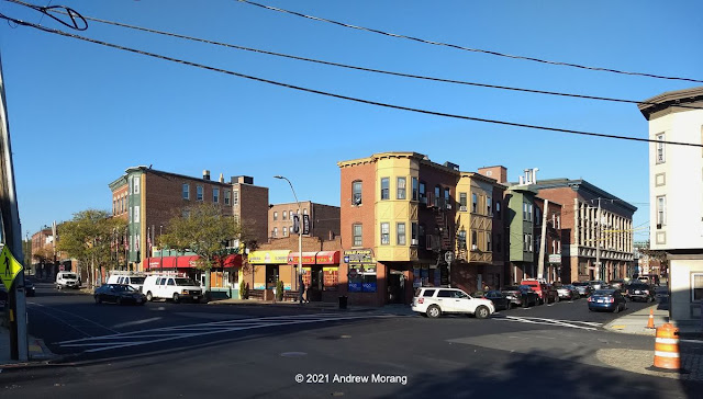
The Back Bay has been Boston's most fashionable neighborhood since the marsh ands tidal flats along the original Charles River were drained and filled, with construction starting in 1859. From Wikipedia:
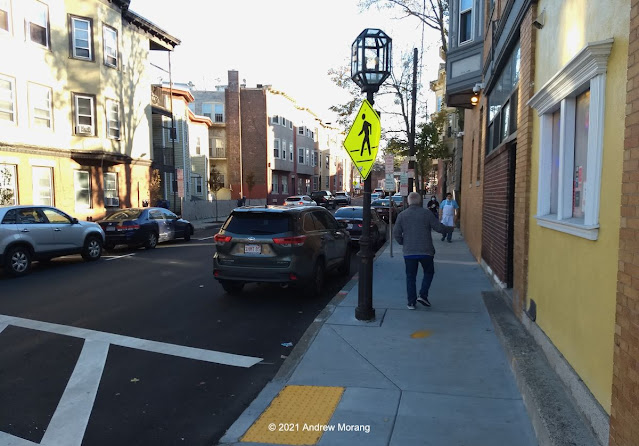
Setback requirements and other restrictions, written into the lot deeds of the newly filled Back Bay, produced harmonious rows of dignified three- and four-story residential brownstones (though most along Newbury Street are now in commercial use). The Back Bay is listed on the National Register of Historic Places, and is considered one of the best-preserved examples of 19th-century urban architecture in the United States. In 1966, the Massachusetts Legislature, "to safeguard the heritage of the city of Boston by preventing the despoliation" of the Back Bay, created the Back Bay Architectural District to regulate exterior changes to Back Bay buildings.
My wife's mother and parents lived in the Back Bay before World War II, but I do not know the address. If you worked in downtown Boston, this would be elegant and convenient.

Visit Boston, walk in the Back Bay, admire the fashionable and expensive stores, lunch at a bistro, have your hair done at a spa, and consider how history surrounds you.

References

Rosen, P. S., Brenninkmeyer, B. M., and Maybury, L. M. 1993. “Holocene Evolution of Boston Inner Harbor, Massachusetts,” Journal of Coastal Research, Vol 9, No. 2, pp 363-377.

Whitehill, W.M.  1968.  Boston, A Topographical History.  Second edition, enlarged, Belknap Press of Harvard University Press, Cambridge, MA, 299 p.


The snow pictures are from Kodachrome II film, probably taken with my dad's Canon rangefinder camera (unknown model) and its 50mm ƒ/1.9 Canon Serenar lens. My dad's 1944 Kodachrome is from a Perfex camera (unknown model).

Thursday, January 6, 2022

Afternoon at Logan (Boston, Massachusetts)

Dear Urban Decay readers, Happy New Year! Let us all hope that 2022 is a better year all around than 2021, which was pretty horrible for many people. At least the US stock market was happy, but that does not help millions of Americans. Maybe the pandemic will wane in the coming year and we can sort-of return to normal travel and mixing unsocial gatherings. 

In the meantime, here are some photographs from my archives of Boston and Logan Airport.
_______________________________________________________________________________

Panorama of Boston and Logan Airport from Hilton Hotel, May, 1988. (4 Kodachrome frames from a Rollei 35S camera; click to enlarge and see details)

I have flown in and out of Logan Airport too many times to remember, starting sometime in the 1950s. 

The US Army built the original landing field, then named Boston Airport, in 1923 on tidal flats in East Boston. The fill at that time consisted of cinders, meaning coal clinkers. Many of the 1800s fills in and around Boston were a convenient way to dispose of clinkers. The term then used was reclamation, as if humans were "reclaiming" land from the sea. I remember during the 1973 oil crisis, some people suggested burning coal at home as a source of heat. My uncle, an old-timer, told me that was an absurd idea. Where would we take the ash and clinkers? He was right; it would be difficult to dispose of the coal waste for a city the size of Boston and its suburbs. 

The Army operated Boston Airport until 1928, when they transferred it to the State of Massachusetts. As the years progressed, the state added more landfill, expanded runways, and built terminals. The field was renamed the General Edward Lawrence Logan International Airport (IATA: BOS). Today, Logan is a bustling transport hub, the 16th busiest airport in the USA, with many daily international flights.

Typical 1988 afternoon on the Southeast Expressway, waiting to transit to the Callahan Tunnel and to Logan Airport

Logan is also a topographic confusion (OK, total mess) of twisting roads, buildings seemingly perched haphazardly all over the place, one-way streets, and choked traffic. It is often a nightmare getting in an out of Logan, especially by car. Decades ago, the State should have purchased another location for their main airport, a site inland that was not as constrained by water and had easier access. 

The photograph above shows a typical afternoon on the old (now demolished) Southeast Expressway en route to Logan Airport. The Southeast Expressway was one of the grandiose 1950s projects to build high speed roadways through American cities, regardless of the environmental and societal cost. Opened in 1959, it was instantly hated because it partly cut off the Italian North End from the rest of the city. As you recall, these highways often cut through low-income neighborhoods (usually meaning African-American) as if the continuity of their neighborhoods was of no value. Also, those people usually did not have the access to high-power lawyers or political friends to argue their situation. But this sordid topic of corruption and giveaways to the construction industry is for a future blog article. 


In 1988, I attended a training class in Cambridge and stayed a few nights at the Hilton Hotel at Logan Airport. Surprisingly, my room had an interesting view west towards downtown Boston (see the panorama) and overlooking some of the Logan hangars. Not bad for an airport hotel. This older building has been replaced by a modern and larger Hilton. In 1988, some operators still used propellor planes. Eastern Airlines was still operating, before being absorbed into PanAm and thereafter disappearing into bankruptcy oblivion.

In the photograph with the Eastern Airlines hangar, the long building across the water is the former Army Supply Base, also known as the Boston Quartermaster Terminal. In the late 1930, my father worked for the US Army Corps of Engineers in that building. 

These are Kodachrome slides from a Rollei 35S compact camera with a 40mm ƒ/2.8 Sonnar lens. I scanned the slides with a Plustek 7600i scanner and created the panoramas with Photoshop CS6. 

UPDATE. (Extra information in response to a comment left by Jim Grey below.) 

Issue 1: The MBTA Blue Line stops at Airport (appropriate name). The problem with this stop is that it is too far from the terminals for most people to walk. Therefore, a surface bus runs on a loop to the terminals, car rental center, and Airport station. Decades ago, the bus cost 25 cents, cash only. I always wondered, a tourist steps off the plane from Paris or Lagos and he is supposed to have 25 cent coins ready to drop into the coin box? At least now, the bus no longer requires a fee. 

Issue 2: In almost every European city that I have visited, plus Bangkok and Hong Kong, the train comes literally under the terminal. Go through passport control, pick up your bags, and take the escalator down to the train station. No need to fight snow or rain with your luggage. In 60 years, the MBTA has not been able to reroute the Blue line into a subterranean station the would be convenient for passengers? Seriously? And Boston likes to think it has a world-class airport?

Issue 3: In Airport station, you use a vending machine to buy a transit pass for one ride or various time periods. OK, that is easy. But a sign states that there is a reduced fare for senior citizens. However, this fare machine will only refill or validate an existing senior pass. You need to acquire the senior card downtown at another station. Seriously?

Thursday, December 30, 2021

Morning in Chelsea, Massachusetts

Chelsea is a historic city across the Mystic River from Boston, Massachusetts. The Naumkeag Tribe lived in that area for thousands of years before the first European settler built a trading post in 1624. Several battles during the revolutionary war were fought in Chelsea. 

When I was young, Chelsea was a rough and tumble working-class community with factories and dense housing. This usually consisted of wood triple-deckers, often in poor condition. Many were erected after 1908, when an immense fire destroyed large portions of the older neighborhoods

In 1973, a second great fire left about 20 percent of the city in ashes. Residents left, the tax base collapsed, and the city sank into crime, corruption, and gross mismanagement. The State of Massachusetts imposed a state-approved receiver to control the city, improve schools, overhaul the police, and dismantle the corrupt city government. By 1995, the city was on the mend.

Morning at the junction of Pearl Street and Congress Avenue, Chelsea
Park Street
Congress Avenue

Since my last visits in who knows how many years, the city has been revived and semi-gentrified. Today, it looks pretty good. My childhood memories are totally out of date. The houses are mostly vinyl-clad, the streets clean, and the nearby school bustling with children and parents walking their kids to school (walking?). The area in the photographs above has become largely Hispanic, and I heard Spanish being spoken regularly. There were no spooky vibes as I feel in many other American cities. I could live here with no major issues except for the congestion and lack of parking. 

Heading north, Route 1 is still pretty crummy, but it is strip America of gaudy architecture as opposed to burned out and abandoned malls and strip shopping centers.

Katz Bagel Bakery, 139 Park street, Chelsea
Katz Bagel Bakery interior - fresh and authentic

My wife and I recently stayed in a Logan Airport hotel on the Chelsea side of Chelsea Creek (a waterway that flows into the Mystic River near where it debouches into Boston Harbor). The breakfast was offal. What is wrong with American hotels? I walked west into town to see where I could get a decent coffee. I found myself at Katz Bagel Bakery. This is the real thing! This family-owned company has been making bagels here since 1938. I bought three and asked about a package of cookies on the counter. The baker said free, take them. As for coffee, he directed me to a Hispanic convenience store. A Hispanic lady was mixing coffee con leche with vast amounts of sugar, but I poured my own for only $1.  

The Jewish tradition dates back to the early 20th century, when Chelsea was a major destination for Russian and Eastern European immigrants. Russian Jews came in large numbers after the 1890s, in response to pogroms in their home country and, after the 1917 revolution, to Communist persecution.  

Charlestown street leading downhill from the Bunker Hill Monument
USS Constitution ("Old Ironsides"), Boston National Historical Park. 

Cross the Mystic River to Charlestown, another a historic city within sight of Boston. Charlestown was the site of the Battle of Bunker (Bunkah) Hill, one of the early battles of the Revolutionary War. On a 2006 visit, I was surprised to see that Charlestown has also been gentrified and looks very nice. 

I have written about Boston before:
Standby for more photographs of Boston and vicinity.  If you have a chance, definitely visit Boston, savor the history, explore the cultural and historical offerings, and eat good food. (But don't try to drive in the city unless you are really brave.)

Happy and prosperous New Year to you all. I hope 2022 it is better and healthier than the ghastly 2021 that is about to end.

UPDATE

After a comment from a reader about the offal at American hotels, I thought I would include a photograph of the breakfast buffet at a hotel in the Passo di San Pellegrino in the Italian Dolomites. Many Italian hotels offer breakfasts like this. And the pastries are made by the chef on the premises. As I wrote before, what is wrong with American Hotels and their vile food offerings? Who eats at a captive restaurant in an American hotel?

Typical breakfast, Hotel Arnica, Passo di San Pellegrino, Italian Dolomites


Saturday, October 5, 2019

From the Archives: Boston, Massachusetts, in 1944

My father spent part of the World War II working for the US Navy in Puerto Rico. He returned to Boston in 1944 when his contract was over. He had always been a keen photographer and took many pictures of relatives and their friends. I looked through his Kodachrome slides and found only four of Boston. He probably thought that everyone photographed Boston and that mundane city scenes were uninteresting. It is a pity because mundane street scenes take on a documentary importance as the years and decades pass.

Charles River from Cambridge, Massachusetts
Boston and Charles River from Cambridge
Boston Garden and Swan Boat (pedaled by human power)
Boston harbor, Anscochrome transparency

These photographs look so innocent, so tourist-like. But consider the geopolitical conditions of 1944. The world was at war. In the Soviet Union, Soviet armies were painfully beating back the German army in immense battles during which tens of thousands on both side perished. Russian and Ukrainian peasants were starving in their destroyed villages, and German civilians in the homeland were also close to malnutrition. In the Pacific, American troops were slowly clearing islands of Japanese occupiers at horrifying cost. In China, millions were starving. But in the United States, children sailed on the Charles River and the Boston Garden was clean and blooming with flowers. A civilian could buy Kodachrome film and get it processed. (It is possibly that my dad bought the Kodachrome at the Navy base in Puerto Rico at his former job, but nevertheless, he felt secure enough in its availability to take casual pictures.) War must have felt far away, although Americans were unified in beating the Axis powers.

I believe these photographs were from an American-made Perfex 35mm camera. In the future, I need to scan many more of my dad's 1944 frames of family events and casual gatherings.

I have written about Boston before (click this link about Quincy Market). I wish I had taken far more pictures of ordinary scenes. You can also type "Boston" in the search box.

Sunday, March 10, 2019

Quincy Market, Boston, Massachusetts - Reuse of Historic Market Buildings

In my previous article, I related the sad news that the famous Durgin Park Restaurant in Boston closed in January, 2019. Durgin Park was located in the north-most granite building of the Quincy Market complex. The granite came from the famous Quincy Quarry, where my friends and I rock-climbed in the 1960s (but that is another story for a future article).
Quincy Market in the mid- to late-1800s, from Boston Public Library 
Faneuil Hall from the Custom House Tower, Nikkormat camera, 105mm lens
Government Center and Boston City Hall, 1970, from Custom House Tower, Nikkormat camera, 28mm lens
Boston's well-known Faneuil Hall is just to the west, and beyond that, Government Center, with its 1960s Brutalist-Moderne Boston City Hall ("the world's ugliest building"). Up through the 1950s, the area west of Faneuil Hall was known as Scollay Square, a formerly vibrant commercial and entertainment district. But by World War II, Scollay was grungy and run-down. My dad called it Squalid Square. In the late-1950s, the City of Boston razed more than 1000 buildings and redeveloped the area as Government Center. Unfortunately, we have no family photographs of Scollay Square.
Although the City developed Government Center in the the 1960s, Quincy Market retained its commercial tenants up through 1975 or 1976, continuing to be occupied by wholesale butchers, fish vendors, and green grocers. In the photographs above, you can see cars and trucks parked in front of well-used shop fronts (these are scans of Kodachrome and Agfachrome slides; click any picture to enlarge it). I remember buying a Christmas tree there one year and taking it home via the MBTA subway. A friend told me that her father, who worked on the family farm near the New Hampshire border in the mid-20th century, remembered taking vegetables by truck to the market.
Quincy Market reconstruction before the Bicentennial, view from Durgin Park Restaurant
Quincy Marker reconstruction, Kodachrome slide, Leica IIIC, 5cm ƒ/2 Summitar lens
In preparation for the nation's Bicentennial, the granite buildings of Quincy Market were completely renovated and leased to restaurant and retail space. 

Readers may recall that before the Bicentennial, historical preservation had minimal respect in the United States. Let developers condemn, pillage, and build new was the common approach to older "blighted" neighborhoods, especially if they were occupied by African Americans. Many books have been written on how corrupt mayors and city governments destroyed historical neighborhoods in the name of "progress" and payoff from developers (e.g., see Fullilove (2016) or O'Connor (1995)). Now we have mid-20th century parking garages and crappy blighted apartments
Quincy Market from Faneuil Hall, 1980
Quincy Market and Custom House tower, 1980
Winter evening, 1980, 28mm lens
By the 1970s, respect for our historical and architectural legacy was finally developing in the United States, and the Bicentennial was a catalyst for historic preservation in many east coast cities. The Boston project became a poster child for what could be done in older cities with a bit of imagination and respect for the past. The Quincy Market redevelopment was an outstanding success, and tourists flocked to the newly revived market district (Quincy 2003). It has remained popular for four decades.
No more butchers or wholesalers, just chocolate. © 2008 Paul Murphy (digital file)
Three cheers for the new Quincy Market - or was it for the pizza? Pentax Spotmatic, 28mm ƒ/3.5 SMC Takumar lens
Quincy Market from window in Faneuil Hall, Leica M3, 35mm ƒ/2 Summicron-RF lens
Readers who have not been to Boston: do go and enjoy a walk through history. Try the restaurants (but sadly, Durgin Park Restaurant closed in January 2019), have a craft beer, munch a bagel, and think about the sailing ships that once docked between these handsome buildings. 

References

Fullilove, M.T., 2016. Root Shock: How Tearing Up City Neighborhoods Hurts America, And What We Can Do About It, Second Edition. New Village Press; Second edition (November 1, 2016), 304 p.

O'Conner, T.H., 1995. Building A New Boston: Politics and Urban Renewal, 1950-1970. Northeastern University Press, 368 p.

Quincy, J. 2003. Quincy's Market: A Boston Landmark. Northeastern University Press, 256 p.

Monday, March 4, 2019

Hot Coffee Coming Through: Durgin Park Restaurant, Boston, Massachusetts

Introduction and Sad News


"Hot coffee coming through!" That translated to, "Come on, get out of the way, I have these huge plates of food to take to a table." And huge plates was right. But sadly, the plates will be no more. The venerable Durgin Park Restaurant, a Boston fixture for 192 years, closed for good on Saturday, January 12, 2019. The logo over the door stated, "Established before you were born." Definitely true. And I recall printed on the menus words to the effect, "Your father ate here and his father, too." True in my case, as well. As noted in Restaurant Business, "Durgin-Park was generally regarded as the nation’s second-oldest restaurant, behind Boston’s Union Oyster House, which was founded in 1826. Durgin-Park opened a year later, while favorite local son John Quincy Adams was president of the United States."
1970s or 1980s photograph at the ground floor entry to Durgin Park (from Forbes magazine). I recall the lady in the middle row with the puffy black hair.

Some Memories


I first ate at Durgin Park in 1965 or 1966 with my dad. He told me he was introduced to the restaurant by his dad. Grandpa died in 1919, so this may not be correct, but certainly is not out of the realm of possibility. But my father had definitely patronized Durgin Park on and off for decades because he recalled when whale steak was on the menu. I think bear steak predated him.
Typical 1976 lunch crowd at Durgin Park. You shared your table with politicians, workmen, tourists, gangsters - almost anyone, and everyone was cheerful.
The "Hot coffee coming through" ladies, 1976 (Leica IIIC camera, 5cm ƒ/2 Summitar lens, Kodachrome film)
By 2008, the starched white waiter outfits were gone
When I first moved to Massachusetts, the sales tax had just been enacted. The politicians promised that it would never exceed 3 percent. Well, you know how that turned out. But restaurant meals below $1.00 were exempt. Therefore, at midday, Durgin Park offered a 95 cent luncheon, which included a cup of soup, cornbread, a hearty entree, such as yankee pot roast, and a cup of coffee. During the summers, I taught sailing at Community Boating on the Charles River and often walked over to the Faneuil Hall area to lunch at Durgin Park. Even then, a Dollar was a reasonable price for a hearty meal. But as inflation ravaged our economy in the 1970s, the soup and coffee disappeared from the 95 cent lunch and the choice of entrees was reduced. Finally, the 95 cent lunch became a fond memory. Sigh....
Andy and Vico digging in to beans, Yankee pot roast, and scallops
In the 1960s and early-1970s, the lunch crowd was so large, the line for a seat often stretched out the door and along the side of the building. If you waited until about 12:30, the first group of diners, who had been seated at 11:30, were moving out, and you could get a seat in a reasonable time. Another trick in the old days was to buy a drink at the bar. Then you could ascend to the dining rooms on the second floor via a bar-only stair and bypass some of the crowd. But I do not remember patrons drinking spirits in the dining room. Maybe that was restricted to the bar area.
From the 1972-1974 television show, Banacek
The entry hallway and bar were on the ground floor. The dining rooms were on the second floor, accessed by a narrow stair on which the line would stand and wait (eventually they had to wait at the bottom of the stairs). The chief waiter, at the top of the stairs, would survey the dining room and wave groups of two or four to available places at the long, family-style tables. You shared a table with whomever was already there. The kitchens were on the third floor. In the 1970s, it was not uncommon to look out the window and see a quarter cow being hoisted via winch to the third floor.
Young Boston beauty awaiting her chowdah and Yankee pot roast
Parking in downtown Boston was always a problem, even in the 1960s. Back then, the Southeast Expressway was a gruesome elevated concrete roadway carrying I-93 through Boston. This route is now subterranean, thanks to the Central Artery/Tunnel Project or the Big Dig. Most Boston citizens despised the old Southeast Expressway because it cut the heart of the city in half and was a visual eyesore. However, it offered inexpensive parking underneath close to Quincy Market. It was a bit spooky, but we were never mugged, and it offered a short walk to Durgin Park.

Durgin Park Brochure


My wife found a brochure in her recipe box with the famous Boston baked bean recipe as well as a short history from Collier's Magazine (date not specified). Click the link above to see the .pdf file or see the pages individually below (click to expand each page).

The End


Before mid-1970s Bicentennial redevelopment of Quincy Market (see the next article), Durgin Park, Union Oyster House, and a few other establishments were the only lunch spots in this part of Boston. After redevelopment, there were many more choices. Durgin Park soldiered on, but by the mid-2000s, fewer customers came. It did not have a "theme" as is popular in restaurants today. Traditional hearty New England cuisine prepared from scratch ingredients was not trendy. I remember how the menu had changed by the mid-2000s, with vegetarian offerings. They even dropped smelts and mackerel from the menu. How can a true New England eatery not offer mackerel? Or smelts? Modern Americans are too wimpy to eat mackerel? Finally, a 192-year tradition ended. In January, several New England friends sent me the sad news that "Hot coffee coming through" was no more.

The 1976 frames are from Kodachrome film exposed with my 1949 Leica IIIC camera with a 5cm ƒ/2 Summitar lens, which I am still using. I scanned the slides with a Plustek 7600i film scanner using Silverfast Ai software.