Showing posts with label decay. Show all posts

Tuesday, March 29, 2016

Mount Holly Mansion - After the Fire

Mount Holly, on the pleasant shore of Lake Washington, in Foote, Mississippi, is one of those impossibly grand mansions of which many examples were built in the 1800s in various parts of the Mississippi Delta. The 30-room Mount Holly was completed in 1856 of brick with 2-ft-thick walls. It was added to the National Register of Historic Places in 1973. In the 1990s or early 2000s, it had been used as a bed-and-breakfast, but had sat empty for many years. As usual, ownership was unclear. And, as so often tragically happens to neglected buildings, the mansion suffered a disastrous fire on June 17, 2015. I have not yet read an account of who was responsible, but the forlorn walls sit upright in their misery.
I took these photographs in December of 2015. There was no sign of any restoration or activity at all. What happens next? For some pre-fire photographs, please see my April 2011 blog post and read the interesting comments. Preservation Mississippi had an excellent 2010 article on Mount Holly.

Photographs taken with Kodak BW400CN film in a Leica M2 rangefinder camera. The BW400CN is sharp and fine-grain, but does not have the look of traditional silver negative films. I scanned the negatives with a Plustek 7600i scanner using Silverfast software and resized the files with ACDSee Pro 2.5 software.

Monday, January 18, 2016

Into the Woods: Morgan City, Mississippi

Right after Christmas 2015, my daughter, some friends, and I participated in the Audubon Society's annual Christmas bird count on the Sidon, Mississippi, count circle. I had never been there before and did not know the terrain. South of the nearby town of Morgan City (the town in Mississippi, not the city on the Atchafalaya River in Louisiana) are farm fields and remnant patches of bottomland hardwood forest.
We pulled off into a patch of woods to look for birds. There was a collapsed house there, in itself not too unusual. The former occupant left some vehicles behind. The first was an International Harvester truck. This was one of the Loadster series, which ended production in 1979. International Harvester is now known as Navistar International Corporation.
More interesting was a first generation Ford Bronco (1966-1977). This was Ford's small SUV, intended to compete with the Jeep CJ models and the International Harvester Scout.
This was a fairly rustic, basic utility vehicle, which is still respected by serious off-roaders. Notice this example had automatic transmission. Also look at the three knobs to the right of the steering wheel, of which the rightmost one is pulled out. I assume this was either the choke for the carburetor or to operate a vent damper door. Simple but effective, unlike the über-complex electronic nightmares you see in contemporary cars.
There was not much left to the house. This is the fate of wood structures in a humid environment.

Photographs taken with a Fujifilm X-E1 digital camera and the 18mm f/2.0 lens. RAW files processed in PhotoNinja software.

Friday, January 15, 2016

Rest in Peace: Remnants of the "Sprague", Vicksburg, Mississippi

The towboat "Sprague," known as the "Big Mama," was the most powerful and high-capacity sternwheel river boat to ply the Mississippi River. A Mississippi vessel is known as a tow, but really it serves as a pusher, where the powered unit pushes a series of barges up- or down-river. The photograph above, from Mississippi Department of Archives and History, shows the massive stern paddle wheel that would push the entire tow.
This is a 1946 photograph from the Standard Oil (NJ) Collection, Photographic Archives, Archives and Special Collections, University of Louisville.

Southern View wrote about the Big Mama. Some statistics from Wikipedia:
Type:Towboat
Length:276 ft (84 m)
Beam:61 ft (19 m)
Draft:7.4 ft (2.3 m)
Installed power:2,079 horsepower (1,550 kW)
Propulsion:coal-fired steam
The "Sprague" was in operation from 1902 to 1948. After it was decommissioned, it served as a museum on the Vicksburg waterfront. For decades, the Mississippi River melodrama, "Gold in the Hills" was performed onboard. The boat burned at dock on 15 April 1974 under the usual mysterious circumstances. There were plans to restore part of it, but they never came to fruition. Because it was a hazard to navigation on the Yazoo Canal, the hulk was dynamited. Some of the metal remains lay in the dirt and woods just west of North Washington Street for decades. Some bollards or capstans were moved to the Catfish Row playground on Levee street. A few more parts and and the rudder are in the parking lot next to the Klondike restaurant on North Washington Street.
But the largest metal bits are still in the thickets next to the Yazoo Canal. It is easy to reach the site, and there are no "no trespassing" signs. These two photographs show stacks and some unknown tubing.
 Some of the pipe joints have crumbling asbestos.
The boilers must have been quite impressive when intact. Note the bee holes in the packed mud.
Most of these parts are hard to see in summer, when the vines and poison ivy engulf everything. I don't understand why they have not been taken to Catfish Row, where tourists could see how mighty the "Sprague" was once.

These digital images are from a Fujifilm X-E1 digital camera with Fuji 18mm f/2 lens. I processed the RAW files with DxO Filmpack 5 with the Kodak Tri-X or Agra Scala film emulations. They still do not look like real black and white film photographs, so next time I'll return with film.

For more historical photographs and scans of one of the programs, please click this link.

Wednesday, November 25, 2015

Mississippi River Basin Model - continuing decay, November 2015

The former U.S. Army Corps of Engineers' Mississippi Basin Model in Buddy Butts Park in Jackson, Mississippi, remains abandoned and neglected by the City of Jackson. As you might expect, the site is more and more overgrown and vandalized than ever. On this visit, my friends and I explored some of the buildings, which are gradually collapsing.
The first building, next to the water tower, was a pump house partly built over a sump. The catwalk is still intact despite the roof collapsing.
 A steel shed once contained air compressors and other machinery of unknown purpose.
This building once contained the Stevens chart recorders and may have been an executive control center for the model. I showed photographs of the old Stevens recorders in my 2010 article, but all have disappeared now.
These shelves once contained rolls of paper with holes representing some sort of coding (octal?). The flow of water via electrical or pneumatically-actuated valves was controlled by these paper strip charts.
This is one of the inflow controllers. I wish it was intact and wish I knew how it worked.
My friends and I came across another building that we had not explored before.
This building contained the remains of two huge air compressors. I am still not sure exactly how the compressed air was used, but it had something to do with the pneumatic controllers and the chart strip recorders.
This viewing platform was once used by tourists who visited the site. In the 1960s, the Basin Model was a popular tourist attraction (as was the Waterways Experiment Station before 9/11). I have read that many of the former German prisoners of war who worked on the site in World War II came to see the functioning model.
The model is a peaceful place on a quiet Autumn afternoon. Visit it soon before the buildings and concrete terrain elements are completely overgrown.

For some earlier articles, please click the links:

Photographs taken with a Fujifilm X-E1 digital camera with a Fujinon 27mm f/2.8 lens. Raw files processed in PhotoNinja software.

UPDATE JULY 2017:  A volunteer organization has been formed to clean and clear the site and develop it as an education/interpretive center. Readers interested in participating in the cleanup work, please contact: 

Sarah McEwen
President, Friends of the Mississippi River Basin Model
601-376-9131
Twitter: @MSRiverBasinMod
Facebook: @FriendsofMississippiRiverBasin Model

Monday, October 6, 2014

Vicksburg in the Old Days (the '90s)

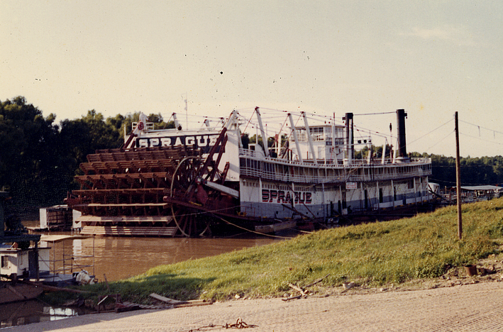
No, not the 1890s, the 1990s. I recently rummaged through some of my negatives and was horrified that they were already 20 years old. I suppose you are officially an old geezer when you think something is not particularly old but your co-workers would consider them so 20th century or so non-digital (you mean, like chemical-based?). This "old days" post will consist of a semi-random walk around Vicksburg with film.
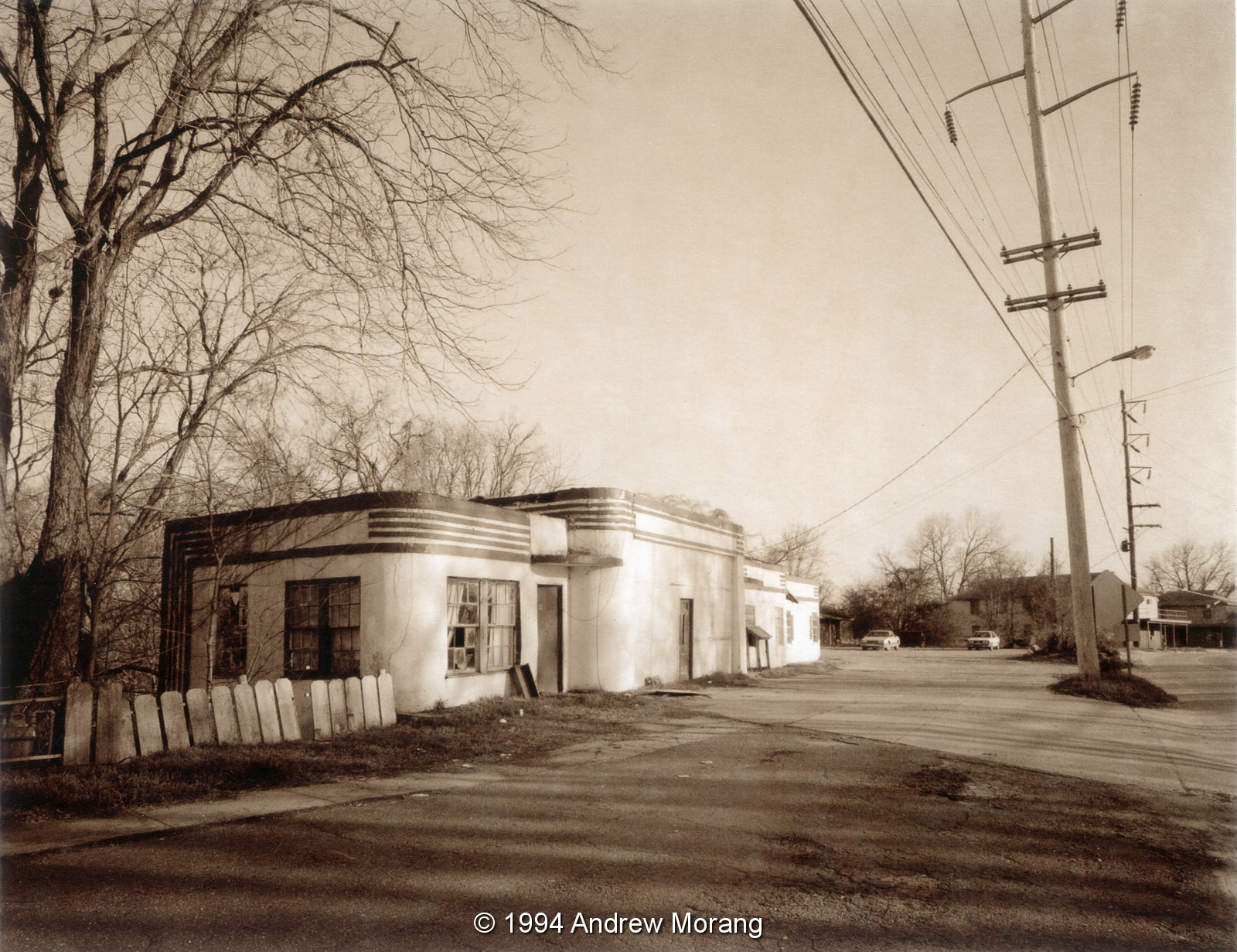
This is Ryan's Coal Yard Package Store, at the corner of North Washington Street and First East. The building was torn down sometime in the early 2000s. At one time, this (or a predecessor building) was a coal yard. It was right next to the railroad tracks, and most Vicksburg homes heated with coal before the 1930s. (Trivia fact: Coal fires caused cinders that occasionally escaped from chimneys. Therefore, most older homes were re-roofed with asbestos shingles in the 1920s and '30s because the asbestos was fire-proof.) This is a Kodak Tri-X 400 frame taken with a Nikon F3 camera.
This is the warehouse right across the street from the Ryan Coal Yard. The place is empty and for sale now. The Fina gasoline station in the distance is where Klondike restaurant is now located.
This is L D's Kitchen at 1111 Mulberry Street, just a short distance south of the Ryan Coal Yard. The building is still in use as a restaurant. At one time, it was a package store and then a lounge. This is a photograph taken with a 35mm Summicron-RF lens on a Leica.
Here are three shotgun shacks, possibly off Clay Street. Many of these have been torn down in the last two decades.
This is the old commercial building at 719 Grove Street. It was condemned for over a year but is now being restored. This is a Polaroid Type 54 instant print taken with a 90mm ƒ/6.8 Raptar lens on a 4×5" Tachihara camera.
Right across Grove Street from the commercial block was the Vicksburg Steam Laundry. It was formed in 1910 and closed some time before 1985. The laundry was in the building that previously housed the first commercial Coca-Cola bottling plant in the country. The building burned in the early 1990s. The rumor is that someone started to redevelop it but found asbestos, so instead torched it. That way, the fire department took care of the problem by washing the asbestos down the storm drains.
The Jackson Street YMCA was demolished in 1995. It was built in 1924 and served the African American community. When it was built, YMCAs were segregated. Notice "Boys' Entrance" above the door. The Jackson Street Community Center, address 923 Walnut Street, now occupies this lot.
Heading south along the river, this is the Riverview Motel at 4009 Washington Street. The site is an empty lot now. This is a Polaroid 4×5" sepia instant print.
This view south along Washington Street looks about the same today. The old motel that resembles a barracks is still in business.
This is a former gas station converted into a motel or apartment on Washington Street, with a river view. The building was demolished in the early 2000s. This is another Polaroid 4×5" sepia instant print.
This is the Carr School on Cherry Street. The hulking building had been closed for decades and lay vandalized, an eyesight to drivers entering town via Halls Ferry Road and Cherry Street. Fortunately, it was restored in 2014 and is now used as apartments.
Back to Clay Street, this is the Junius Ward YMCA at 821 Clay. It has been closed for over a decade, but in 2014, I saw some renovation underway at an erratic pace.
The residence halls in the "Y" were last used in the late 1970s. On contemporary standards, the accommodations were rather basic (What, no air-conditioning? Quelle horreur!), but served as temporary residence for hundreds of men who moved to Vicksburg, including two of my friends.
Further east, this is the lot next to the old Vicksburg Ford at 2704 Clay Street. The garage (on the right) now houses TD's Tires. The apartments at the back are an odd architectural design, suspended between telephone posts driven into the ground. The apartments are occupied by a mixed clientele.
Turn around 180 degrees and look north; the old Mercy Hospital was a block away. It may have been named Parkview in 1996, but I can't remember. The little cottage at the very left, facing Clay Street, may have been the home of J. Mack Moore, the photographer who took hundreds of photographs of Vicksburg in the late 1800s and early 20th century. Mack Moore coated his own glass plates and used a large format camera. When the house was demolished, stacks of his glass negatives were found in the basement, some of which he had recycled for use as window panes. The collection is now at the Old Court House Museum.
Proceed north on North Washington about 5 miles and you reached Margaret's Gro, which the Reverend Dennis had converted to his Temple to God.
The Reverend had a creative streak with bricks, paint, wood, Styrofoam, and anything else he could glue or cement in place. He told me that he learned his brick skills from German bricklayers. He had been a prison guard for World War II prisoners and learned from his charges. Even as late as the 2000s, German tourists came to see Margaret's Gro. (Another trivia item: Germans soldiers were terrified of American black soldiers because of the gruesome stories they had been told by their propaganda machine. Therefore, they tended to be pretty docile when guarded by black soldiers.)
In February, 1989, an ice storm knocked down power lines all over Mississippi. Some parts of Vicksburg were without electricity for almost a week. This is a view of Drummond Street.
Here are two more views of the 1989 ice storm. These are scans of 4×5" Polaroid Type 54 film.
These cottages are on the slope below West Pine Street, just west of the old bus barn. The Kansas City Southern railroad tracks are just below. At one time, there was quite a community of little houses along this slope, but most have been torn down, and the kudzu has taken over. I recall some of these residents had vegetable and corn gardens.

In the future, I will scan more negatives.