Showing posts with label Fuji. Show all posts

Monday, October 8, 2018

Photographing the Cotton Compress of Vicksburg with the Texas Leica (Panatomic-X B&W film)

Background


Dear Readers, for many years, I have used a splendid bear of a camera, the Fuji GW690II rangefinder, also known as the Texas Leica. It has a similar morphology to a Leica rangefinder, except it is, well, really big. The name is most appropriate. As you know, everything in Texas is larger: the vast open spaces across which you must drive, the enormous pickup trucks with dual rear wheels, the oil pumped from the  Permian Basin, the out-sized personalities like President Lyndon Johnson, the magnificent mansions in the River Oaks section of Houston, and the credit card bills of the ladies who occupy said mansions.

Notes on the Fuji Rangefinders


Fuji's original medium format cameras using 120/220 film were the Fujica G690 and GL690 from the late 1960s and mid-1970s. These had interchangeable lenses, and examples in good condition are highly coveted now. They provided a generous 6×9 negative area (actually, about 55×82mm). The GW690 Professional followed in 1978. This differed from the earlier models by having a fixed 90mm f/3.5 lens. The GSW690 Professional had the same body but was equipped with a wide-angle 65mm f/5.6 lens.

In 1985, Fuji made minor revisions and introduced the GW690II, GSW690II, and GW670II. My Texas Leica is the GW690II, which I bought new in 1991.

In 1992, Fuji introduced version III in sizes 6×7, 6×8, and 6×9. It is confusing to keep them all straight, but all are excellent picture machines; choose the negative size you want and look for an example in good condition. The leaf shutter is in the lens, and all controls are on the lens. On mine, filter size is 67mm.

The GW690II camera is a handful. The rangefinder is not as contrasty as one in a Leica, but the Fuji one works well. The body does not have the über-precise meticulous craftsmanship feel of a Rolleiflex or a Hasselblad, but the optical results from the 90mm f/3.5 EBC Fujinon lens are stunning. It is a five-element design with  four groups, all multi-coated. The film moves flat across the film gate and may lie flatter than in the Rolleiflex or Hasselblad. With the 690, you get 8 exposures on a roll of 120 film. When 220 film was in production, a roll would yield 16 exposures.

The main feature I miss in the GW690II is a self-timer. Because I often take pictures in old factories or buildings, I like to place the camera on a shelf or platform for a long exposure. But the lack of a timer means I need a cable release to avoid vibrating the camera. The older Rolleiflex is more handy in this respect.

The classic Panatomic-X Film


My favorite black and white film is the long-discontinued Panatomic-X. Eastman Kodak Company introduced Panatomic-X in 1933 and discontinued it in 1987. The film had been reformulated during its five-decade existence, so my late production was different than the original. It was designed to be an extremely fine grain film, which meant it could be enlarged for large prints and still retain details. This was of value to architectural, fine-art, and aerial photographers. Some 9-inch aerial photography film was a version of Panatomic-X. The version I have in 120 size was rated at ISO 32, but I shoot it at 20 and develop it in Rodinal at 1:50 dilution. Agfa’s Rodinal was a developer that retained the grain structure and therefore looks “sharp” (i.e., it does not have solvent action to partly dissolve the edges of the grain clumps). Used with good lenses and careful technique (that means a tripod), the detail in a Panatomic-X negative is astonishing, even in this age of 36-megapixel digital cameras.

My stock of Panatomic-X expired in 1989, but the rolls have been in the freezer and seem to be perfect. Unfortunately, only 15 rolls are left. Eventually, all good things come to an end. And honestly, Kodak TMax 100 or Ilford Delta 100 seem almost a fine grain and will be a suitable replacement.

The Vicksburg Cotton Compress


A cotton compress was a facility that compressed raw cotton into dense bales. Early compress facilities were steam-powered and were active in Autumn, when the cotton was being harvested. Decades ago, compresses were found throughout the US South when cotton was king. The cotton bales were transported away by rail or by steamboat. When I visited Łódź, Poland, a major textile and industrial center in the 1800s and early 1900s, I was surprised to learn that much of their raw cotton had once come from the USA South. I assume cotton bales from towns like Vicksburg were shipped down the Mississippi River and then transferred to ocean-going vessels in Baton Rouge or New Orleans.

In recent years, cotton production in Mississippi has greatly reduced and has been replaced with corn (for ethanol) or soybeans (export to China). The Vicksburg compress at 2400 Levee Street was in business through the late 1990s or early 2000s. I wish I had asked the operators if I could take photographs when it was in action. 
The historic brick buildings at the Vicksburg Cotton Compress at 2400 Levee Street are almost completely gone. Around 2010-2011, a company bought the buildings and removed the bricks for use somewhere else. Newer steel sheds are still standing but abandoned. There is no obvious action to reuse them.
I took the black and white film photographs in this article on a cold, gloomy day in late December of 2010. I also used a Sony DSC-R1 for digital photographs, which I have shown before (click the link). (Also click any photograph to enlarge it.)
I especially liked the textures and complexity of the tool benches and storage bins. These were old and well-used - from an era when we made things in the USA.
I think this was the machine that compressed cotton into mashed bales. I do not know how it all worked, and I wish I had asked to see the process when the compress was open in the 1980s and 1990s.
Cooper Postcard Collection, courtesy of Mississippi Department of Archives and History. Date not specified.
Vicksburg compress, from the Cooper Postcard Collection, courtesy Mississippi Department of  Archives and History.  Date not specified.
 I hope these massive old timbers were recycled. These were probably old-growth pine or cypress.
An interesting pedestal sink with a single metal support post. I could have a traditional sink like this at home.


Photographs technical:
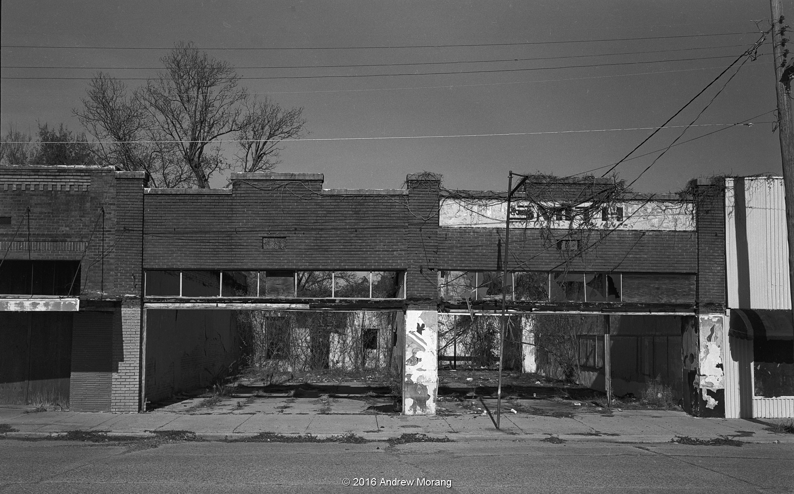
Film: Kodak Panatomic-X film, which has been out of production since the late 1980s. I developed the film in Agfa Rodinal 1:50.
Camera: Fuji GW690II 6×9 rangefinder camera with a 90mm EBC Fujinon lens.
Exposures: I exposed at EI=20, so all frames were tripod-mounted, and many exposures were ½, 1, or more sec. long.
Scanning: Minolta Scan Multi medium-format film scanner, operated with Silverfast Ai software, film profile set at Tri-X 400 setting.
Clean-up: I used the heal tool in Photoshop CS5 to clean up lint and other marks.

Sunday, February 11, 2018

Gone Forever: Smith Hall at the Bonner Campbell Institute, Edwards, Mississippi

The Bonner Campbell Institute or college, formerly the Southern Christian Institute, is west of Edwards, Mississippi, along Old U.S. Highway 80 (once known as the Dixie Overland Highway). The college was one of the early institutions in America dedicated to educating African Americans during the era when most southern states did not consider them worthy of education. I have written about the Bonner Campbell before. In late January, while driving west on Old U.S. Highway 80, I saw that the handsome pillared building known as Smith Hall was totally gone. This motivated me to scan my 2010 film negatives and share the photographs.

The Southern Christian Institute was placed on the National Register of Historic Places in 2007. A Vicksburg friend, Ms. Nancy Bell, who is director of the Vicksburg Foundation for Historic Preservation, did the survey work and wrote the descriptive text. She confirmed that at that time, the buildings were in good condition. The following text is from the official description:

"The Southern Christian Institute (SCI) is situated on 53.6 gently rolling acres at 18449 Old U.S. Highway 80 near Edwards in western Hinds County. The property is rectangular in shape and has 1,434 feet of frontage along the south side of Highway 80 and a maximum depth of 1,776 feet. The campus' seven buildings are situated to either side of a roadway that runs perpendicular to Old Highway 80, and these buildings are linked by concrete walks. The one and two-story structures are constructed of rusticated concrete block, brick, and stucco. Also on the campus are a bell tower and a water tower, and other amenities include a swimming pool and a playground. There are mature pecan, live oak, and cedar trees scattered throughout the property.

In 1882, SCI purchased the plantation of Col. McKinney L. Cook and immediately began repairing the existing buildings, which included the c. 1853 Greek Revival mansion house, a two-story, frame, five-bay, center hall structure with hip roof and two-tiered, full-width gallery. Within five years, a two-story classroom building, a small bam, and two two-room tenant houses were constructed. In 1891, an addition was made to the original plantation mansion to house a girls' dormitory, and over the next 44 years, numerous buildings were constructed, including dormitories, a president's house, a teachers' home, industrial building, and classroom building, in addition to auxiliary buildings such as a grain house, stables, buggy shed, and laundry building.

The campus presently includes seven buildings: the president's house, administration/ classroom building with auditorium, an assembly hall, dormitories, cafeteria, and a multipurpose building that was constructed in 2000. The old Cook mansion was destroyed by fire around 1970, and all that remains is a chimney, which stands on the north end of the campus. The existing historic resources were built by the students during the first 35 years of the 20th century, and many reflect the Colonial Revival style that was popular during that period."
I had always admired this building from the road. When I photographed it in 2010, it has suffered some vandalism, but the building looked sound and the asbestos roof seemed intact.  From the official description:

"Smith Hall Girls' Dormitory 1915 Colonial Revival. Facing west, this building is a two-story, U-shaped, stucco-over-metal lathe, dormitory building (15,412 s.f.) on a raised rusticated concrete block basement with an asbestos covered hip roof. Several colors of asbestos tiles were used to spell out "1914 Smith Hall" on the west side of the roof. There is a two-tiered porch that extends across two thirds of the front fa$ade and over one-third of the north side. This porch is covered by an asphalt-shingled hip roof, with exposed rafter tails, which is supported by tapered stuccoed wooden columns (on the second floor) resting on rusticated concrete block."
Approximate location where Smith Hall once stood (digital photograph).
Allison Hall, the cafeteria complex, has also been demolished.

"Allison Hall (Stanton Hall, Cafeteria) 1909 Colonial Revival influence. Facing east, Allison Hall is built in two sections: the rear section is a two-story square and the front section is a long, one-story, rectangular building. The front section is constructed of rusticated concrete block and topped with an asphalt hip roof. There are ten bays on the main facade: two 2/2 double-hung wooden windows, a single-leaf glazed wood door with a sidelight and transom (configuration of this entry was originally double-leaf with a transom), and two 2/2 double-hung wooden windows."
This building is still standing, but I was unable to check it during my recent visit.

"Administration/Classroom Building 1926. The Administration/ Classroom Building, which faces west, is a two-story, brick, rectangular classroom building on a raised stuccoed basement and crowned by a gable roof with parapeted end walls. A three-bay, gabled, projecting pavilion is in the center of the main facade. There are nine bays on the front facade: four large multi-light, metal, louvered windows; two pair of non-historic, double-leaf doors with covered transoms; and a central pair of non-historic double-leaf doors flanked by multi-light metal louvered windows. A wide concrete band separates the first and second floors and another accents the cornice. The second floor windows have plain concrete lintels. There is an additional wide concrete band that runs across the gable end of the cross gable, above which is a pair of fixed six-light windows with a shaped concrete head mimicking a hood mold."
"Bell Tower 1926. The bell tower is a two-tiered brick structure with an asbestos-shingled hip roof having exposed rafter tails. Brick piers support a wide concrete platform on which brick piers support the roof, which is trimmed by a wide concrete cornice. The bell hangs from the upper tier's ceiling."

The site was also listed on the 10 Most Endangered Places in Mississippi register, which needs to be updated to register the loss of buildings.

Dear Readers, this is how we lose out architectural heritage.

The 2010 black and white photographs were taken on Kodak Panatomic-X film with a Fuji GW690II medium-format 6×9 camera, tripod-mounted. I developed the film in Agfa Rodinal 1:50 and scanned it with a Minolta Scan Multi medium format film scanner.

Tuesday, February 6, 2018

Mouldering Away: the Elks Club Lodge 148, Greenville, Mississippi

For at least 20 years, when I passed through Greenville, I admired this stately building at 504 Washington Avenue. The imposing structure of Greek temple appearance, like many banks of the era, was intended to convince viewers of classical architecture, permanence, and the prosperity of its proprietors/builders/owners.
Card 90710, Cooper Postcard Collection, Mississippi Department of Archives and History (MDAH)  
Card 90936, Cooper Postcard Collection, MDAH.
Card 91689, Cooper Postcard Collection, MDAH
The 1906 Neoclassical-styled building is attributed to architect Patrick Henry Weathers, according to a Mississippi Department of Archives and History fact sheet.
The only recent information I could find was a 2016 article by Suzassippi in Preservation Mississippi about how Mississippi Action for Community Education (M.A.C.E), owner of the building, was trying to secure funding.
The grand entrance stairway is gone, replaced by two opposing narrow stairs under the overhang. The concrete limestone block lower surround was also removed for unknown reason. Let's hope this structure can be saved.

2014 photographs taken with a Fuji GW690II medium-format camera on Kodak Panatomic-X film, developed in Rodinal 1:50. I scanned the negatives with a Minolta Scan Multi medium format film scanner operated with Silverfast Ai software.

Update March 10, 2018: I drove by the Elks Club in the morning. A chain link fence in poor condition surrounds the property. Some of the plywood panels over the windows have fallen off. There is no indication of any repair or stabilization. Fate: unknown.

Tuesday, January 23, 2018

Footloose around Vicksburg with Black and White Film

Abandoned cement silos, Redwood, Mississippi
Dear Readers, Vicksburg is an interesting town topographically and historically. When the light is diffused, which means winter when there is rain or mist, I can't resist driving around and looking for interesting scenes. The following will be a semi-random set of film photographs. We will start in the north in Redwood on Hwy 3 and work our way south to U.S. 61 and then on into town. The silos in the photograph above have been empty since the 1970s. If you are interested in more views near Redwood:  https://worldofdecay.blogspot.com/2017/06/the-mississippi-delta-19-into-woods-in.html
Chimney, U.S. 61 north of Vicksburg near Redwood, Mississippi
This chimney sits all by itself just west of the southbound lane of 61. Most people drive by quickly and ignore it.
Road leading from gravel quarry, North Washington Street, Vicksburg (Update March 2019: the house on the left has been demolished)
Kings Point ferry boat landing, Chicasaw Road (Mamiya C220, 50mm lens)
Drive west on Chicasaw Road, and eventually you reach the ramp for the Kings Point Ferry. The ferry is operated by the Warren County Board of Supervisors and provides access to Kings Point Island. Most of the traffic consists of logging trucks and hunters, but if the weather has been dry for a few weeks, a 2-wheel drive car can pass on the roads.
Beulah Cemetery is a historic burial ground at the end of Martin Luther King, Jr., Blvd. The cemetery was overgrown and neglected for many years but has been cleaned and put on city maintenance during the last 5 years. It is a peaceful spot.
Empty house at 2228 MLK, Jr., Blvd, directly next to Beulah Cemetery
1904 MLK, Jr., Blvd., Vicksburg
Condemned house, 1844 MLK, Jr., Blvd, Vicksburg
Georgia Ave., Vicksburg
Head back downtown, and you pass empty or condemned houses on MLK, Jr. Blvd. Georgia Ave. drops steeply down to the south. There were once many more houses in this valley (and I may have some pictures of them from decades ago), but today, the City could cease maintenance of this road with no obvious inconvenience to anyone.
2212 Grove St., Vicksburg
We have lost many early-20th century houses and cottages. There just is not an economic incentive to fix up a house that has been neglected too long. This little asbestos-shingled cottage on  grove Street is an example.
61 Coffeehouse, Vicksburg
By now, it is time for a coffee. Vicksburg's best espresso or other java beverage can be found at 61 Coffeehouse at 1101 Washington Street, right at the corner of Grove Street. Decades ago, this building housed Velchoff's Restaurant. The always interesting Attic Gallery is upstairs.
Morgan Lane, east of Washington St. and south of Bowmar Ave.
2008 Pearl Street, Vicksburg
Pearl Street parallels the railroad tracks. Decades ago, Pearl Street was lined with modest cottages and shotgun houses. But residents and the operators of bed and breakfast homes complained of the noise from the locomotive horns. Over the years, the railroad bought properties and tore down the houses. And the city closed the grade crossing, after which the train engineers no longer needed to sound the warning horns. Click the link for photographs of many of these houses: https://worldofdecay.blogspot.com/2014/03/more-pearl-street-cottages-vicksburg.html
2511 Cedar Street, Vicksburg
We head east to Military Avenue, another historic part of town. Here, too, many of the early 20th century houses have been neglected or torn down.
Copeland's Bar & Grill, 2618 Halls Ferry Road, Marcus Bottom. As of 2018, the establishment looks closed.  
Marcus Bottom, Halls Ferry Road, Vicksburg
We can end our short tour at Marcus Bottom, an old neighborhood at the junction of Marcus Street and Halls Ferry Road. A new convenience store has been built on the site of this toilet.

The square frames are from a Rolleiflex 3.5E 6×6 camera with 75mm f/3.5 Xenotar lens, using Panatomic-X film. Most of the horizontal frames are from a Fuji GW690II 6×9 camera with Fuji 90mm f/3.5 lens on Panatomic-X or Tri-X film. The grainier horizontal frames are from a Leica IIIC 35mm camera with Kodak TMax 100 film.

Saturday, January 13, 2018

More Long-term Decline: Tallulah, Louisiana

Snyder Street, Tallulah, Louisiana
Tallulah, the parish seat of Madison Parish, Louisiana, is a small town in northeast Louisiana just off Interstate 20. I remember going there about 25 years ago with some other photographers to take pictures. It was rather forlorn then, and is even rougher today. The main businesses are the parish government and the large state prison on Green Street, with agriculture in the surrounding farm fields.
220 Snyder Street, Tallulah, LA, Dec., 2016.
Depot Street, Tallulah (digital file from 2013)
Snyder Street, facing the railroad tracks, was once the thriving commercial strip. Today, most of the store fronts are empty, and a couple of roofs have collapsed. Several times a day, a Kansas City Southern freight rumbles by, often with four locomotives pulling container carriers. This is the new global commerce that has left towns like Tallulah behind.
East Green Street is also U.S. Highway 80, which runs east-west through town. A number of old commercial buildings are in various states of use and abandonment. Before the 1970s, U.S. 80 was the only major highway, and all through traffic drove right through town. But I-20 was routed south of town, and today, most travelers ignore the city unless they specifically have a need to pull off at the Tallulah exit (and many of them just go to the truck stops and then continue on the interstate).
The Madison Parish Court House was cheerful and crowded during the 2013 Teddy Bearfest. I wrote about the 2013 Teddy Bearfest in a previous article.
This is one of the many abandoned stores, this one on Chestnut Street, facing the courthouse.
East of town, Louisiana Route 602 takes a U-shaped path south of the interstate. It makes an excellent bicycle route as you pass farm fields, silos, and patches of woodland.
Former restaurant, 314 West Green St., Tallulah
Former teen center, 407 West Green St., Tallulah
Abandoned house, 522 West Green St. This structure is no longer extant.
Closed store, 800 West Green Street, Tallulah
Heading west on Green Street, which is U.S. 80, you pass some rather rough neighborhoods, then pass the prison, and eventually get to farmfields. The main attraction to the west is the Tensas River National Wildlife Refuge, which has a large resident bear population.
Shotgun houses across the street from the prison, U.S. 80.
The rectangle black and white photographs are from a medium format Fuji GW690II camera with 90mm f/3.5 lens. The film was either Kodak Panatomic-X or Kodak Tri-X 400. The 2017 view of shotgun houses is from a Hasselblad 501CM camera. I scanned the negatives on a Minolta Scan Multi film scanner using Silverfast Ai software.