Thursday, October 11, 2012

Industrial archaeology: Redstone Quarry, North Conway, New Hampshire

New Hampshire is known as the "Granite State," and no wonder! There are granite outcrops throughout the state. Since the 1800s, quarries in New Hampshire and adjoining Vermont have provided hard, durable, and beautiful igneous rock for buildings, street paving blocks, monuments, and breakwaters throughout the east coast and even internationally.

Redstone Quarry, in North Conway, operated from 1887 until 1948. The remnants of machinery, derricks, and buildings constitute one of the more interesting industrial archaeological sites in New Hampshire. The most detailed description of the site is at the excellent WhiteMountainHistory.org web site. Some fascinating pre-1948 photographs are posted there.
The Redstone Quarry is at the base of Rattlesnake Mountain in Redstone (part of the town of Conway). The woods have grown so thickly, there is little to see from the highway, and you have to walk on dirt paths to see the remains.
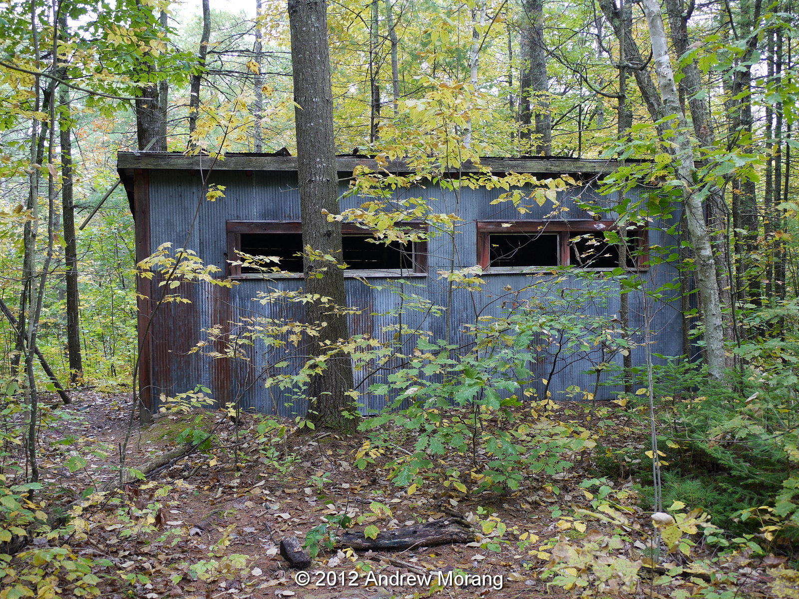
One of the few standing buildings is the old latrine and bath house.
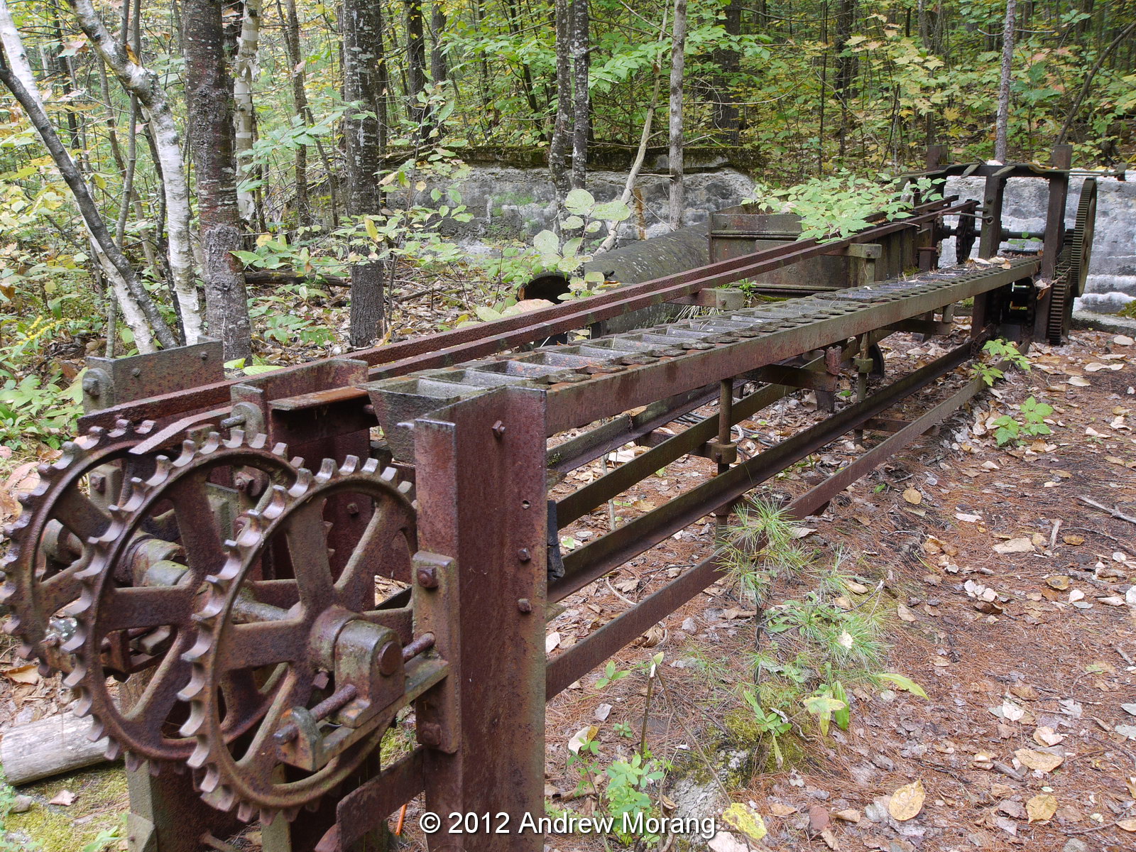
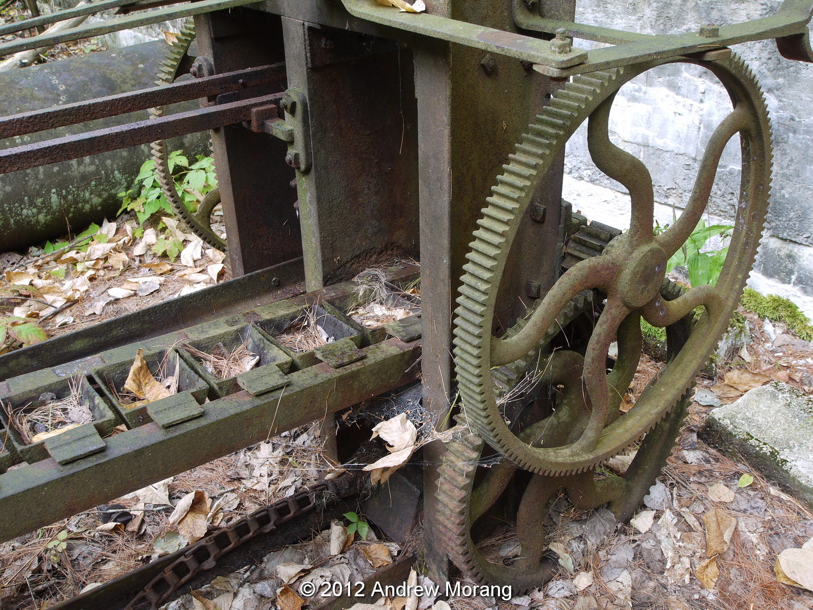
Further uphill is the blacksmith's forge and tool conveyor belt. I am not sure of its function, but the little buckets are so sturdy, I assume they were designed to hold hot objects. Possibly tools went through a quenching bath after they had been sharpened or heated.
This is the remains of a boiler. I have not seen the engine house, which would have contained larger boilers, but the White Mountain History web site (link above) shows a photo of a collapsed roof.
Now we come to one of the most interesting sites, the machine building that housed the polishing rock lathe. The wood building is incomplete and is missing some of its roof. I am not sure where the boiler building was located that provided power for the lathes, but it must have been nearby.
This is the 5-ft Face Plate of the polishing lathe and the spindle to hold a rotating column of granite. Can you imagine polishing a column of rock over 5 ft in diameter? Astonishing what craftsmen could do a century ago with equipment that we today consider primitive.
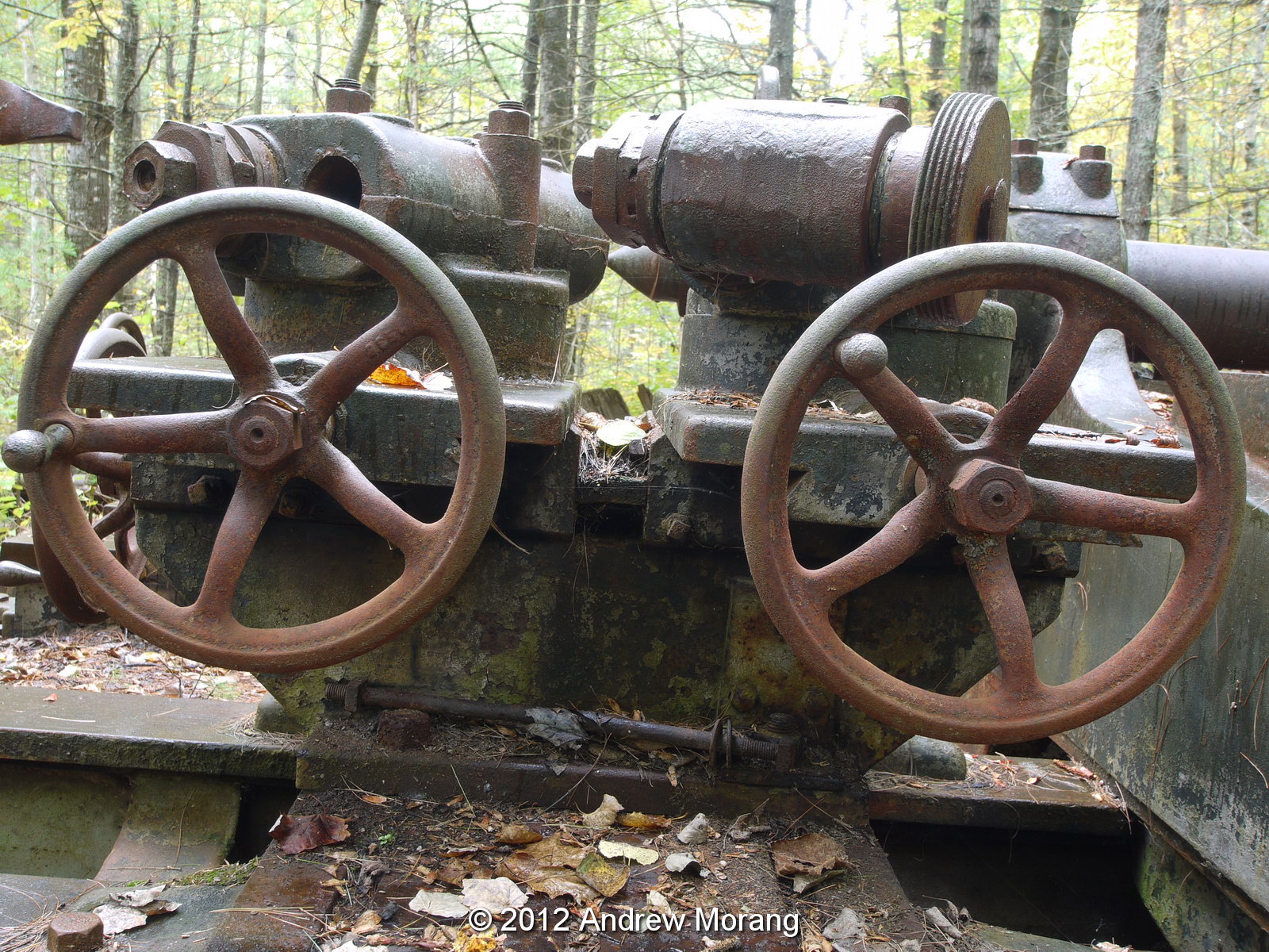
Outside on the ground are remains of the rough turning lathe. You can see where belts (leather?) would have run across different-size pulleys to provide power.
Look at this heavy-duty universal joint, an example of precision machining from almost a century ago. This is how we built a nation: hard work, pride, and precision workmanship.
Not far away in the woods are mounts for wood booms, used to swing rock around the work site. I read that the spruce booms came from the Pacific Northwest on special railroad cars (at that time, timber of sufficient size no longer grew in the US Northeast).
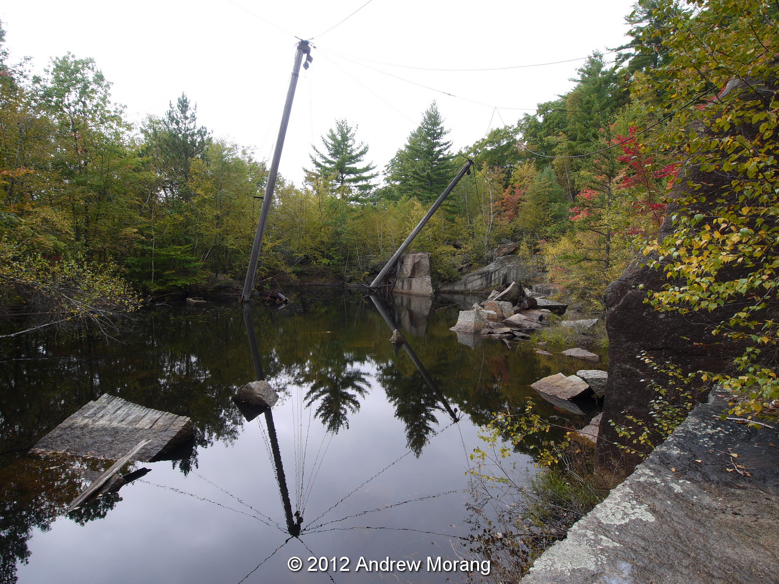
Walk further uphill and you reach the pink quarry. The pit is filled with water, but some of the booms are still standing!
Much of the debris in the pink quarry has tumbled down and is highly unstable. The clean rock face gives you an idea of the quality of the granite from this source.
As you walk west back to town, you come across a dormitory building in surprisingly intact condition. But vandals have added artwork to the inside.
There are examples of the pink granite all around North Conway. This planter is made from pink slabs.
And you see granite fence-posts in town and in area farms. No danger of these posts ever rotting.
This is the Hale cemetery on West Side Road, near the town of Conway. Look at the size of these remarkable granite slabs used as a wall. These may be grey granite from another site, but it was difficult to tell in the waning evening light.
This is a 1920s photograph of a rock lathe from the web page quarriesandbeyond.org. Notice the stoneman is not wearing eye or head protection. Many of these stone workers died young from silicosis, a terrible disease.
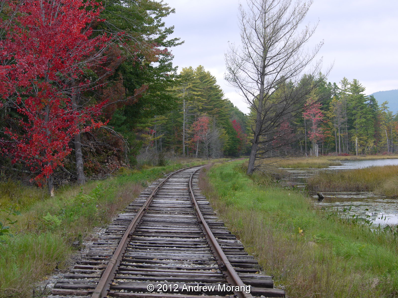
On a more cheerful note, autumn in New England is spectacular. The changing leaves are a visual delight. If you have never seen them, you must make this a life goal. This is Pudding Pond, and the tracks once served the Redstone Quarry.

These are digital files from a Panasonic G1 digital camera with 14-45 mm Panasonic Lumix and 9-18mm and 40-150mm Olympus lenses, tripod-mounted. I thank my North Conway friends for showing me these unusual sites. I have some older medium-format film negatives of the quarry that I need to scan and post some day.

Update Nov. 2019: I scanned my 2003 medium format film negatives and wrote a new article on Redstone Quarry. Please click the link to go to the new article. I thank all you readers.

Update: Shotgun shacks demolished, Mary's Alley, Vicksburg

In 2010, I posted some photographs of the cottages and shotgun shacks on Mary's Alley, in the Kings area of North Vicksburg. The houses had been condemned by the City because they frequently flooded.
As of mid-2012, the houses are gone. This is a recent aerial photograph taken with 6-inch pixel resolution. The footprints of the former houses are outlined in yellow. The footprints were based on 1995 aerial photography.  I converted one of the layers in the 1995 Microstation .dgn files to ESRI Shapefiles.  As you can see, many of the houses in this area have been demolished. Deconstruction...

 Map created with ESRI ArcMap GIS software version 10.0

Thursday, September 27, 2012

Small western farm town: Likely, California


Drive on US 395 though the desert of eastern California and western Nevada, and you pass many small agricultural towns.  They are a bit sleepy but very interesting for their architecture, home-made signs, and historical elements.  Likely, California, is one of these.  It lies on the south side of the South Fork of the Pit River in the northeastern corner of California, not far from Lava Beds National Monument (fabulous geology!).  According to Wikipedia, one of the last of the American Indian wars was fought nearby at Infernal Caverns.

 Here is the General Store, complete with gasoline pump and a bench to sit out and enjoy the afternoon.
Notice the "Most Likely Cafe" has similar stucco architecture as the General Store.
This former filling station serves as covered parking.

The weather is so dry, the volunteer fire department can park its trucks outside.

Drive through some of these small towns:  the residents are friendly and the scenery and history are interesting.

(Photographs taken with a Panasonic G1 digital camera.  Map created  with ESRI ArcMap software v. 9.3).

Sunday, September 23, 2012

Urban non-decay: Portland, Oregon

Portland, Oregon, is one of my favorite examples of urban non-decay.  Through hard work, imagination, and intelligent urban planning, Portland has maintained its heritage of late-1800s and early-1900s office buildings, stores, and hotels. And they are in use, proving that historic buildings are most certainly viable in the modern era. In addition, Portland is one of the greenest cities in the United States and encourages bicycle use and public transport. The elected regional government, Oregon Metro, has established an urban growth boundary to separate urban land from rural land and prevent uncontrolled sprawl. On the outskirts, there are some McMansion ghettos, but seemingly not as many as other cities. Why are so many other US cities so far behind?

This is a small selection of photographs from my recent trip to Portland. I suggest this Wikipedia article for readers interested in the city and its history and topography.  Even better, go and visit!
Here is an 1890 photograph of Portland from Wikimedia Commons, with Mount Hood in the distance (to the east).
Readers know I like bridges.  This is the underside of the Burnside Bridge over the Willamette River.
Portland is a big food cart city.  Here are some examples on SW 3rd Avenue. The Big-Ass Sandwiches cart even won a contest in Adam Richman's Best Sandwich in America food reality television program. I ate a great veggie giro at a Greek cart, whose proprietors really were from Greece.
 Portland has an amazing collection of historical office and commercial building.  The carving and decoration are symbols of an era when businessmen and industrialists were proud of their buildings and considered them to be a major contribution to the fabric and culture of their city.  They wanted the best and hired craftsmen and stone masons to make a statement.
Portland is a good pedestrian city, and the streetcar is free within an inner-city zone.
On the odd side, there are some great mannequins in town. These were in a store that sold small underpants (underpanties?) for gents.

Black and white photographs created in-camera with a Panasonic G1 digital camera.

Tuesday, September 18, 2012

Columbia River Bridges


The mighty Columbia Rivers drains portions of British Columbia, Montana, Idaho, Washington, and Oregon. It has the greatest discharge of any US river entering the Pacific Ocean and is the fourth-largest river in the United States. Because it drops steeply from the mountains of Idaho and the high plateau of central Washington, it has tremendous hydroelectric potential. Since the early 20th century, the Columbia has been developed with 14 hydroelectric dams, and almost every mile of the once free-flowing river now consists of reservoir pools. The map, from the Wikimedia Commons, shows the extent of the river's basin

I explored some of the lower Columbia River Gorge during a recent trip, and two historic bridges caught my eye. The photograph above shows the spectacular gorge near Cascade Locks, about 40 miles east of Portland. The locks were completed in 1896, but they were subsequently submerged in 1938 when Bonneville Lock and Dam was completed some distance downriver.


The elegant steel truss cantilever Bridge of the Gods was opened in 1926 at a length of 1,127 feet (343 m). But once Bonneville dam was completed, the bridge was too low for navigation, so it was raised and the approaches were lengthened. It now has a length of 1,856 feet (565 m).


About an hour drive east, you reach the The Dalles, once the site of a long series of rapids. This is a much drier climate zone, almost desert. The Dalles Dam was completed in 1957, submerging the rapids, along with fishing platforms and other structures used by native Americans for hundreds of years. The Dalles Bridge is another handsome mid-century steel cantilever truss bridge, spanning the Columbia between The Dalles, OR, and Dallesport, WA. It was completed in 1953.

Photographs taken with a Panasonic G1 digital camera.