Showing posts with label Seattle. Show all posts

Saturday, March 29, 2025

On the Waterfront - Seattle, Washington (Summer 2024)

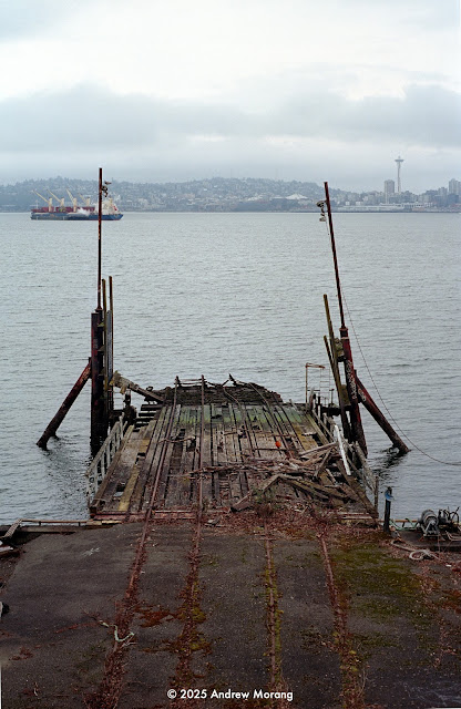
The Seattle waterfront has changed drastically since I lived in Seattle in the mid-1970s. At that time, the horrible 2-level Alaskan Viaduct snaked along the waterfront. Underneath was a sort of nether-land, similar to the underside of the Southeast Expressway in Boston. But at least there was parking under the concrete. Back then, waterfront Seattle was a working district, with warehouses, small factories, and industrial activities. 

Today, the viaduct is gone! Alaskan Way is sunny. Now there are bike lanes, gardens, and a clean new surface street, Elliott Way. Warehouses have been rebuilt into condominiums, and totally new buildings have been erected. And the traffic flows underneath through the SR99 tunnel. 


Alaskan Way


Pier 50 view north along Alaskan Way (Kodak Tri-X film, Rolleiflex 3.5E camera)

The grotesque viaduct once marred this view. Now this is a cheerful and popular bund or esplanade.


This monstrous cruise ship loomed over the waterfront. I have never been close to a vessel this large. It was like a floating office building. I can understand why more and more popular destinations in the Mediterranean, like Venice, Santorini, and Barcelona, object to these ships disgorging thousands of tourists in a short period. They overwhelm the local infrastructure, water supply, and plumbing. But the merchants like the shoppers.


Pier 70 view south along Alaskan Way from the Olympia Sculpture Park
Sounder commuter train
BNSF tracks near Pier 66

In the past, I wondered where the trains came from that ran on the tracks parallel Alaskan Way. I only recently learned that the Great Northern Tunnel extends for about a mile under the business district. This was a major engineering accomplishment in 1904. The southern entrance is just north of the King Street station. The northern entrance emerges from the mountain almost under the Pike Place Market. The opening is obscured by fencing along Elliott Way.  This is another example of the great engineering that made a nation. 

Great Northern Tunnel north entrance (Samsung phone digital file)
BNSF freight train near Pier 70

It feels like a train comes along about every 15 minutes. The amount of commerce is amazing.

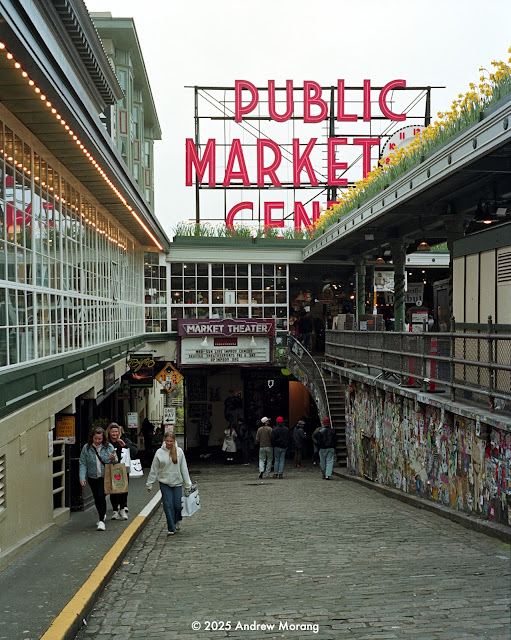
Pike Place Market


Everyone takes pictures and selfies at the famous Pike Place Market. My Olympia photography friend comes here often and does excellent work. I took pictures in the Market in 1973 when I lived in Seattle. 


The famous Pioneer Building is a Richardsonian Romanesque edifice of stone, red brick, terra cotta, and cast iron. It faces Pioneer Square, now rather grungy because of the homeless and filth. 

I remember entering the Pioneer Building when it was being renovated in the early 1970s. There was an inner atrium with iron railings. Somewhere in the basement was the well-known French restaurant, the Brasserie Pittsbourg. I remember eating here with friends and, possibly, my dad. Do I have any photographs from those happy and innocent 1970s?


Entrance to the Brasserie Pittsbourg, March 3, 1970 (courtesy of the Seattle Public Library, photograph by Werner W. Lenggenhager, 1899-1988)

This ends our short walk in downtown Seattle and along the waterfront. I took these photographs on Kodak Tri-X 400 film with a Rolleiflex 3.5E camera with 75mm ƒ/3.5 Xenotar lens. This is a 1959 model still going strong. Most Rolleiflex twin lens cameras are superb picture machines. Praus Productions in Rochester, NY, developed the film.


Saturday, November 16, 2024

When Film is too Old (Seattle 04)


Sample film strip, Epson Perfection 3200 Photo scanner

Oh, oh, some old film is just that, film that should have been discarded long ago. 

I bought an expired roll of Kodak High Definition film (Max 400??) at Photoland, the laboratory at The Evergreen State College in Olympia. It had been frozen but was much too old. I wanted to test my new/old Pentax MG. I had never heard of High Definition, and online information was scarce. It may have been discontinued around 2005. Kodak had a bad habit of renaming their various emulsions, often changing names in different markets. 

Most of the roll was grossly underexposed, and holding the strip up to the light, I could barely see any image data. The Epson 3200 flat bed scanner was remarkable at its ability to extract something for me to review. Some of the frames from Seattle looked marginally promising. I am amazed how well my Nikon Coolscan 5000 can extract data from a lousy negative. For the examples below, I scanned the frames with the Coolscan's automatic exposure function. Then I opened some of the frames in Photoshop and manually adjusted the contrast.   


Arriving at King Street Station, Seattle
King Street Station
Smith Tower from Jackson Street
Maybe I'll Walk-In (or maybe not)
Pine Street scooters
I am a Rockfish. Make some delicious fish 'n chips from me. Note the enormous eyes.

Rockfish are rather ugly. They live on rocky bottoms in cold water. There are at least 30 species in the Pacific Northwest. But they are delicious eating. Dingey's at the Olympia Farmers Market offers rockfish fish 'n chips. 

Let's drop in to Party in Reality. Well, maybe no.

I took these pictures with a Pentax MG camera, which has aperture priority autoexposure (meaning, you select an aperture on the lens, and the camera sets the correct shutter speed based on the through-the-lens light meter). The MG meters for as long as 14 or 15 seconds, which would be useful for tripod-mounted scenes. 

But because the film was so flawed, I do not know if the exposures were correct. The lens was a 50mm ƒ/2 Pentax-A with an unusual 5-element air-spaced optical design. 

Expired color film is a gamble. It just does not age well. Do not bother buying it. But black and white films, especially slow speeds, seem to last for years, especially if stored cool. Long-term readers may remember my amazing results with 60-year-old Versapan film packs

Thursday, April 4, 2024

From the Archives: Pike Place Market (Seattle) in 1973

Once upon a time, when I was young and energetic, I lived in Seattle, Washington, while attending the University of Washington (the 'Dub). I liked to go downtown with my friends to explore or eat at interesting restaurants. I found some March 1973 negatives from that previous life. 

My dad had been visiting from out of state. We took the ferry boat to Bremerton and later explored Pike Place Market. He liked Pike Place, but that was expected. He was an old hand at exploring markets, such as the famous Flea Market in Athens or the Scott's Market in Rangoon.


My dad checking out the scene
The fish fellow looked crabby
Candles were such a thing in the 1970s
Mellow time, 1973-style
Chopping the cows.
Stacking the crabs neatly. It reminds me of the Central Market in Athens. 

I took these photographs on Kodak Tri-X 400 film with my Nikkormat FTn camera and 28mm ƒ/3.5 or 50mm ƒ/2 Nikkor lenses. I vaguely recall developing the film in the darkroom in McMahon Hall with Microdox-X developer. I did not know what I was doing, but still, the negatives have survived a half century (just as our digital files will, right?). They were scratched and had dirt and lint issues, so I cleaned the examples you see here with the heal tool in Photoshop CS6. 

We will look at more Seattle pictures in future articles. Please type "Seattle" in the search box to see older entries.


Thursday, December 28, 2023

From the Space Needle in 1995 (Seattle, Washington)

Business took me to western Washington in 1995. A coworker and I looked at the beach at Ocean Shores, which faces the Pacific Ocean at the mouth of Grays Harbor. Southward sediment transport had built a wide beach against the north jetty. Developers were building condominiums on the beach. Was this a vulnerable location? Were there feasible escape routes if sirens warned of a tsunami? What would happen to the beach if the sediment transport shifted to moving north? 

After the field trip, we had a few days to spend in Seattle. My coworker had never been to the city and was intrigued by the Space Needle. A fellow we met under the Needle generously offered us two free tickets for the elevator. It was a gorgeous sunny day, so, of course we took the lift to the viewing balcony.


Room with a view: Space Needle from the Mediterranean Inn (Fuji digital photograph taken with a Jupiter-8 lens)
2004 panorama of South Lake Union district from Eastlake Avenue E

First, the general setting. This is a 2004 panoramic photograph of Queen Anne (the hill to the right), South Lake Union, Uptown, and Belltown districts (taken with a Hasselblad X-Pan camera). The Needle is the iconic tower built for the 1962 World's Fair. In the 1970s, when I was a student here, this area south of Lake Union was a commercial district of warehouses and manufacturing. By the early 2000s, it was transforming into condos, clubs, museums, and modern businesses. In the photograph above, the red building in the foreground is part of the Fred Hutchinson Cancer Center, one of the foremost cancer research institutes in the world. Click the picture to enlarge the scene and see the snowy Olympic Mountains in the distance.


Port of Seattle, view south from Space Needle

Now, let's ascend to the viewing balcony on the Space Needle and look south. Seattle is a high value seaport. It is a spectacular natural harbor because it is ice-free, deep, and sheltered from Pacific Ocean storms. In the photograph above, you can see the container terminal in the distance with a freighter in the roadstead. A ferry boat is on its way to Bremerton. Many Seattleites commute daily via the ferries. Seattle is also a major cruise terminal, but I do not see any cruise ships in this scene. 

To the left, you can see two features that are now, thankfully, gone. 

The big white dome is the infamous Kingdome. I recall some of the controversy during construction in the 1972-1973 period. It was sited in the Industrial District south of Pioneer Square. African-American businesses were displaced (i.e., forced out at low real estate values). Construction was plagued with errors, poor design, and a contractor who was unable to complete the work. The building suffered water problems. Parts of the roof collapsed in 1994. Finally, controlled implosion brought down the nasty structure in March of 2000. A century-old African-American community had been replaced by a boondoggle that lasted 27 years. King County taxpayers had to pay for the bonds for another 15 years. Hmmm, is it possible some corruption might have been involved?


Alaskan Way Viaduct before demolition (from Wikimedia, based on Open Street Maps)

To the right of The Kingdome is the Alaskan Way Viaduct, a double-decked freeway that carried State Route 99 along the waterfront. The city built the viaduct in three phases between 1949 and 1953. It cut off the city from the waterfront, similar to the way the Southeast Expressway in Boston became a barrier between Boston, the North End, and the waterfront. The web site, The Historic Pacific Highway in Washington, has more information about the viaduct

Engineers knew that the viaduct was vulerable to earthquakes. The 1989 Loma Prieta earthquake in Oakland, California, destroyed the similar Cypress Street Viaduct, causing 42 deaths.  The 2001 Nisqually earthquake in Seattle damaged the viaduct and its supporting Alaskan Way Seawall. The steel flanges, girders, and bolts that I saw in 2004 were attempts to shore up the structure of the viaduct.  

My coworkers at the Corps of Engineers were well aware of the viaduct's earthquake vulnerability. They told me which lanes to use in case the upper structure collapsed. By carefully driving between the concrete support rows, my car would be only partly squashed by the descending concrete roadway. I was so reassured....

After long and heated debate, King County, the city, and the Port of Seattle decided to bore a tunnel under the route of the viaduct and totally remove the concrete eyesore. You know the story: the tunnel cost vastly more than originally predicted and numerous technical issues slowed construction, but it finally opened to traffic in February of 2019. Demolishing and crunching up the viaduct took only a year. The city now has access to the waterfront without the concrete eyesore. 

On recent trips to Seattle, I have driven Route 99 instead of fight the traffic on I-5. The tunnel appears to flow well while I-5 is bumper-to-bumper. Cameras automatically tag your car to identify where to send a bill for the toll. 


Union Bay with University of Washington Campus in the distance

Turn to the northeast and look at the body of water. Union Bay is a freshwater bay in the center of Seattle. The Fremont Cut (to the left) lets boats reach Puget Sound via the Hiram M. Chittenden Locks. The Montlake Cut, beyond the I-5 bridge in the distance, gives access to Lake Washington. Museums, shipyards, houseboats, and seaplane companies line the shore of Lake Union. "Sleepless in Seattle" takes place in these houseboats. The Vashon Glacier excavated the lake about 12,000 years ago and sculpted most of the contemporary geomorphology in the Puget lowlands.


Lake Union view south

This is Lake Union from the Gas Works Park, the site of a former coal gasification plant from the early 20th century. The Gas Works operated from 1873 to 1956, when natural gas from Canada supplanted the nasty and toxic gas plant. A landscape architect and University of Washington professor, Richard Haag, designed a plan to convert the site into a park, retaining some of the steel towers and tubes.

This ends our much too quick overview of Seattle. I want to look at my 1970s archives and see if there are more photographs from downtown.

By the way, if you want to see a really bad Elvis movie that features the Space Needle, watch "It Happened at the World's Fair." As TCM described it, "The Monorail and Space Needle are prominent as Mike (Elvis Presley) and friend Sue-Lin (Vicky Tiu) take in the sights". It is an utterly absurd plot, but Elvis sings. What more could you want in a movie?


Sunday, April 17, 2022

The Wide View in Seattle (Hasselblad XPan 02)

Beer Bust, 14th Street, Seattle

Seattle is a beautiful city nestled between Puget Sound and Lake Washington, with stunning views of Puget Sound and the Olympic Mountains to the west and the Cascades to the east. The city is hilly because of the glacial drumlins, remnants of the glaciers that covered this area during the ice age. 

In the late-1800s, Seattle was a bustling supply station for the Alaska gold miners. The famous (infamous) seamstresses, of which there were thousands, served the clothing and "other" needs of the miners and sailors. Seattle grew into a major timber, ship-building, and shipping city.

The economy grew, and during much of the 20th century, Seattle was a Boeing city, making many of the commercial aircraft used throughout the world. But in 1971, trouble came to Seattle. The US Senate and House of Representatives voted to cancel any further development of Boeing's supersonic transport, originally intended to be a competitor to the European Concorde. Boeing fired thousands of engineers and technicians. The city sank into depression. People joked how the last person out could turn off the lights. I recall that the downtown in the 1970s had the seedy look of an old American city, with tired buildings, dirt, and closed shops.  

When I returned to Seattle for a short assignment in 2004, the economy had turned around. Was this the same city? Seattle had become a tech Mecca, with Microsoft and numerous other computer and electronics firms in Bellevue, just across Lake Washington from the city. Traffic was snarled and dense, all day long. Glass office buildings filled downtown. Housing was expensive even on 2004 standards (and a purchase then would be considered an astonishing investment when you look at today's housing prices). New money parked their Ferraris and Porsche at their lakeside cottages. 

Here are a few photographs of Seattle that I took in 2004 with a Hasselblad XPan panoramic camera, using its 45mm lens. In the previous article, I described the remarkable XPan. Click any picture to see more detail.

Where did all those office towers come from? View south towards downtown Seattle. I-5 is on the left.

South Lake Union district with Space needle in the center

The 184 m-tall Space Needle is an icon for the city.  It was built for the Century 21 Exposition and has remained Seattle's most popular tourist attraction ever since. Elvis even made love (sang) to Joan O'Brien in the needle-top restaurant in "It Happened at the World's Fair" (1963). The movie was a real stinker, but the 1962 views of the Exposition are very interesting. 

The area in the foreground is south of Lake Union. During most of the 20th century, it was known for warehouses, industry, and manufacturing. Now it is trendy, with loft apartments, coffee shops, and condos. Why do I always miss these trends and fail to buy a warehouse or two?

Queen Anne Hill and Lake Union in 2004

If you are really rich (or lucky), you can live on Queen Anne Hill and see Puget Sound to the west, Seattle and the distant Mount Rainier to the south, and Lake Union to the east. It is a bit crowded, and house lots are squashed together, but there is a nice sense of community, with local stores and restaurants. In the early 1900s, a funicular streetcar ascended Queen Anne Avenue. In the photograph above, the snow-capped Olympic Mountains are in the far left of the scene.

Queen Anne Avenue without the funicular (2021 digital file)
Kerry Park, Queen Anne Hill, Seattle (2021 digital file)

Of course you would like to live on Queen Anne Hill if you had this view.

Lake Union, Seattle

Lake Union is a freshwater lake within the city of Seattle. In the mid-20th century, it was rimmed by industrial companies, shipyards, NOAA's ocean survey fleet, and some residences. Today it is a technology hub and trendy center for restaurants and clubs. On a warm afternoon, you will see kayakers, seaplanes, bicyclists, sail boats, and ducks - all having a good time. 

This ends our short look at Seattle. Make time to visit the Pacific Northwest, walk around Seattle, take photographs, eat fish, and drink craft beer.

Some day, I will scan my 1970s negatives of Seattle. Standby.