En route to the UK and my eventual flight back to USA, my next stop after Salzburg was Munich, Germany. I had visited Munich many times when I was a child, but do not remember much from these earlier trips. A childhood friend lived in Munich, but his apartment was too cramped to accommodate me, so I booked a modest (= cheap) room in a pension. Winter travel in Europe was very convenient in this way in the old days.

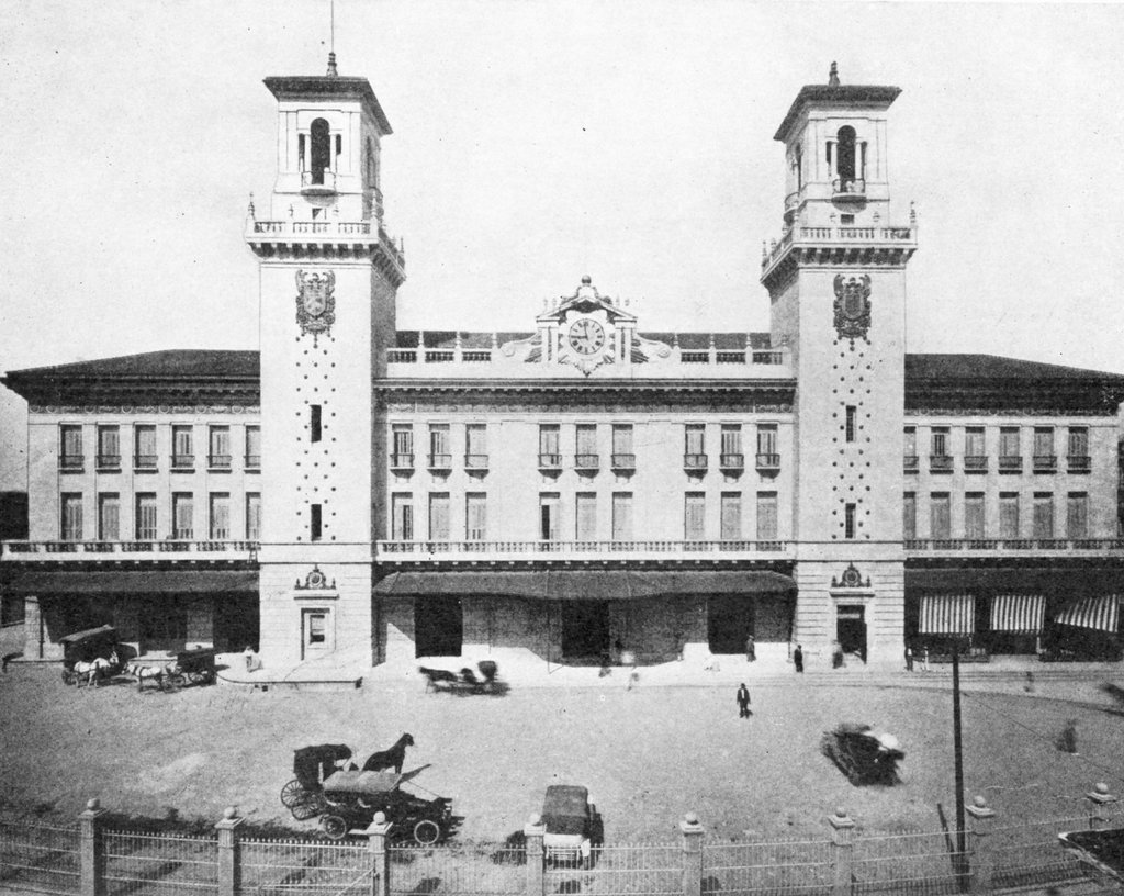
The Munich Haupbanhof is a bustling transportation center with trains coming and going all day and through much of the night. You can catch a train to almost any city in even the furthest corner of Europe, although connections into the Balkans can be a bit sketchy. The bahnhof is a mixture of add-ons and reconstructions, without a coordinated architectural look. I do not know if the main platforms still look like my 1979 photograph.
If World War II had resulted in a different outcome, we might have seen a totally different station and rail network. Adolf Hitler envisioned an incredibly ambitious Breitspurbahn (broad-gauge railway) network using 3,000 mm (9 ft 10⅛ in) track. The system would connect the far reaches of the Reich, with lines leading to India (!), Baku (= oil), and even to Fairbanks. The railroad stations for these new super trains would be enormous ornate domed buildings, with gigantism being the overall motif, similar to the plans to rebuild Berlin. The double decker rail cars would be equipped with lounges, a cinema, and luxury restaurants (similar to ocean liners). Railroad engineers and economists knew the plan was utterly hopeless, but nevertheless, some 200 engineers and officials worked on plans during the war. They were the lucky ones, because this job kept them out of the Eastern Front.
 |
| View from the Rathaus of the Frauenkirche (Nikkor 28mm ƒ/3.5 lens with orange filter) |
 |
| Marienplatz |
Whenever I visit an unfamiliar city, I try to find a high tower or hill from which to see the setting. Marienplatz is the historic center of Munich, a gathering place since Henry the Lion founded the city in 1158. I love visiting cities where history engulfs you. Most tourists come to Marienplatz when they first arrive.
 |
| Marienplatz |
 |
| Chilling out at the Rathaus |
 |
| Unhappy Greeks wondering what happened to their bodies |
Leo von Klenze (1784–1864), architect to the court of Ludwig I, built the Munich Glyptothek. Unhappy Greek, Roman and Etruscan heads and bodies hang around. Will these guys will ever return to their original homes? Are their bodies still back home?
 |
| Chinesischer Turm at the Englischer Garten. 1-litre beer steins? |
 |
| Angel of Peace (Friedensengel) |
One could spend weeks in Munich taking in the art, architecture, and culture. Well, that applies to most of Europe. Definitely go there - watch, absorb, eat, enjoy, live life.
To be continued next week.