Showing posts with label Washington. Show all posts

Thursday, December 28, 2023

From the Space Needle in 1995 (Seattle, Washington)

Business took me to western Washington in 1995. A coworker and I looked at the beach at Ocean Shores, facing the Pacific Ocean at the mouth of Grays Harbor. Southward sediment transport had built a wide beach against the north jetty. Developers were building condominiums on the beach. Was this a vulnerable location? Were there feasible escape routes if sirens warned of a tsunami? What would happen to the beach if the sediment transport shifted to moving north? 

After the field trip, we had a few days to spend in Seattle. My coworker had never been to the city and was intrigued by the Space Needle. A fellow we met under the Needle generously offered us two free tickets for the elevator. It was a gorgeous sunny day, so, of course we took the lift to the viewing balcony.


Room with a view: Space Needle from the Mediterranean Inn (Fuji digital photograph taken with a Jupiter-8 lens)
2004 panorama of South Lake Union district from Eastlake Avenue E

First, the general setting. This is a 2004 panoramic photograph of Queen Anne (the hill to the right), South Lake Union, Uptown, and Belltown districts (taken with a Hasselblad X-Pan camera). The Needle is the iconic tower built for the 1962 World's Fair. In the 1970s, when I was a student here, this area south of Lake Union was a commercial district of warehouses and manufacturing. By the early 2000s, it was transforming into condos, clubs, museums, and modern businesses. In the photograph above, the red building in the foreground is part of the Fred Hutchinson Cancer Center, one of the foremost cancer research institutes in the world. Click the picture to enlarge the scene and see the snowy Olympic Mountains in the distance.


Port of Seattle, view south from Space Needle

Now, let's ascend to the viewing balcony on the Space Needle and look south. Seattle is a high value seaport. It is a spectacular natural harbor because it is ice-free, deep, and sheltered from Pacific Ocean storms. In the photograph above, you can see the container terminal in the distance with a freighter in the roadstead. A ferry boat is on its way to Bremerton. Many Seattleites commute daily via the ferries. Seattle is also a major cruise terminal, but I do not see any cruise ships in this scene. 

To the left, you can see two features that are now, thankfully, gone. 

The big white dome is the infamous Kingdome. I recall some of the controversy during construction in the 1972-1973 period. It was sited in the Industrial District south of Pioneer Square. African-American businesses were displaced (i.e., forced out at low real estate values). Construction was plagued with errors, poor design, and a contractor who was unable to complete the work. The building suffered water problems. Parts of the roof collapsed in 1994. Finally, controlled implosion brought down the nasty structure in March of 2000. A century-old African-American community had been replaced by a boondoggle that lasted 27 years. King County taxpayers had to pay for the bonds for another 15 years. Hmmm, is it possible some corruption might have been involved?


Alaskan Way Viaduct before demolition (from Wikimedia, based on Open Street Maps)

To the right of The Kingdome is the Alaskan Way Viaduct, a double-decked freeway that carried State Route 99 along the waterfront. The city built the viaduct in three phases between 1949 and 1953. It cut off the city from the waterfront, similar to the way the Southeast Expressway in Boston became a barrier between Boston, the North End, and the waterfront. The web site, The Historic Pacific Highway in Washington, has more information about the viaduct

Engineers knew that the viaduct was vulerable to earthquakes. The 1989 Loma Prieta earthquake in Oakland, California, destroyed the similar Cypress Street Viaduct, causing 42 deaths.  The 2001 Nisqually earthquake in Seattle damaged the viaduct and its supporting Alaskan Way Seawall. The steel flanges, girders, and bolts that I saw in 2004 were attempts to shore up the structure of the viaduct.  

My coworkers at the Corps of Engineers were well aware of the viaduct's earthquake vulnerability. They told me which lanes to use in case the upper structure collapsed. By carefully driving between the concrete support rows, my car would be only partly squashed by the descending concrete roadway. I was so reassured....

After long and heated debate, King County, the city, and the Port of Seattle decided to bore a tunnel under the route of the viaduct and totally remove the concrete eyesore. You know the story: the tunnel cost vastly more than originally predicted and numerous technical issues slowed construction, but it finally opened to traffic in February of 2019. Demolishing and crunching up the viaduct took only a year. The city now has access to the waterfront without the concrete eyesore. 

On recent trips to Seattle, I have driven Route 99 instead of fight the traffic on I-5. The tunnel appears to flow well while I-5 is bumper-to-bumper. Cameras automatically tag your car to identify where to send a bill for the toll. 


Union Bay with University of Washington Campus in the distance

Turn to the northeast and look at the body of water. Union Bay is a freshwater bay in the center of Seattle. The Fremont Cut (to the left) lets boats reach Puget Sound via the Hiram M. Chittenden Locks. The Montlake Cut, beyond the I-5 bridge in the distance, gives access to Lake Washington. Museums, shipyards, houseboats, and seaplane companies line the shore of Lake Union. "Sleepless in Seattle" takes place in these houseboats. The Vashon Glacier excavated the lake about 12,000 years ago and sculpted most of the contemporary geomorphology in the Puget lowlands.


Lake Union view south

This is Lake Union from the Gasworks Park, the site of a former coal gasification plant from the early 20th century. 

This ends our much too quick overview of Seattle. I want to look at my 1970s archives and see if there are more photographs from downtown.

By the way, if you want to see a really bad Elvis movie that features the Space Needle, watch "It Happened at the World's Fair." As TCM described it, "The Monorail and Space Needle are prominent as Mike (Elvis Presley) and friend Sue-Lin (Vicky Tiu) take in the sights". It is an utterly absurd plot, but Elvis sings. What more could you want in a movie?


Tuesday, December 19, 2023

Cruising Rural South Central Washington

Years ago, when I was young and strong, I sometimes hiked on Mount Rainier in south central Washington state. Back then, I did not do urban decay photography and did not pay attention to the rural towns south of Seattle. Finally, in summer of 2023, I had a chance to revisit the area and take a few snapshots. These towns were probably a lot more interesting in the 1970s, when the lumber industry was beginning to wind down and western Washington state had not gone through its conversion from a resource extraction economy to a high technology, finance, and arts economy. 

I sometimes regret not photographing good grunge when it was available. However, many people argue with plenty of backup evidence that infrastructure and small town society in USA has deteriorated in recent decades. The rural South certainly shows this pattern. But even here in the Pacific Northwest, I expect to find interesting material to photograph in the future as I explore. 

Let us take a short drive from Olympia towards Paradise, on the south side of Mount Rainier. 

Looking for coffee in Rainier

Rainier is a former lumber town and appears to be a bit rough. I want to explore soon.


Mountain Highway E, La Grande, Washington
Old La Grande Post Office

La Grande is an unincorporated community in Pierce County. Most people heading to Mount Rainier buzz on through in a hurry.


Elbe, Washington

The Mount Rainier Scenic Railway runs between the towns of Elbe and Mineral. I am not sure if the cars on the siding above are currently used or if the railroad has other rolling stock. 
  
Time for coffee in Ashford

Keep driving east and going up in elevation, and you pass Ashford. There is not much there, but you could pick up a coffee.


Copper Creek Inn


Near the Nisqually entrance to Mount Rainier National Park is the Copper Creek Inn, Cabins, and Lodge. They claim that this is the oldest continuously-operating restaurant in the state, in business since 1946. We has a superb salmon meal, and their blackberry pie is a piece of berry and culinary heaven (dare I compare it with the chocolate baklava at Niko Niko's in Houston??). Regardless, I am heading back to Copper Creek. 


Mount Rainier is an impressive stratovolcano, rising to 14,410 ft above sea level. I have not climbed to the summit but have walked a section of the Wilderness Trail, which circles the mountain. The Paradise visitor center on the south side of the mountain is mobbed in summer with tourists. Plan ahead, go early.


Snow lake - you can't see the mosquitoes

Snow Lake is an easy walk from the Stevens Pass Road, a short distance from the Paradise Visitor's Center. The highest elevation is 4,700 ft (1440 m), so easy breathing. In June, the mosquitoes were not easy!! 


At Tugboat Annie's, Olympia

Back to Olympia and dinner at Tugboat Annie's. Someone is still in the 1970s with his VW dune buggy.

I took most of the photographs with expired Kodak Bright Sun (= Gold 100) film using my Voigtländer Vito BL camera. The 50mm ƒ/3.5 Color-Skopar lens (a 4-element Tessar design) always performs well. I exposed the film at EI=100, but for the next roll, I will give more exposure (EI=64). The film is more grainy than fresh rolls, and some of the colors are a bit off. It was a worthwhile experiment, and I have three more rolls to use. 


Friday, October 20, 2023

In the Olympics with a Film Treasure: Kodak Gold 100 (Abandoned Films 07b)

Years ago, you could buy Kodak's Gold 100 color negative film almost everywhere. When I needed a color film that always produced excellent prints, Gold 100 was my usual choice. For the ultimate resolution in 35mm, I used the famous Kodak Ektar 25 (also long discontinued), but the 100 was more versatile and easier to use. Late in its life, Kodak relabeled it as Bright Sun 100, but I think it was the same Gold 100. 

As long-term readers know, I have a weakness in experimenting with older films. With some checking on eBay, I found a 4-pack of Bright Sun/Gold 100 (both names on the same package - not confusing at all) that expired in 2004, near the end of production for this film. The seller claimed it had been in room temperature all its life. It was certainly worth an experiment.

Here are some examples from the Olympic Peninsula in the grand Pacific Northwest. During my July trip there, I loaded a roll in my little Voigtländer Vito BL camera with its remarkably capable 50mm ƒ/3.5 Color Skopar lens and took snapshots. Please click any picture to expand.


Wishkah Blue Artists Studio, Hoquiam, Washington 

I photographed the little studio in 2022. This year, it looked a bit more forlorn. I am not sure how active it is.

Waiting to get moving, Hwy 101, Humptuips
Pizza Grill, Route 101, Lake Quinault

Lake Quinault is a gorgeous elongated lake in the west edge of the Olympic Mountains. I photographed the old Kestner-Quigley homestead farm near the lake in 2022. 

Sunsets West Co-op, Clallam Bay (with polarizing filter)

We stopped here en route to Neah Bay and bought some nuts and dried fruits. The food options in the far northwest of the Olympic Peninsula are rather limited.

Fixer-upper house, Woodland Avenue, Neah Bay
Tall house, Bay View Drive, Neah Bay
Red house, Bay View Drive, Neah Bay
Native Grounds and breakfast stop, Neah Bay

We stayed two nights in Neah Bay. It is a quiet little town on the Makah Reservation in Clallam County. From town, it is a short drive to Cape Flattery, the furthest point west on continental USA (excluding, of course, the Hawaiian Islands and Alaska, where Sarah Palin* could see Russia). At Cape Flattery, we saw some new birds for us, the Pigeon guillemot and Pelagic cormorant. And in town, we saw the Glaucous-winged gull. 

The Gold 100 experiment was a success. It is probably lower contrast than when new. I definitely like this version better than the new Gold 200, which is too grainy for my tastes. The 100 looks similar in resolution to the contemporary Portra 160, which I will probably use in the future once my 3 remaining rolls of Gold 100 run out. Maybe Kodak can reintroduce it (we can hope). My little Vito BL camera, with its 50mm ƒ/3.5 Color-Skopar lens, performed well, as usual. 

In the future, I will post a series of Gold 100 frames from the 1990s in New York City. Stand by.


* Sarah Palin was a former Alaska governor. She was a genuine ding-a-ling and doomed John McCain's presidential hopes. How does the R party generate these brash goofballs and then champion them? Is it a political death wish?


Sunday, June 19, 2022

In the Olympic Peninsula (Washington)

Olympic Peninsula, Washington (courtesy ontheworldmap.com)

The Olympic Peninsula is a fabulous terrain of mountains, temperate rain forest, lakes, and lonely beaches. The Olympic Mountains dominate the core of the peninsula. In a previous life, I hiked in the Olympics, climbed Mount Olympus, and camped along the rugged Pacific shore. I revisited in early 2022 but only had time for casual day trips. 

Rain forest near Lake Quinault

First of all is the incredible rain forest. It overwhelms with giant trees, moss, ferns, and lushness. These lush forests are among the limited remaining primeval temperate rain forest in the lower 48 states. Rainfall ranges from 140 to 167 inches per year (in contrast, Vicksburg, Mississippi, receives around 57 inches and Athens, Greece, receives only 14.9 inches). We saw the unusual American dipper in one of these ponds. This little bird bobs up and down and walks along the bottom of ponds. 

Kestner-Higley Homestead, Lake Quinault, Olympic Peninsula (Gold 200 film, Kodak Retina IIa camera, 50mm ƒ/2 Xenon lens)
Chevrolet truck, Kestner-Higley Homestead
Chevrolet truck
Chevrolet truck taken on Fuji Acros film, Leica M2, 35mm ƒ/2 Summicron lens 

The Kestner-Higley Homestead is at the northeast corner of Lake Quinault. The short circle trail is an easy and fun walk.

Pottery studio, Hoquiam (Gold 200 film, 1/100 ƒ/8)

This little 1930s grocery store is now a pottery studio. It is on East Hoquiam Road seemingly a long way from any towns.

Lincoln Street Grocery, Hoquiam (Gold 200 film, 1/100 ƒ/8)

Heading south on US 101, you reach Hoquiam. This former lumber town is on the north shore of Greys Harbor. The town is a bit rough and will offer some interesting photo subjects in the future.

Seat with a view, 121 Park Avenue, Aberdeen (Gold 200 film, 1/100 ƒ/5.6½)
Wishkah River at junction with Chehalis River, Aberdeen (1/100 ƒ/5.6)

Aberdeen is more than a bit rough. I need to return and look around for more photo opportunities. The city is at the mouth of the Chehalis River where it debouches into Greys Harbor. The city thrived as a lumber port during the early 20th century because Greys Harbor was ice-free. The lumber could be shipped south along the Pacific coast to markets in California and Asia. But most of the mills closed in the 1970s and 1980s, and the town went through rough times. 

We ate at Duffy's Restaurant and had excellent smelts. Smelts are little salt water fish that are usually fried. In a previous life, the famous Durgin Park Restaurant in Boston served smelts. But once they dropped smelts (and mackerel!) from the menu, I knew the end was coming. 

This ends our all-to-short tour of the Olympics. Most of the photographs are from Kodak Gold 200 film that I exposed in my little Kodak Retina IIa camera. I scanned the film with a Plustek 7600i film scanner.

Sunday, June 12, 2022

Exploring the Capitol (Olympia, Washington) (Oly 02)

Washington State (from netstate)
Olympia and Capitol Lake (Hasselblad XPan camera, 45mm lens, Fuji Reala film)

Olympia is the capitol of Washington State. The city is nicely situated at the south end of Puget Sound about one hour southwest of Seattle (or 2 or more hours during rush hours - which last much of the day). Olympia is a nice little city with a population of about 55,000, but that increases to around 270,000 if you include nearby Lacy and Tumwater. Olympia was only incorporated as a town in 1859, making it a relatively new city compared to where I have lived in the past. 

4th Avenue, view east

The downtown is reasonably well-preserved and active. But it did not strike me as especially dynamic despite being the state capitol. It definitely has a less frenetic pace than Seattle or Tacoma. In the business district, most buildings appear to have tenants, and I saw bars, restaurants, banks, coffee shops, and theaters. Some of the downtown has the look of Old American City, a place that may have enjoyed a more golden era decades ago. 

Railroad bridge over Capitol Lake (35mm ƒ/2 Summicron lens) 

The rail network through the city is a bit complicated. This bridge crosses Capitol Lake (see the aerial panorama above).

7th Avenue Tunnel from Columbia St. SW (50mm Summicron, ƒ/4.0½)

After the rail line crosses Capitol Lake, it turns north and then turns east through the 7th Avenue Tunnel. I met a homeless man emerging from the dark and he said people regularly walk through it (hmmm, not me). A few years ago, a homeless fellow was struck by a train and lost an arm.

7th Avenue Tunnel from Jefferson Street (90mm ƒ/4 Elmar lens, 1/125 ƒ/4.0½)
7th Avenue (50mm Summicron lens)

 It took some looking around to find urban decay topics, but I found some.


When I asked the homeless fellow where the railroad tunnel emerged, he said near the black house. I did not know what he was talking about until I saw this old house coated with black paint. (Update: the house has burnt down.)

Jefferson Street view north (90mm ƒ/4 Elmar lens, 1/125 ƒ/5.6)

The tracks run down Jefferson Street to the Port of Olympia. I thought they were unused until one evening, I heard the familiar clanging and horn of a locomotive. 

Lumber pier, Woodard Bay Natural Resources Conservation Area (90mm Elmar, 1/250 ƒ/8.0)

The Woodard Bay Natural Resources Conservation Area is northeast of downtown. The pier once served Weyerhaeuser Timber Company's rail cars bringing lumber from the south. Formerly known as the South Bay Log Dump, cranes loaded timber onto barges, which then took the wood to mills in Everett. Today, the pier supports colonies of yuma myotis and little brown myotis bats. They forage as far as Capitol Lake and eat tons of insects every night. 

No coffee today, 3525 Shinckle Road

This ends our short tour of Olympia. Type "Olympia" in the search box to see older articles.

The black and white photographs are from Fuji Acros film exposed at EI=80 in my Leica M2 camera. Northeast Photographic in Bath, Maine developed the film, and I scanned it with a Plustek 7600i film scanner. The aerial panorama is from 2004, when I spent a few months in Seattle on a work project at Willapa Bay. A friend flew me over Olympia and to the coast.

Sunday, June 5, 2022

Jayden's German Store (Small Towns in Washington 02)

Pacific County and Willapa Bay. 

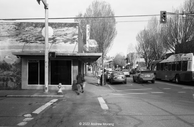
Driving west on Washington State Route 6, you eventually reach the environs of Willapa Bay. This is one of the largest estuaries on the North Pacific coast. For over a century, it was famed for its oyster harvest. The town of South Bend is on a bend of the Willapa River and serves as the county seat of Pacific County. During some business trips in the early 2000s, my coworkers and I passed through South Bend. It looked pretty rough back then.  


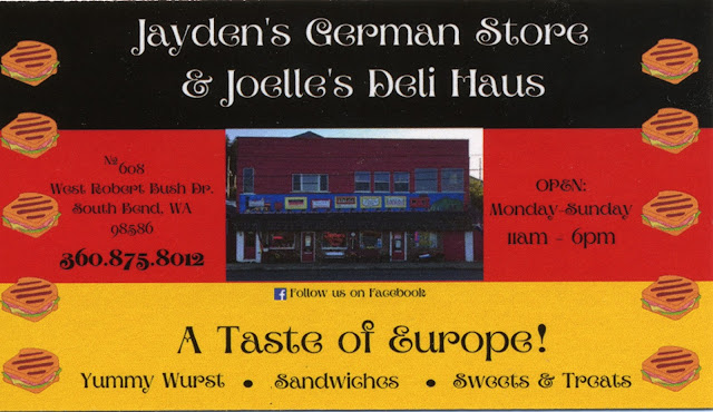
In March of 2022, South Bend looked much better. We wanted to lunch somewhere and were surprised to see signs for Jayden's German Store? What, a German deli in South Bend? We could hear the Brätwurst calling us ("Come eat me...").


Jaden's store is right on the main road. Find a place to park and shop for souvenirs, chocolate, mustard, and cookies. Pick up a few hot brats for lunch. We learned that the owner formerly cut hair and then decided to open the store and sell items from the old country.


Hand-made signs. Folk art at its best. I love places like this.


No more coastal coffee (Gold 200 film, Kodak Retina IIa camera, 50mm ƒ/2 Xenon lens)

Unfortunately, Coastal Coffee in its cheerful little blue house was no more.


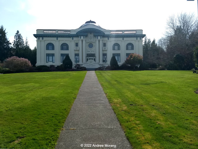
The Pacific County Courthouse is an unusually ornate structure in immaculate condition. We met the city clerk, and she graciously opened the building and showed us around. 

Standby for more southwest Washington in the future.

Most of these photographs are from a Moto G5 mobile phone except for the frame of the cheerful little blue coffee shack.