Showing posts with label XPan. Show all posts

Saturday, August 22, 2026

A Jewel in the City: Lake Union, Seattle, Washington (Sea 12)


Lake Union in June, 1995, view northeast from the Space Needle (Kodachrome 25 slide)


Overview


Lake Union is a freshwater lake entirely within the city of Seattle. The lake is a glacial basin, scoured out by the Vashon Glacier about 12,000 years ago. It receives fresh water from Lake Washington to the east and discharges to Puget Sound via the Lake Washington Ship Canal that leads west. The Hiram M. Chittenden Locks (Ballard Locks) maintain the level of Lake Union and allow boat traffic to transit from salt water to fresh water. 


Lake Union view NW with Queen Anne Hill to the left.
(2004 panorama taken with Hasselblad XPan panoramic camera with 40mm lens)

Lake Union view west towards Queen Anne Hill
(2004 panorama taken with Hasselblad XPan panoramic camera with 40mm lens)


November on Lake Union, view west to Queen Anne Hill
(Kodak Ektar 100 film, 50mm ƒ/2 Summicron lens at ƒ/2.8)

East Side  


When I lived in Seattle in the early 1970s, much of the shore around Lake Union was industrial, with shipyards, warehouses, a power plant, and miscellaneous boat activities. Today, the area south of the lake has transformed into condos, hospitals, cafes, and tech worker office buildings. The west shore below Queen Anne Hill has condominiums and restaurants.  

The east side of Lake Union along Fairview Avenue East is still industrial and interesting. Let's concentrate on this area. We will start near the Silver Cloud Hotel and walk north.


Seattle Seaplanes with Queen Anne Hill in the background
Seattle Seaplanes (Kodak Tri-X film, Rolleiflex 3.5E Xenotar)

You can rent a seaplane for a tour. The office is on the old yacht. 


Shed (floating?) at 1501 Fairview Ave. E. (Fuji Acros II, 25mm ƒ/4 Snapshot Skopar lens)
Lake Union Drydock Company


It looks like a homeless person occupied this old camper.


Howe and East Blaine Stairs


Seattle is hilly. The glaciers left drumlins throughout the Puget lowland. Early in the 20th century and continuing to recently, the City built stairs on the edges of many bluffs and hills. Sometimes, a street stops, and the stairs ascend or descend to the continuation of the street at a different elevation. Seattleites in the know use the stairs for exercise. 

A handy book, SEATTLE STAIRWAY WALKS, An Up-And-Down Guide To City Neighborhoods by Jake & Cathy Jaramillo, lists 25 of the best neighborhood walks in the city. 

If you are exploring east Lake Union, take the Eastlake, North Capital Hill, and Portage Bay walk. You walk under the I-5 pilings and ascend the East Blaine steps. Then you walk to the top of Capital Hill, past magnificent early 20th century mansions, descend to Portage Bay, then reascend and finally descend to Eastlake via the Howe steps. 


Underneath I-5 below the Howe steps (25mm ƒ/4 Snapshot Skopar lens)

East Blaine steps at Lakeview Blvd. E., 

Garage on Broadway East (50mm ƒ/2 Summicron lens)


Après Exploring

 
 Exploring the shore and walking 3.2 miles and about 800 steps is tiring. What do you do? Well, of course, you go eat seafood at Duke's Seafood South Lake Union. And drink a pale ale or two. Ahhh...
 
Health food Seattle style

 
The 2004 panoramas are from a Hasselblad XPan camera with 40mm lens. I had rented it at Glazers Camera for a project. I should have kept it longer and taken more panoramas around the city. The 2024 and 2025 photographs are from Rolleiflex, Pentax MX, and Leica M2 cameras with Tri-X and Fuji Acros film.
 

Ai Statement

 
The photographs and text above are mine, complete with flaws and strange syntax. I am not using Ai for any verbage. And all photos are from some place on earth with no Ai manipulation or removal/addition of "features." I consider that intellectual fraud. Here on Urban Decay, you will see the setting with all its warts and excess power lines and trash. I sometimes clean lint and chemical blobs from scans due to processing errors, and, of course, I crop frames as needed. But the scene in the frame is genuine, the photons that fell on some place at some time.
 
Dear Readers, thanks for your support. All comments/criticisms/scorn welcome. 


Saturday, January 24, 2026

On the Waterfront: Browns Point, Tacoma, Washington (Tac 06)


April 2004 view of Browns Point and cottages below Marine View Drive
(Hasselblad XPan panoramic camera, 45mm lens, Fuji Reala film)

Let us continue our quick September 2025 tour of Tacoma's waterfront. After exploring the commercial harbor on an overcast September day, I drove along Marine View Drive (Rte 509) to Browns Point. The bluffs rise steeply up from the road, but some new suburban developments have been carved into the hillside.

(Click any picture to enlarge details.)


Tank Farm vista and Double-brested cormorants, northeast Tacoma
(Kodak Panatomic-X film, 250mm ƒ/5.6 Sonnar lens, yellow filter)

I think I would not opt to live above a tank farm, but they do have a nice view to the west of the harbor and downtown Tacoma.

Trucking company, 1749 Rte 509 (80mm ƒ/2.8 Planar-CB lens)
Unknown chemical storage, 1749 Rte 509 (100mm ƒ/3.5 Planar lens)
Chipping machine, 1748 Rte 509

The southern part of Marine View Drive is lines with industry and material handling companies. 

Further north, the bluff rises steeply to the east, but the narrow beach has some cottages and year-round housing. Former pullouts with a view of the bay are now blocked and signed with "No Parking Any Time." I assume this was to keep off the homeless RVs and cars. 


Beach cottage, Marine View Drive
Watch kitties on patrol (100mm ƒ/3.5 Planar lens)
Hubcap heaven? Or just good stuff?

Cranes at Washington United Terminals from Marine View Drive
(250mm ƒ/5.6 Sonnar lens, yellow filter)

I took these phots on Kodak Panatomic-X film with my Hasselblad 501CM camera and various lenses. Glazer's Camera in Seattle developed the film. I scanned it with a Minolta Scan Multi medium format film scanner. 


Saturday, November 19, 2022

The Mississippi Delta 38b: Hwy 49W and the Belzoni area (XPan 12)

Dear Readers, let's take another look at the Mississippi Delta with the panoramic Hasselblad XPan camera. Please type XPan in the search box to see older articles from Vicksburg, the Delta, Jackson, and Louisiana.

After my drive north on Highway US 49E to the little town of Sidon, I headed west through flat and lonely farm fields on MS 511 (Phillipston Road) and MS 7, finally reaching Morgan City on US49W. Long-term readers may remember that I looked at Morgan City in the Mississippi Delta 23. I also explored junk in the woods in 2015. 


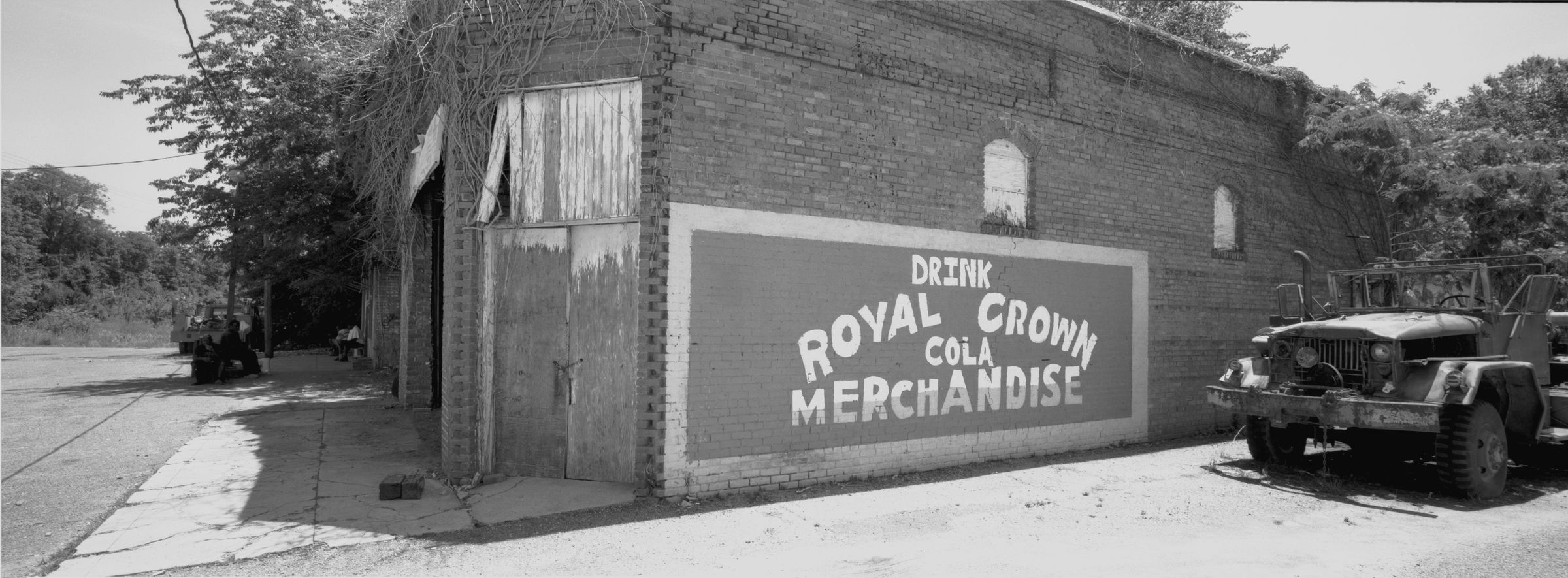
1st Avenue, Morgan City (30mm ƒ/5.6 lens)

This former commercial block has only one building with an intact roof. The dudes were hanging out in the shade and drinking.


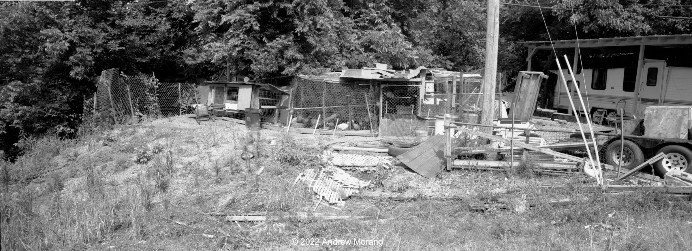
Fixer-upper barn, Swiftown (45mm, yellow filter)
Gin, Swiftown (90mm ƒ/4 lens)

Swiftown is not really a town, just an unincorporated community in Leflore County about 7 miles south of Morgan City. The barn next to a trailer was interesting. The cotton gin looks unused.

Head south about 10 miles and you reach Belzoni. 


Junction of MLK Jr. Drive and Church Street, Belzoni

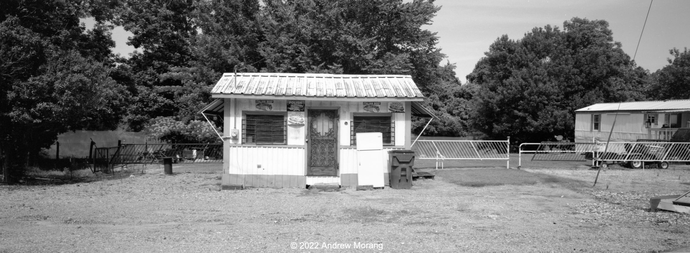
My friend, who grew up in Belzoni, told me that these Quanset huts were restaurants owned by a local Italian family, the Mechattos. They were immigrants from Sicily. My friend's grandmother called them "The Hut." They made wonderful homemade salad dressing. One waitress was called Tootsie. My friend did not know when the family left or stopped operating the restaurant. 

China Street, Belzoni

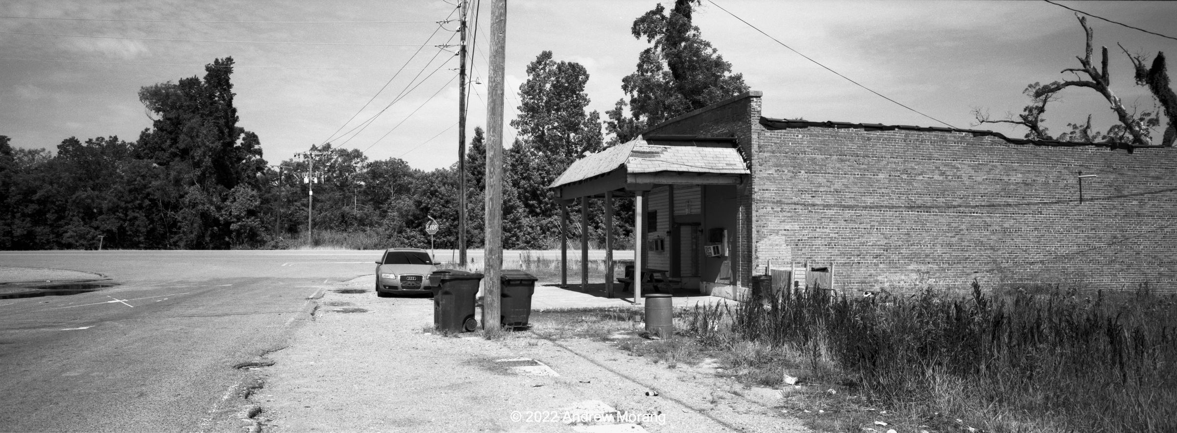
Much of Belzoni is pretty rough today. And it may no longer be the Catfish Capital of the World. Please click the link for some 2021 photographs of Belzoni.

Thank you all for riding along in the Mississippi Delta.


Friday, November 11, 2022

The Mississippi Delta 37b: Eden, Tchula, and Sidon (Xpan 11)

On my recent trip north on Route 49E, I revisited the tiny town of Tchula. I photographed here in 2020 with black and white film. This time, I was using my friend's Hasselblad XPan panoramic camera and wanted to capture some scenes in the wide view.


Eden


Attack of the Spacemen, Eden, Mississippi (45mm lens, ƒ/8.0½, yellow-green filter)

Eden is a little town of about 130 inhabitants in Yazoo County just west of 49E. There is not much to see except for the Cyclopian spacemen in front of the closed convenience store. I have admired them before. We continue north on 49E.

Tchula


Bridge to Cooper Road, Tchula (45mm, yellow-green filter)
Guinea hen house, Front Street, Tchula. Note the wandering rooster.
Time for lunch, Front Street, Tchula (45mm lens, yellow-green filter, ƒ/8.0½)

Front Street may have been the former 49E. It semi-parallels Tchula Lake, which is really a tributary stream to the Yazoo River.


The Tchula Hardware Company on 201 East Main Street is like a throwback to another era - a hardware store with all the useful things you can use to fix your house, bicycle, car, flooring, or appliances. The gent siting outside graciously said I could to take pictures inside. A young lady in a couch did not pay any attention to me. I placed the XPan with the super-wide 30mm lens on a counter and set the self-timer. The exposures at ƒ/11 were in the 2-4 seconds range. To see some of the detail, please click any picture.

Sidon


West Railroad Avenue, Sidon (45m lens, yellow-green filter, ƒ/11)

There is not much to Sidon now. East and West Railroad Avenues have no commercial buildings any more other than the post office. The wide bare stretch where my car is parked may have once been a rail yard or the location of a depot.

This ends our short trip on US 49E in the central Delta. Stand-by for more exploring in the future. Thank you for riding along.

Thursday, November 3, 2022

The Mississippi Delta 39: Thornton

Thornton is the remnant of a town on US 49E south of Tchula and north of Yazoo City in the Mississippi Delta. Two dilapidated square-front commercial buildings remain on the only street in town. More buildings would have once formed a small commercial core. 


Silos and gin south of Thornton (Kodak Tri-X film, Fuji GW690II camera, 90mm ƒ/3.5 EBC-Fujinon lens, yellow filter, 1/250 ƒ/8)

I drove on 49E on a blazing hot day in 2020. This gin and the silos may be unused, but possibly in Autumn, when cotton is harvested, the gin is put back into operation. The frames above are from a medium format Fuji GW690II camera with Tri-X film (click any frame to see details at 2400 pixels wide.


Mark's store in Thornton (45mm lens, yellow-green filter)
Mr. Kevin hangin' out, Thornton (45mm lens)

In 2022, I drove back north on 49E but this time stopped in Thornton. Mr. Kevin was standing in front of one of the square buildings. At 11:00, he was already slurring and asked me if I came to see Mark. I said sure. Mark came out of the other square building and was in much better shape. He said his father formerly owned the building and ran a store. At this time, it looked like Mark lived there. I forgot to ask if they had safe drinking water. Other gents in town were also drinking or enjoying weed. Mark generously said I could photograph the store. They all admired my 42-year-old car, which is a conversation ice-breaker. Kevin said with a car like that, he could get the chicks.

J. Chambers Street view west, Thornton (45 mm lens, yellow-green filter)

The three last photographs are from a Hasselblad XPan panoramic camera and the 45mm ƒ/4 lens. The film was Fuji Acros, exposed at EI=80. The light was harsh and glarey.

For more articles about the Delta, type "Mississippi Delta" in the search box. Click any photograph above for more details.

Thursday, September 29, 2022

More Wide View in West Jackson/Hwy 80 (Xpan 10)

Dear Readers, I have inflicted photographs from west Jackson on you before. Highway US80 was once a major commercial artery with factories, restaurants, hotels, and motels. Today it is rough. Traffic buzzes past empty warehouses and factories. Motels look like dives.

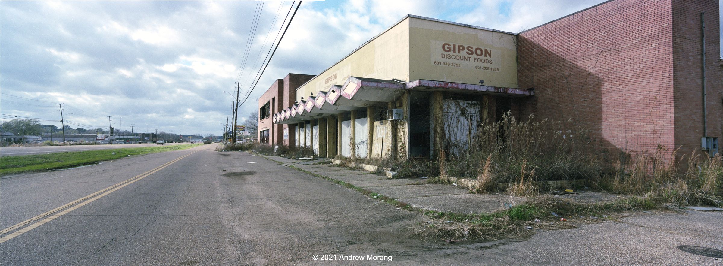
Not much discounting any more (30mm ƒ/5.6 lens)

The former Gipson Discount Foods is an example of the type of abandoned warehouses that you see along 80. It has some elements of post-war moderne decoration, possibly not too bad when new. And the yellow paint was cheerful.

Former employee entry to Coca-Cola bottling plant (30mm ƒ/5.6 lens)

The "Plant" is, I think, the former Coca-Cola bottling factory, originally built in 1949. The complex appears to be unused, but I recently saw a new fence. Possibly it is an attempt to exclude homeless people. According to a 2010 article in West Jackson:

The plant was a mainstay on Highway 80 for 58 years. Then, in 2007, the company vacated the aging facility and moved into a newer building in the Northwest Jackson Industrial Park near Interstate 220. The bright spot in this story: at least they didn’t leave the city. However they did leave 143,000 square feet of building space to rest vacant and lonely on the west side.

Kodak Super-XX film, 180mm Caltar II-N lens, yellow filter

The 1949 architecture was considered modern in the post-war era. A Tulsa real estate brokerage company auctioned the site in 2016, but I did not see on their web page who (if anyone) bought it.  

Jackson Southwest Hotel, 2649 Hwy 80 West, Jackson

The Jackson Southwest Hotel, possibly a Holiday Inn at one time, sits empty and vandalized on a hilltop just west of Ellis Avenue. According to WLBT News in October of 2020, a grant will help revitalize it into a residence for seniors. I previously wrote about the hotel in 2020.

Hotel O, Ellis Avenue, Jackson

The Hotel O is on Ellis Avenue just north of the westbound ramp to Interstate 20. Despite its modern appearance, vagrants have lived in it for several years and have set fires. You can see fire damage on the right side of the building in the photograph above. It is likely that the building will be razed soon, just like the former Best Western Metro Inn, which was once right across the street. The Metro Inn was crunched up in April of 2021, and nothing is left. 

Is this really what happens in American cities? Build, maximize the tax benefits, let the property decline as it moves down the food chain, abandon it, and then demolish it at taxpayer expense? What a ghastly waste of resources, earth materials, and energy.

The panoramic photographs are from Kodak Portra 160 film via the amazing Hasselblad XPan camera and its 30mm and 45mm lenses. Click any frame to see details at 2400 pixels wide.