Showing posts with label Hospital. Show all posts

Saturday, September 20, 2025

2025 E. Washington Road Trip 04 - In Decline: the Saint Ignatius Hospital of Colfax

St. Ignatius Hospital, Colfax, Washington (28mm ƒ/2.8 Vivitar lens)

Colfax is a small city in the beautiful Palouse terrain of eastern Washington. The Palouse is known for its gentle rolling hills, which consist of wind-blown silt and dust (loess) deposits. Farmers grow wheat over much of this area. Colfax is the county seat of Whitman County. 

One of the city's notable architectural structures is the unused and long-neglected Saint Ignatius Hospital. Mother Joseph Pariseau and the Sisters of Providence built the hospital in 1893. It served central and northern Whitman County until 1968. The hospital relocated to the new Whitman Community Hospital in 1968, and a nursing home occupied the old building until it was abandoned in 2002 after a water main broke in winter. The building was neglected for years, and the city tried to condemn it. In 2015, the former hospital opened for public tours, based on claims that the site is haunted. You can book paranormal tours. Landlock Holding LLC bought the building in 2021.

When I visited the site in May of 2025, I met a workman who said he was on duty full time to do renovations. He was in process of replacing windows and making other repairs. I could not enter but could walk around the grounds.


Cornerstone (28mm Vivitar lens)
Former power plant
Nurses' residence building


All of the buildings that were once part of the hospital complex are in poor shape. 

St Patrick's Church and the former St. John's Academy occupy a lot just west of the former hospital. 


St. Johns Academy - unused?

St. John's Academy opened on June 6, 1915. The Franciscan Sisters of Perpetual Adoration operated a grade and high school in the building. The Parish closed the building in 1966. It looks like it has received some maintenance since then because it looks sound and secure. 


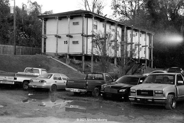
Abandoned apartment building

I took these photographs on May 9, 2025, on Kodak Portra 160 film with my Pentax MG camera. Most were with an inexpensive Vivitar SMS 28mm f/2.8 lens in Pentax K mount. $25 for a totally functional 28mm lens?? One day, these photographic bargains will disappear.  For some frames, I used Photoshop CS6 to correct converging verticals. The right way to do this would be to use a shift lens, but no more photo purchases - I promise......

Thursday, December 16, 2021

Wandering around Upper Clay Street, Vicksburg, Mississippi

Clay Street view west (Panatomic-X film, Hasselblad 250mm Sonnar lens, 1/15 ƒ/8.0½)

Clay Street is the major east-west road through Vicksburg. Before Interstate 20 (I-20) was completed in the early 1970s, US 80 came into town on Clay Street. A driver heading west would drive on Clay to downtown, turn left on Washington Street, and drive south to the old Mississippi River bridge.

I label the part of Clay Street just west of the Vicksburg National Military Park as upper Clay, while the area downtown near the Yazoo Canal is lower Clay. Here we will look at some scenes in upper Clay. Decades ago, private homes lined the street, but now it is strip America of the ugliest sort. You car, tire, and muffler repair shops, check-cashing and title-loan places, a few real estate offices, abandoned buildings, a dead A&P super market, derelict historic homes, and fast food emporiums. Empty lots show where houses once stood. A former resident labeled this "the ugliest street in America." Well, maybe not the ugliest, but certainly a contender. 


The Eastview Apartments, situated between Clay Street and Baldwin Ferry Road, are low income housing subsidized by the federal government via HUD (Housing and Urban Development). They are unusual construction, being suspended between telephone poles that were driven into the ground on the steep hillside. It was a practical solution compared to grading flat terraces and pouring concrete slabs. 

Eastview Apartments with Stouts Bayou in foreground (Panatomic-X film, Hasselblad, 50mm ƒ/4 Distagon lens, green filter)

Stouts Bayou flows under Clay Street through some form of culvert or tunnel because it emerges out of the hillside below the Eastview Apartments. This is kudzu jungle. It needs a cleanup by goats.


Warfield's ServiceCenter, at 2910½ Clay Street, has served customers for over 30 years. Good people.
 

One of the nondescript street running into Clay Street from the north is Hope Street. The proprietor at A & V Discount Tobacco & Beer generously let me take a photograph.


The long-unused Parkview Regional Medical Center building looms over the area north of Clay Street. It has been vacant since 2002, except for homeless who occasionally find ways to enter.

Mercy Hospital, Grove St. (Kodak Super-XX film, Tachihara 4×5" camera, 90mm ƒ/6.8 Angulon lens)

The Sisters of Mercy, who have a long history of care in this town, originally built Mercy Hospital in 1957. The present owners have tried to sell it but with no results. Who wants an obsolete hospital building considering the cost to renovate and upgrade electricity, exits, stairwells, and utilities? Externally, it looks intact, but I do not have information on the roof or the interior. 

When I took photographs in the parking lot in the rear, the neighbors came by and said they watch for vagrants. The police come, clear away the homeless, and then they return later.


Further west is a short segment of Crawford Street. This is not the main Crawford Street downtown but a short detached section running directly next to Stouts Bayou. The houses are on the south side of the road and have access via wood bridges. I photographed more of the Crawford Street region during my tour of neglected Vicksburg houses (Nov. 16, 2020 article).

1517 Main Street (Panatomic-X film, Hasselblad 501CM camera, 80mm lens, 1/8 sec. ƒ/8.0½)

Main Street is one of Vicksburg's historic streets. It is still lined with old houses, but one by one, they have been condemned and demolished. This house at 1517 looks pretty good, and I do not know its issues.

This ends our short tour of upper Clay Street. Standby for more Vicksburg photographs soon. Thank you all for riding along.

Friday, October 16, 2015

TB Sanatorium, Parnitha, Athens, Greece

Mount Parnitha (in Greek, Πάρνηθα) is a mountain about 30 km north of downtown Athens. When I was a child, it was a common Sunday outing to drive up the winding mountain road to the upper reaches of Parnitha to play in the snow of just enjoy the dense forests. We always passed a hulking old hospital that my parents said was a former sanatorium. In the 1950s, the memory of tuberculosis (or TB) was still fresh in many people's minds. Before the era of antibiotics, a long rest in an environment with clean air was the only hope for TB sufferers (and even then, the recovery rate was low).
A hospital on Parnitha was first was built in 1912 to treat patients suffering from tuberculosis. The facility treated many prominent citizens of Athens over the years. Unfortunately, despite the best efforts of doctors and the purported benefits of the fresh air in sanatoria, in the early 20th century, over 50 percent of patients died within five years. The first successful immunization against tuberculosis was based on attenuated bovine-strain tuberculosis, known as the bacille Calmette–Guérin (BCG). The BCG vaccine only received wide acceptance in USA and Europe after World War II. Thanks to public health initiatives, tuberculosis was largely eradicated from most of Greece and the Parnitha hospital closed in the 1950s or early 1960s. The building at the site is newer than 1912, I guess a reconstruction from the 1950s.
Around 1965, the Greek National Tourist Organization bought the hospital and renovated it as part of the now-defunct Xenia hotel chain. What a disgusting concept: a TB hospital as a hotel? 

The Xenia hotels were a major infrastructure program in the 1950s and 1960s, when Greece wanted to enhance its tourist potential. After the devastating civil war that ended in 1949, Greece lay in ruins and only major cities had hotels. The Xenias were often built in beautiful locations near archaeological sites. Many were of post-war modernist architecture. But they were government-run, and by the 1970s (even the 1960s) were hopelessly outclassed by commercial hotels. I recall drafty, echoey entry halls, erratic hot water, and grim breakfasts that featured stale bread, Nescafe, and a disgusting Tang-like orange drink. According to Wikipedia, the Xenia program was terminated in 1983. Many of the concrete buildings have not aged well, and they often looked out of place in towns among classical stone buildings.
The intrepid visitor ascends the crumbling steps into what was once the main entry hall. Some of the carpet is still there. I processed these photographs in color to show the red and blue carpeting, probably not very elegant even in the 1960s.
I suppose in the past, the public rooms might have been reasonably cheerful on sunny days.
The hallways are long and gloomy, and the concrete and plaster is spalling and crumbling into powder.
Some of the graffiti is pretty imaginative and worth showing in color.
I did not see much furniture. Some bloggers have shown kitchen equipment, but I was hesitant to explore too deeply by myself. My nephew said drug activity happens there, but on the weekday that I visited, all I saw was some other photographers. Still, I decided to not venture alone into the dark cellar.
In 2007, a devastating fire burned a wide area around Parnitha. The fire destroyed rare Greek Fir and Aleppo Pine. Since then, the fallen timber has been removed, leaving a wasteland of bare rock and thin soil. The forest will take decades or centuries to recover. The odd sculpture garden used fire-damaged tree trunks. 

The lower photograph shows the Regency Casino Mont Parnes, minus the once-beautiful forest. The casino and hotel have a cable car, but the site is so remote from Athens, I am surprised it can remain in business.

Click the links below for other articles on the TB sanatorium:

The Greek Reporter

Deserted Places blog (from 2012)

PBS (Public Broadcast System) aired an excellent documentary in February, 2015, on tuberculosis in America, titled The Forgotten Plague. I recommend it highly.

I took these photographs taken with a Panasonic G3 digital camera, with RAW files processed in PhotoNinja software. I drew the map with ESRI ArcMap software.

UPDATE:  For some 2016 photographs on Kodak Tri-X film:  https://worldofdecay.blogspot.com/2016/12/the-tb-hospital-on-parnitha-greece.html

Saturday, July 14, 2012

Kuhn Memorial (Charity) Hospital, Vicksburg, Mississippi


The long-abandoned Kuhn Memorial Hospital, in Vicksburg, Mississippi, has become a popular site for urban archaeology, or at least for decay photography. The spooky old buildings are only a half mile northeast of the Warren County Courthouse on a large lot south of Martin Luther King, Jr., Boulevard, formerly known as Jackson Road.


The site was the original location of the Vicksburg City Hospital in the 1830s. The State took over the operation of the facility in 1871 and re-named it the State Charity Hospital at Vicksburg. For an excellent summary of the hospital's history, readers can refer to a 2010 article in Preservation Mississippi. The red brick building ("a substantial house") in the antique postcard (from Mississippi Department of Archives and History) was in use until 1962. A modern annex was built in the rear in 1959 and the institution was renamed Kuhn Memorial Hospital. One of the comments written in response to the Preservation Mississippi article noted that the 4th floor was a minimum security prison. Another noted the presence of mental patients.

The building on the right was an annex for Confederate veterans. It burned under mysterious circumstances in 1918. The site is now forested. Today, we forget that for well over a half century following the Civil War, veterans from both sides of the conflict needed medical care and, often, housing and food. Many were crippled or in very poor health.

The state replaced the original brick house in 1962 with this substantial and rather stern modern building. In 1993, it was still secure and intact. (Kodachrome slide taken with a Leica M3 rangefinder camera and the 35 mm f/2 Summicron-RF lens (the famous 1st generation 8-element version)). 

The hospital is still visible from MLK Boulevard, but is now moldering and nasty.

These photographs show the east and west sides of the 1962 building, with the 1959 annex in the back.


On December 31, 1989, The Vicksburg Post ran an article titled, "Closing of Kuhn Memorial Is Vicksburg's Top 1989 Story." The article summarized the convoluted arguments in the 1989 legislative session regarding funding for Medicaid versus continuing to fund Mississippi's three charity hospitals.

On February 23, 2010, The Vicksburg Post ran an article on the hospital titled, "20 Years After." The former business manager remembered how the hospital was a multifunctional facility, with a burn center, occupational therapy, and physical therapy. Kuhn provided free or low-cost health care to residents from all over central Mississippi. Most were Medicare patients after the program began in 1965. The hospital employed a variety of specialists, including doctors from the Philippines, Cuba, and Korea. In addition to medical services, the hospital was also a training facility for nurses and resident doctors.

The hospital closed its doors in 1989, a victim of changing economic priorities and poor economic modeling. Details of the closure can be seen in the
Mississippi Code of 1972, as Amended. "(1) From and after July 1, 1989, the Kuhn Memorial State Hospital at Vicksburg, the South Mississippi State Hospital at Laurel, and the Matty Hersee Hospital at Meridian shall be closed, and the Legislature shall not appropriate any funds for the operation of those hospitals after that date." Thus ended the era of state charity hospitals in Mississippi. 

Medical care for the poor continues to be abysmal in this state. And the state government refuses to expand Medicaid, another chapter in the sad saga of marginalizing and degrading the poor.  

In 1994, the State gave the land back to the City of Vicksburg (according to The Vicksburg Post article). In 1996, the City sold the property to Lassiter Associates of Baton Rouge. As of 2012, it belongs to the Ester Stewart Buford Foundation of Yazoo City. 

For a few years, the buildings were locked and windows secured with plywood. Once vandals removed the plywood, deterioration accelerated.

This is the breezeway that connected the 1959 and 1962 buildings.


The interior is a mess of decayed and collapsed acoustic ceiling tile, vandalized electrical fittings, and peeling paint. On my own, I hesitate to venture too far into the building because of security. One day, a policeman drove around the property in his cruiser and seemed most surprised to see me with my large tripod. He did not expel me but warned me of debris and hazards (hint, better clear out).


This is a loading dock on the west side of the 1959 building, near the prominent water tower that is visible from a long distance. This is a height of land, possibly selected in the 1800s because of breeze and fewer mosquitoes.

(April 2014 note: Please click the link for a 2014 update.)

UPDATE: the entire hospital has been razed. There is no remnant left for photography or exploring. 


This is one of the older parts of town, and Jackson Street (Openwood Road) was the historical route to Jackson. This pink wood-frame house at 1499 MLK Boulevard has been deserted since 2010. (2014 update: the house has been demolished.)


A few blocks to the east is Feld Street, another one of Vicksburg's little-known one-way streets (see Figure 1, the road map). The road runs along a ridge crest, and the houses line the road at ground level, with their rear sections supported on pillars. This was a common construction practice early in the 20th century. Nos. 512 and 516 were both deserted and on the City condemnation list. Once lost, these lots canon be redeveloped.

I took the 2010 photographs with a Sony DSC-R1 digital camera, tripod-mounted. The two 2012 photographs are from my Panasonic G1 camera mounting a 1949-vintage Leica 5 cm ƒ/2.0 Summitar lens. At maximum aperture of ƒ/2.0, it produces swirly aberrations around a sharp center.

For later articles and photographs of Kuhn Hospital, please type "Kuhn" in the search box.