Tuesday, January 18, 2022

Checking out Monroe, Louisiana (Part 2)

KCS rail yard from Desiard Street, Monroe, Louisiana (Hasselblad 501CM camera, 80mm ƒ/2.8 Planar-CB lens)

Dear Readers, in the last article, I showed you the Ouachita River and the Kansas City Southern railroad bridge. Let's move east and see what else is interesting in the big metropolis of Monroe. 

New York Furniture, Desiard Street, Monroe (1/250 ƒ/11.5, yellow filter)
707 Desiard Street, Monroe (80mm Planar-CB lens, 1/250 ƒ/11.5, yellow filter)
Old City Cemetery, Monroe (80mm Planar-CB lens, green filter)

Desiard Street was once one of the prominent commercial streets passing through the city and then crossing the Ouachita River. Today, it is pretty sad, with empty lots, boarded-up buildings, and trash. The Old City Cemetery has ornate tombstones of prominent citizens.  


Beth Eden MB Church, Milhaven Road, Monroe (1/250 ƒ/5.6)
Abandoned house, Milhaven Road, Monroe

Proceed west following the railroad yard, and you enter modest neighborhoods of mid-century houses. Sadly, we saw many closed or abandoned homes. 

KCS rail yard off Oak Street, view west
City of Monroe workshop, Oak Street (1/250 ƒ/11.5, 80mm Planar-CB lens, yellow filter)

Monroe has three rail yards, underscoring its importance as a rail junction city. I have not yet visited the yard south of I-20. Next trip....

120 Cotton Street, West Monroe
Cotton Street, West Monroe (orange filter)

Cross the Ouachita River to the Cotton Port Historic District of West Monroe, and you are in Antique Alley. This features an impressive collection of stores selling antiques, furniture, knickknacks, craft beer, and miscellaneous stuff designed to separate visitors from their money. The streets are busy many evenings with Open Houses, Champaign Strolls, Christmas on the River, and other events. Good for them! Come and spend money.

This ends our short trip to Monroe. We will return some day to explore some more.

All photographs are from Kodak Tri-X film exposed with my Hasselblad 501CM camera, all hand-held. I posted the pictures at 2400 pixels wide, so click any photograph to see more detail.

Wednesday, January 12, 2022

Checking out Monroe, Louisiana (Part 1)

Dear Readers, Happy 2022 to you all. I hope you are all prosperous, safe, and optimistic this year.

Kansas City Southern rail bridge over the Ouachita River, Monroe (Tri-X film, Hasselblad 501CM camera, 80mm ƒ/2.8 Planar-CB lens, green filter)

Monroe, formerly Fort Miro and now the seat of Ouachita Parish, is the "big city" of north central Louisiana. The family and I used to attend theater productions at the Monroe Civic Center and have flown out of MLU airport, but otherwise have not spent much time there. Readers may remember that in 2020, I followed part of historic US 80 through the northern part of the city (it was not too exciting). 

A Virginia friend asked about someplace to explore, and I suggested Monroe. We drove there on a sunny warm day and headed to the Ouachita River at the historic city core.


The railroad tracks come right through the business district and cross the Ouachita River on a beautiful old pivot bridge. Some railroad maintenance workers let us enter the railroad property and take photographs. They said the bridge still occasionally pivoted when a barge was passing on the river. The Ouachita is a Federal Navigation Project, meaning to is maintained by the US Army Corps of Engineers:  

"The Ouachita-Black Rivers Navigation Project provides dependable year-round commercial navigation from the mouth of the Black River to Camden, Arkansas, a distance of approximately 330 river miles." (from the Ouachita River Valley Association

I showed my Hasselblad to one of the railroad workers, and he was fascinated to look through the waist-level finder and see that the view was reversed left to right. Maybe I made a film convert.


South Grand Street may have once been the main commercial strip paralleling the river. The area looks reasonably clean and well-maintained. Empty lots show where old commercial buildings have been demolished. But the standing buildings have businesses or occupation. 


Many of these late-1800s or early-20th century shops and buildings used cast-iron frames and supports on the facade. This was a common construction method, and you still see millions of buildings around the country with the cast iron beams. Any old-town downtown will have these buildings. The big advantage of cast iron was that the vertical supports could be much more slender than masonry supports of similar bearing capacity. 


The side of buildings that faced the railroad were typically a bit rough or industrial. You definitely see this when you take the Amtrak through the Northeast Corridor.

These photographs are from Kodak Tri-X 400 film, developed by Northeast Photographic in Bath, Maine. I exposed them at EI=320, all hand-held. The light was bright and glarey.

This ends our short tour of the riverfront region of Monroe. Standby for Part 2.

Thursday, January 6, 2022

Afternoon at Logan (Boston, Massachusetts)

Dear Urban Decay readers, Happy New Year! Let us all hope that 2022 is a better year all around than 2021, which was pretty horrible for many people. At least the US stock market was happy, but that does not help millions of Americans. Maybe the pandemic will wane in the coming year and we can sort-of return to normal travel and mixing unsocial gatherings. 

In the meantime, here are some photographs from my archives of Boston and Logan Airport.
_______________________________________________________________________________

Panorama of Boston and Logan Airport from Hilton Hotel, May, 1988. (4 Kodachrome frames from a Rollei 35S camera; click to enlarge and see details)

I have flown in and out of Logan Airport too many times to remember, starting sometime in the 1950s. 

The US Army built the original landing field, then named Boston Airport, in 1923 on tidal flats in East Boston. The fill at that time consisted of cinders, meaning coal clinkers. Many of the 1800s fills in and around Boston were a convenient way to dispose of clinkers. The term then used was reclamation, as if humans were "reclaiming" land from the sea. I remember during the 1973 oil crisis, some people suggested burning coal at home as a source of heat. My uncle, an old-timer, told me that was an absurd idea. Where would we take the ash and clinkers? He was right; it would be difficult to dispose of the coal waste for a city the size of Boston and its suburbs. 

The Army operated Boston Airport until 1928, when they transferred it to the State of Massachusetts. As the years progressed, the state added more landfill, expanded runways, and built terminals. The field was renamed the General Edward Lawrence Logan International Airport (IATA: BOS). Today, Logan is a bustling transport hub, the 16th busiest airport in the USA, with many daily international flights.

Typical 1988 afternoon on the Southeast Expressway, waiting to transit to the Callahan Tunnel and to Logan Airport

Logan is also a topographic confusion (OK, total mess) of twisting roads, buildings seemingly perched haphazardly all over the place, one-way streets, and choked traffic. It is often a nightmare getting in an out of Logan, especially by car. Decades ago, the State should have purchased another location for their main airport, a site inland that was not as constrained by water and had easier access. 

The photograph above shows a typical afternoon on the old (now demolished) Southeast Expressway en route to Logan Airport. The Southeast Expressway was one of the grandiose 1950s projects to build high speed roadways through American cities, regardless of the environmental and societal cost. Opened in 1959, it was instantly hated because it partly cut off the Italian North End from the rest of the city. As you recall, these highways often cut through low-income neighborhoods (usually meaning African-American) as if the continuity of their neighborhoods was of no value. Also, those people usually did not have the access to high-power lawyers or political friends to argue their situation. But this sordid topic of corruption and giveaways to the construction industry is for a future blog article. 


In 1988, I attended a training class in Cambridge and stayed a few nights at the Hilton Hotel at Logan Airport. Surprisingly, my room had an interesting view west towards downtown Boston (see the panorama) and overlooking some of the Logan hangars. Not bad for an airport hotel. This older building has been replaced by a modern and larger Hilton. In 1988, some operators still used propellor planes. Eastern Airlines was still operating, before being absorbed into PanAm and thereafter disappearing into bankruptcy oblivion.

In the photograph with the Eastern Airlines hangar, the long building across the water is the former Army Supply Base, also known as the Boston Quartermaster Terminal. In the late 1930, my father worked for the US Army Corps of Engineers in that building. 

These are Kodachrome slides from a Rollei 35S compact camera with a 40mm ƒ/2.8 Sonnar lens. I scanned the slides with a Plustek 7600i scanner and created the panoramas with Photoshop CS6. 

UPDATE. (Extra information in response to a comment left by Jim Grey below.) 

Issue 1: The MBTA Blue Line stops at Airport (appropriate name). The problem with this stop is that it is too far from the terminals for most people to walk. Therefore, a surface bus runs on a loop to the terminals, car rental center, and Airport station. Decades ago, the bus cost 25 cents, cash only. I always wondered, a tourist steps off the plane from Paris or Lagos and he is supposed to have 25 cent coins ready to drop into the coin box? At least now, the bus no longer requires a fee. 

Issue 2: In almost every European city that I have visited, plus Bangkok and Hong Kong, the train comes literally under the terminal. Go through passport control, pick up your bags, and take the escalator down to the train station. No need to fight snow or rain with your luggage. In 60 years, the MBTA has not been able to reroute the Blue line into a subterranean station the would be convenient for passengers? Seriously? And Boston likes to think it has a world-class airport?

Issue 3: In Airport station, you use a vending machine to buy a transit pass for one ride or various time periods. OK, that is easy. But a sign states that there is a reduced fare for senior citizens. However, this fare machine will only refill or validate an existing senior pass. You need to acquire the senior card downtown at another station. Seriously?

Thursday, December 30, 2021

Morning in Chelsea, Massachusetts

Chelsea is a historic city across the Mystic River from Boston, Massachusetts. The Naumkeag Tribe lived in that area for thousands of years before the first European settler built a trading post in 1624. Several battles during the revolutionary war were fought in Chelsea. 

When I was young, Chelsea was a rough and tumble working-class community with factories and dense housing. This usually consisted of wood triple-deckers, often in poor condition. Many were erected after 1908, when an immense fire destroyed large portions of the older neighborhoods

In 1973, a second great fire left about 20 percent of the city in ashes. Residents left, the tax base collapsed, and the city sank into crime, corruption, and gross mismanagement. The State of Massachusetts imposed a state-approved receiver to control the city, improve schools, overhaul the police, and dismantle the corrupt city government. By 1995, the city was on the mend.

Morning at the junction of Pearl Street and Congress Avenue, Chelsea
Park Street
Congress Avenue

Since my last visits in who knows how many years, the city has been revived and semi-gentrified. Today, it looks pretty good. My childhood memories are totally out of date. The houses are mostly vinyl-clad, the streets clean, and the nearby school bustling with children and parents walking their kids to school (walking?). The area in the photographs above has become largely Hispanic, and I heard Spanish being spoken regularly. There were no spooky vibes as I feel in many other American cities. I could live here with no major issues except for the congestion and lack of parking. 

Heading north, Route 1 is still pretty crummy, but it is strip America of gaudy architecture as opposed to burned out and abandoned malls and strip shopping centers.

Katz Bagel Bakery, 139 Park street, Chelsea
Katz Bagel Bakery interior - fresh and authentic

My wife and I recently stayed in a Logan Airport hotel on the Chelsea side of Chelsea Creek (a waterway that flows into the Mystic River near where it debouches into Boston Harbor). The breakfast was offal. What is wrong with American hotels? I walked west into town to see where I could get a decent coffee. I found myself at Katz Bagel Bakery. This is the real thing! This family-owned company has been making bagels here since 1938. I bought three and asked about a package of cookies on the counter. The baker said free, take them. As for coffee, he directed me to a Hispanic convenience store. A Hispanic lady was mixing coffee con leche with vast amounts of sugar, but I poured my own for only $1.  

The Jewish tradition dates back to the early 20th century, when Chelsea was a major destination for Russian and Eastern European immigrants. Russian Jews came in large numbers after the 1890s, in response to pogroms in their home country and, after the 1917 revolution, to Communist persecution.  

Charlestown street leading downhill from the Bunker Hill Monument
USS Constitution ("Old Ironsides"), Boston National Historical Park. 

Cross the Mystic River to Charlestown, another a historic city within sight of Boston. Charlestown was the site of the Battle of Bunker (Bunkah) Hill, one of the early battles of the Revolutionary War. On a 2006 visit, I was surprised to see that Charlestown has also been gentrified and looks very nice. 

I have written about Boston before:
Standby for more photographs of Boston and vicinity.  If you have a chance, definitely visit Boston, savor the history, explore the cultural and historical offerings, and eat good food. (But don't try to drive in the city unless you are really brave.)

Happy and prosperous New Year to you all. I hope 2022 it is better and healthier than the ghastly 2021 that is about to end.

UPDATE

After a comment from a reader about the offal at American hotels, I thought I would include a photograph of the breakfast buffet at a hotel in the Passo di San Pellegrino in the Italian Dolomites. Many Italian hotels offer breakfasts like this. And the pastries are made by the chef on the premises. As I wrote before, what is wrong with American Hotels and their vile food offerings? Who eats at a captive restaurant in an American hotel?

Typical breakfast, Hotel Arnica, Passo di San Pellegrino, Italian Dolomites


Friday, December 24, 2021

Wandering around Lower Clay Street, Vicksburg, Mississippi

Clay Street descending from Cherry Street (Tri-X film (suffering from reticulation) taken from balcony of motel)

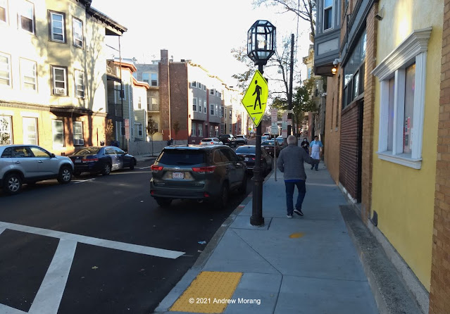
Clay Street comes into the core of old Vicksburg from the east. 

When the Methodist minister, Newitt (or Newit) Vick, platted the town, he intended Jackson Street to be the main east-west commercial street and laid it out as two-lane. But commerce did not develop that way and Clay Street became the main road with hotels, shops, and commercial buildings. The National Registry of Historic Places Multiple Property Documentation Form, written by Nancy Bell of the Vicksburg Foundation for Historic Preservation, includes a readable and detailed summary of the city's growth and architectural changes over the decades. The "urban renewal" fad of the 1970s (i.e., free money from the Federal government) led to the demolition of numerous historic buildings and construction of some revolting and largely-unused concrete parking garages. Someone should follow the money and see who really benefitted from these "renewals."

In this short article, I will show you some photographs from lower Clay Street, the area from around Cherry Street and further west, heading towards the Yazoo Diversionary Canal.  

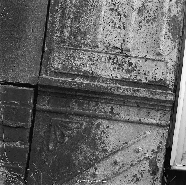
Former Wells & LaHatte appliance company (919 Clay Street), now moved 1 block west (Kodak 4×5" Super-XX film)
Interior of 919 Clay Street (Moto G5 photograph taken through a window)

The Wells and LaHatte company has sold household appliances in Vicksburg since 1935. It is nice to deal with a locally-owned company. They moved from their old building are now one block west at 1301 Monroe Street. 

Former apartments at 915 Clay Street (Super-XX film, 90mm ƒ/6.8 Angulon lens)
915 Clay Street is settling and collapsing (90mm ƒ/6.8 Angulon lens)
Side of 915 Clay Street from Cherry Street
915 Clay Street is an example of the type of multi-floor wood houses that once were more common around town. This one is pretty rough and had been converted into apartments. As of this writing (December 2021), the roof is collapsing into the interior and the house is settling. The photograph of the front door does not have barrel distortion; the house is settling (squashing?) unevenly into the cellar. 

Years ago, an identical wood house occupied the lot to the west, address 911 Clay. In the 1980s and 1990s, Offshore & Coastal Technologies, Inc., had its offices there, but the company closed and the building burned about 10 years ago.

Former Junius Ward YMCA, 821 Clay Street at corner of Monroe (Panatomic-X film, Fuji GW690II camera, 90mm lens)
The Junius Ward YMCA (originally the Young Men's Christian Association) was a center of social and sports activities for decades. The upper two floors contained residence halls for single men. I wrote about the 'Y in 2010 and have posted more interior photographs at other times. The building closed in 2002 when the 'Y moved to a modern facility east of town. No one has been able to reuse the old building, and it sits empty and forlorn. Someone did repair the roof about 10 years ago, but that was the last renovation that I have seen. I read that the building would need modern electrical service, fireproof stairs, and many other serious renovations to make it usable as apartments.

The Old Courthouse Museum sits on a hill in the upper right of the scene.  

Hotel Vicksburg, undated (from the Cooper Postcard Collection, courtesy of the Mississippi Department of Archives and History)
The Hotel Vicksburg at 801 Clay Street opened in 1929 and was the city's sophisticated hotel during the mid-20th century. It was the tallest building in town and even had a radio studio on the roof. Today, it is is the home of the Vicksburg Apartments. I know several people who rented units there and really liked their accommodations. Today, most inns and hotels are generic chain accommodations near the interstate.

Walnut Street view north on a foggy day (Tri-X film, Hasselblad 50mm Distagon lens)
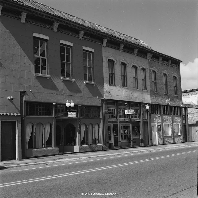
721 Clay Street (4×5" Tri-X negative, 75mm ƒ/8 Super-Angulon lens)

Across the street from The Vicksburg is the elegant 1916 B'nai B'rith Literary Society building, now known as the B.B. Club. In the 1980s and 1990s, this building housed the Vicksburg Police Department. After the police moved to their new building on Veto street, the former mayor, Mr. Lawrence Lyons, bought the BB building and restored it with great care. The police had covered the plaster walls with panelling, but the underlying decorations and plaster work were largely intact. 

Note the sign for The Vanishing Glory. This was a multi-projector slide show held at the Strand Theater. Glory closed in the early 2000s and the Westside Theater Foundation restored and modernized the Strand. I photographed in the Strand in 2011 at the beginning of its restoration. 

The Strand Theater is in the Adolph Rose Building, circa 1890 (717 Clay Street). This is one of the best of the remaining late-1800s commercial buildings in Vicksburg, demonstrating the City's commercial and cultural prosperity in that era. It is on the National Register of Historic Places. I photographed in the Alolph Rose Antiques gallery and will post some pictures soon (stand-by for artsy photographs).

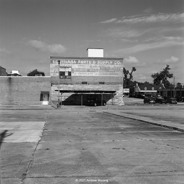
Clay Street view west to Yazoo Diversionary Canal and flood walls

Go west a block to Washington Street, and Clay Street becomes much steeper as it descends to the flood walls and the Yazoo Diversionary Canal. In the 1800, this was the main channel of the Mississippi River. Steamboats tied up along this waterfront, but now the view is marred by the concrete walls. 


A passageway, paralleling Gordon Lane (or alley), runs north through a tunnel in one of the old brick buildings. The tunnel is sort-of picturesque. No, it's just plain ugly. The rear facades of the buildings are sort-of picturesque. No, they are just plain ugly.


All right, the dead boat in one of the lots behind some Washington Street buildings is picturesque.

This ends out short tour of lower Clay Street and vicinity. Standby for more of Vicksburg in the future.

Merry Christmas and Happy Holidays to all of you readers. Thanks for riding along.

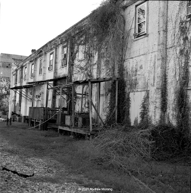
UPDATE:  I found a digital color photograph of the old warehouses on the north side of Clay Street. What would one find in one of these boarded-up buildings?

Lower Clay Street (Fuji X-E1 digital file, 1962 Jupiter-8 lens, ƒ/5.6) 


Thursday, December 16, 2021

Wandering around Upper Clay Street, Vicksburg, Mississippi

Clay Street view west (Panatomic-X film, Hasselblad 250mm Sonnar lens, 1/15 ƒ/8.0½)

Clay Street is the major east-west road through Vicksburg. Before Interstate 20 (I-20) was completed in the early 1970s, US 80 came into town on Clay Street. A driver heading west would drive on Clay to downtown, turn left on Washington Street, and drive south to the old Mississippi River bridge.

I label the part of Clay Street just west of the Vicksburg National Military Park as upper Clay, while the area downtown near the Yazoo Canal is lower Clay. Here we will look at some scenes in upper Clay. Decades ago, private homes lined the street, but now it is strip America of the ugliest sort. You car, tire, and muffler repair shops, check-cashing and title-loan places, a few real estate offices, abandoned buildings, a dead A&P super market, derelict historic homes, and fast food emporiums. Empty lots show where houses once stood. A former resident labeled this "the ugliest street in America." Well, maybe not the ugliest, but certainly a contender. 


The Eastview Apartments, situated between Clay Street and Baldwin Ferry Road, are low income housing subsidized by the federal government via HUD (Housing and Urban Development). They are unusual construction, being suspended between telephone poles that were driven into the ground on the steep hillside. It was a practical solution compared to grading flat terraces and pouring concrete slabs. 

Eastview Apartments with Stouts Bayou in foreground (Panatomic-X film, Hasselblad, 50mm ƒ/4 Distagon lens, green filter)

Stouts Bayou flows under Clay Street through some form of culvert or tunnel because it emerges out of the hillside below the Eastview Apartments. This is kudzu jungle. It needs a cleanup by goats.


Warfield's ServiceCenter, at 2910½ Clay Street, has served customers for over 30 years. Good people.
 

One of the nondescript street running into Clay Street from the north is Hope Street. The proprietor at A & V Discount Tobacco & Beer generously let me take a photograph.


The long-unused Parkview Regional Medical Center building looms over the area north of Clay Street. It has been vacant since 2002, except for homeless who occasionally find ways to enter.

Mercy Hospital, Grove St. (Kodak Super-XX film, Tachihara 4×5" camera, 90mm ƒ/6.8 Angulon lens)

The Sisters of Mercy, who have a long history of care in this town, originally built Mercy Hospital in 1957. The present owners have tried to sell it but with no results. Who wants an obsolete hospital building considering the cost to renovate and upgrade electricity, exits, stairwells, and utilities? Externally, it looks intact, but I do not have information on the roof or the interior. 

When I took photographs in the parking lot in the rear, the neighbors came by and said they watch for vagrants. The police come, clear away the homeless, and then they return later.


Further west is a short segment of Crawford Street. This is not the main Crawford Street downtown but a short detached section running directly next to Stouts Bayou. The houses are on the south side of the road and have access via wood bridges. I photographed more of the Crawford Street region during my tour of neglected Vicksburg houses (Nov. 16, 2020 article).

1517 Main Street (Panatomic-X film, Hasselblad 501CM camera, 80mm lens, 1/8 sec. ƒ/8.0½)

Main Street is one of Vicksburg's historic streets. It is still lined with old houses, but one by one, they have been condemned and demolished. This house at 1517 looks pretty good, and I do not know its issues.

This ends our short tour of upper Clay Street. Standby for more Vicksburg photographs soon. Thank you all for riding along.